The area around Father Capodanno Blvd in Staten Island’s Midland Beach neighborhood is a hub of outdoor activities on the island. For one, Father Capodanno Blvd runs directly adjacent to Midland and South Beaches along with the boardwalk. These beaches along with the boardwalk are extremely popular amongst those who want a less crowded alternative to beaches in Brooklyn and Queens. Father Capodanno Boulevard is also home to the Ocean Breeze Athletic Complex, which is larger than any other track and field facility in NYC including the Washington Heights Armory. Another major destination along the corridor is Miller Field. This is one of Staten Island’s largest assortments of sports fields and one of the borough’s main hubs for league sports. It is likely that Father Capodanno Blvd sees more road users making trips to recreation destinations than any street on Staten Island and most streets in NYC. Outside of recreation facilities, there are multiple senior centers nearby along with a plethora of residences.
Westchester County is one of the most populated counties in New York’s suburbs. The county is home to almost 1 million residents and features a range of communities. This includes charming villages like Tuckahoe and Ardsley and more bustling urban centers like Yonkers and Mount Vernon. The county also features a plethora of major shopping and recreation hubs. These include New Roc City, Ridge Hill and Downtown White Plains.
New York City’s Open Streets program has helped New Yorkers to rethink what streets can be used for besides travel. Since 2020, many New Yorkers have rode their bicycle, ate al fresco at a restaurant, or engaged in another recreational activity on an open street. Others have used them to simply hang out or enjoy having more space than the city’s bustling sidewalks can typically offer. Besides being a fun place to be, open streets have made walking and cycling significantly safer in these areas than it was before the open streets program.
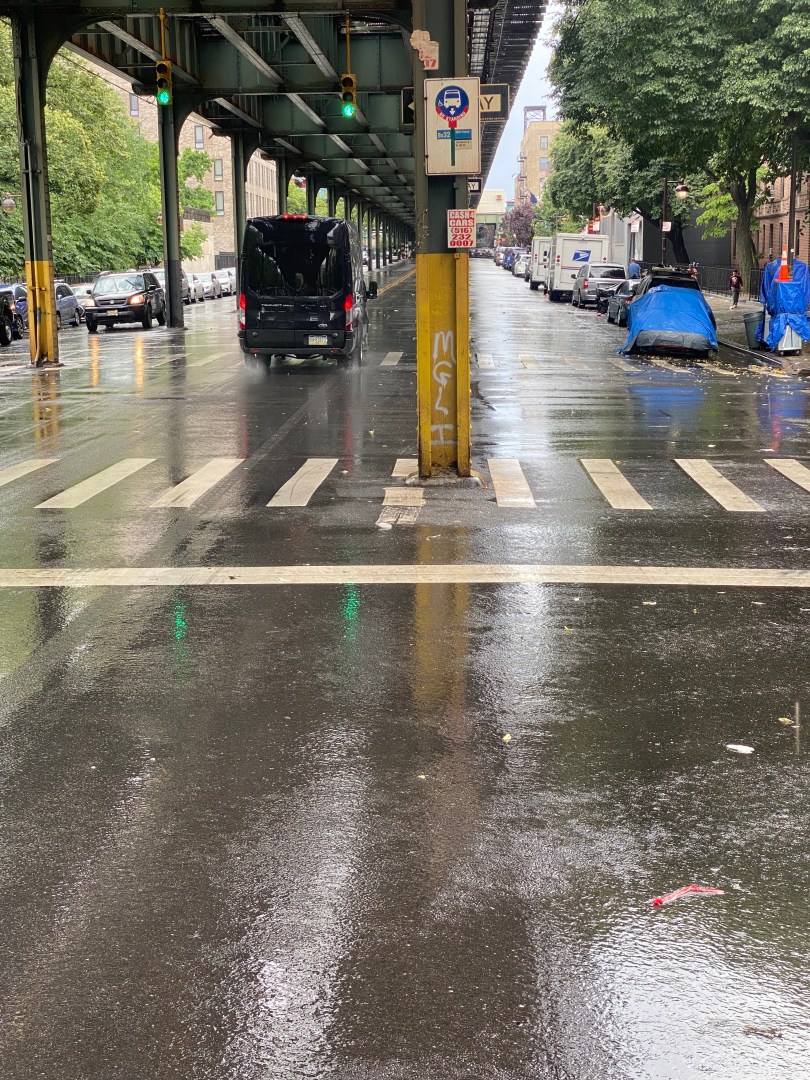
New York City has many bus routes that run beneath elevated subway lines in every borough except Staten Island. These bus routes often serve riders who do not use the trains due to disabilities, safety concerns or longer walks to train stations. They also sometimes serve places that the train doesn’t, often when the train diverges from the street the bus operates on.
3rd Avenue is one of if not the busiest northbound streets on the East Side of Manhattan. Running from the East Village to East Harlem, the street is home to a plethora of businesses, residences and attractions. Major destinations on and around 3rd Ave include Union Square, the Chrysler Building and the Roosevelt Island Tram. 3rd Avenue is also located one block away from the Lexington Ave Subway(4,5,6).
People get around Staten Island using various modes of transportation. According to data from the NYC Department of City Planning, Staten Island is the city’s most car-dependent borough as 83% of households have access to a vehicle. Nonetheless, this still leaves 17% of households and many more youth that primarily get around via walking and mass transit. Many other Staten Islanders also bike to take advantage of the borough’s verdant landscape.
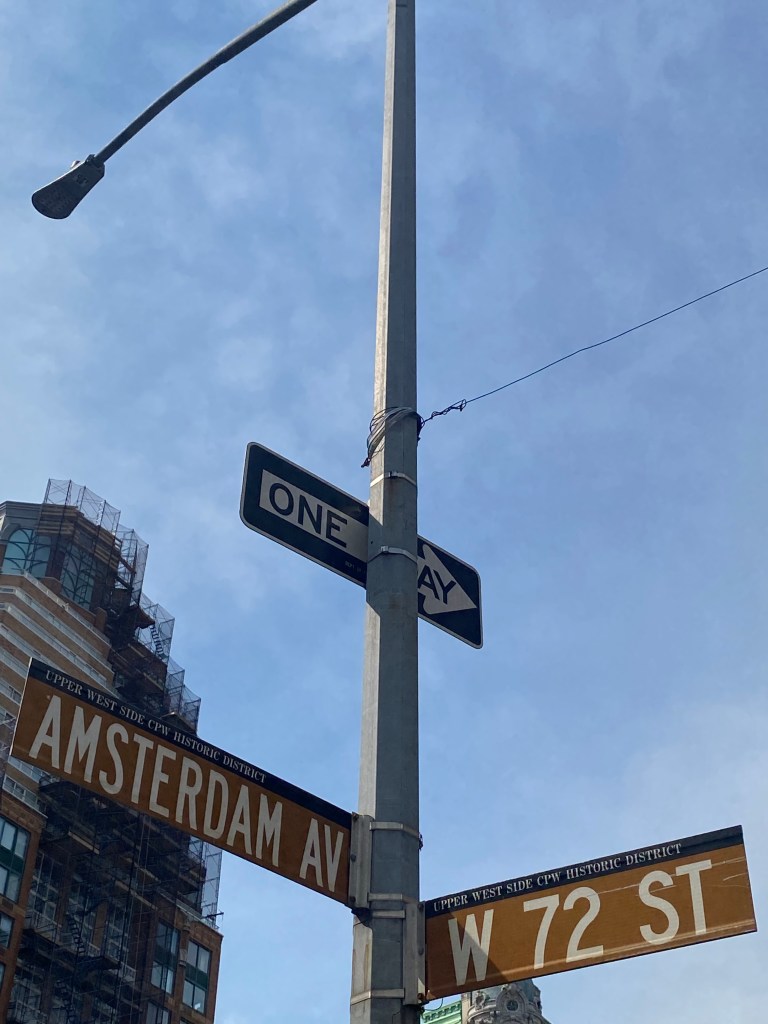
The Upper West Side is one of New York City’s most well known and vibrant neighborhoods. This section of Manhattan is home to major destinations such as the American Museum of Natural History, the Beacon Theatre, and a roughly half of Central Park. In addition, the neighborhood has a plethora of restaurants, cultural institutions and other places that cater to New Yorkers and tourists alike. The UWS is also among the most densely populated residential neighborhoods in NYC with a density of 76,600 people per square mile and a population of about 227,000. For reference, the UWS has a higher population than cities like Baton Rouge, Birmingham, and Providence.
Street signs at intersection of Amsterdam Ave/W 72nd StRead More »
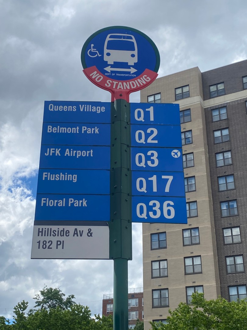
Hillside Avenue travels from east to west is among the busiest streets in Southern Queens. It’s western terminus is at Myrtle Ave, which provides access to Brooklyn and some if its busiest neighborhoods. From there, Hillside Ave travels east into Nassau County, where it connects to the Jericho Turnpike in Westbury. In Queens, a whopping 21 combined MTA and NICE bus routes run on the corridor, serving 194,000 riders daily. NICE is Nassau County’s public bus system. The ridership number for Hillside Ave buses is higher than that of the G Train, which served 70,453 riders in 2023.
To most, Southeastern Queens comprises of Queens south of the Grand Central Pkwy and east of the Van Wyck Expwy(I-678). While it is less densely populated than most of Western Queens, people in many parts of the area still rely on walking and transit to get around. In the two Community Board Districts that cover the bulk of the area, 15 and 33% of residents, respectively, do not own cars. Additionally, there are many youth in these communities who also rely on walking and transit, as you have to be 18 to drive independently in most cases in New York City.
Southeastern Queens is known for some verdant streets and offering a nice urban/suburban blend for its residents. However, the area sorely lacks open space. According to a map from the NYC Parks Department, there are significant portions of Queens CB Districts 12 and 13 that are not within walking distance of a park. In addition, both districts are among the ten districts in New York City in which 0% of residents live within walking distance of a pedestrian plaza. For reference, New York City has 59 community districts. Due to how far residents are from parks, getting to open spaces often requires either a long walk, drive or transit ride for most residents. This makes spaces far less accessible for residents here than residents from other communities, especially for transit commuters. As Southeastern Queens has no subway service in most areas, it is extremely difficult for most without a car to get to open spaces as they have to rely on buses.
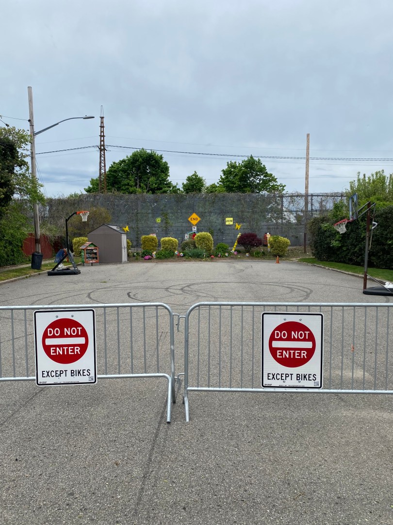
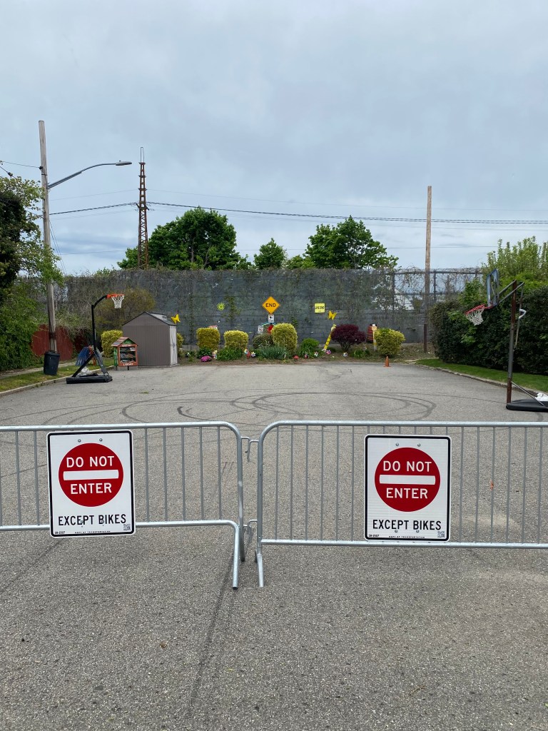
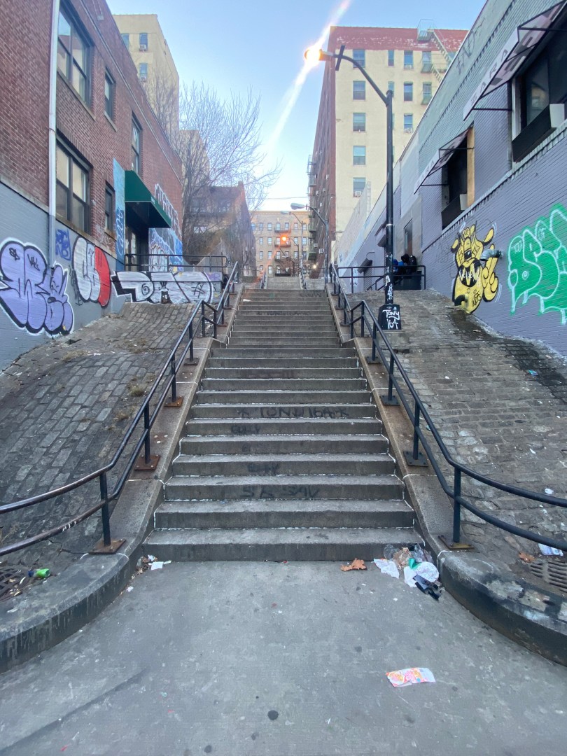
Thankfully for community members, the New York City Department of Transportation(NYCDOT) is planning Southeastern Queens’ first-ever pedestrian plaza. The new plaza will be located on 180th St at the intersection of 180th St and Murdock Avenue in the St. Albans neighborhood. The plaza will be in a dead-end block that serves almost no use to motorists and is the perfect size to serve as a space for community members. According to a presentation from the NYCDOT, the purpose of the plaza is to create more communal open space and increase pedestrian safety at the intersection of Murdock Avenue and 180th St. The plaza proposal also includes a curb extension across the street from the plaza as well as painted crosswalks. While the area is already an open street, the plaza will offer significant enhancements.
Open Street where public plaza will be built at Murdock Ave/180th St.
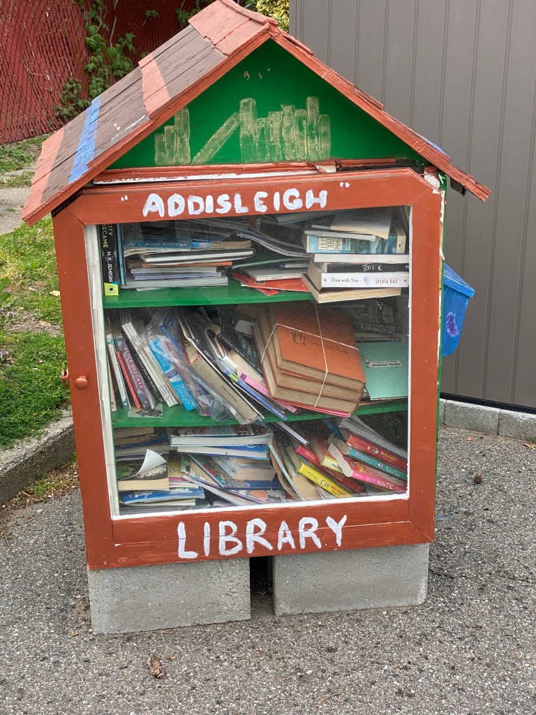
The plaza itself will be 3,750 feet long and protected by granite blocks and delineators. It will also include permanent street furniture such as seats, tables, and planters. In addition, the NYCDOT plans to add asphalt art to the plaza to make it a warm and inviting space for community members to spend their time. The NYCDOT and Addisleigh Park Civic Association will release a Request for Proposals(RFP) for artists who will complete the asphalt art at some point this spring. An RFP is a document that details a project and solicits contractors to bid for the ability to complete the project. The Addisleigh Park Civic Association will also likely be responsible for maintaining the plaza as a partner of the NYCDOT. Most open streets and public plazas have partners that are responsible for their maintenance and upkeep.
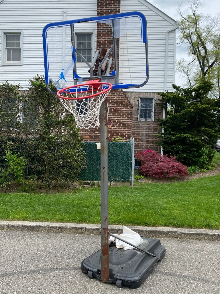
The new plaza will not be the first time the space will be used for the community. Since Spring 2022, the space has been one of NYC’s “Open Streets” managed by the Addisleigh Park Civic Association. Currently, it is fully closed to vehicular traffic seven days a week from 9 AM-10 PM and serves as a space for community members. There is even a small makeshift bookcase that served as a mini-library. However, the open street status means that permanent street furniture could not be present and the activities possible were limited due to the street still being designed for cars. With a plaza, community members can use the space for any car-free purpose so long as it can be accommodated within the space’s boundaries. On my visit to the plaza on Saturday, May 4th, 2024, I noticed chairs being hung to what appeared to be a string along with two dysfunctional basketball hoops. One of the hoops was completely bent, and the other had no backboard, making both unfit for game use. The street became a plaza will address this issue by allowing permanent seating along with higher quality recreational fixtures to be added without the concern of where to place them when an open street is closed, or there is inclement weather. Hence, the plaza will make a huge difference in how the street area will be utilized.
Basketball hoop at Murdock Ave Open Street with no backboard.Basketball hoop with broken backboard and bent rim at Murdock Ave Open Street.Chairs attached to string at Murdock Ave Open Street.Mini-Library at Murdock Ave Open Street.
The Murdock Ave location was chosen for plaza construction by the NYCDOT due to its significant success as an open street. As part of the Open Streets program, the NYCDOT pays attention to successful locations and considers changes to tangibly enhance the open street for users. Since the programs inception in 2020, not too many open streets have received enhancements based on the NYCDOT’s criteria. The ones that have implement or proposed enhancements are been predominantly concentrated in more densely populated communities such as West 22nd St in Chelsea, W 103rd St on the Upper West Side and 34th Avenue in Jackson Heights. Avenue B on the Lower East Side and 4th Street in Park Slope have also been evaluated for improvements. The implementation of this plaza is truly an outlier and effectively be a pilot for how the city creates open space in less densely populated communities with more car ownership.
The project to build the plaza will be completed by the fall with street markings and delineators coming by the summer. The street art and furniture will be installed by late summer or the fall at the absolute latest. Given the streets’ current use by the community, the new plaza will make the space even better for relaxing, having fun and making memories for residents. Additionally, the plaza can be a model for how more cities can utilize more of their streets in more neighborhoods for non-travel uses through willpower and innovation.
*In this article, West Bronx will refer to communities in The Bronx west of Webster/Melrose Ave from 161st St to 238th St. This includes parts of Bronx Community Districts 4, 5, 7 and 8.
MOBILITY CONTEXT
Like most of New York City, the West Bronx is full of vibrancy and diversity. Neighborhoods range from the bustling areas of Highbridge and Mount Eden to the quaint suburban-like communities of Spuyten Duyvil and Riverdale. The West Bronx is known for several of its most famous locations, including Yankee Stadium and the official birthplace of hip-hop at 1520 Sedgwick Avenue in the Morris Heights neighborhood.