New Parking Garage Near Queens Borough Hall Should Be Noncontroversial Solution To Parking Demand, But The Broader Project It Is A Part Of Is Anything But

By Joseph Morales

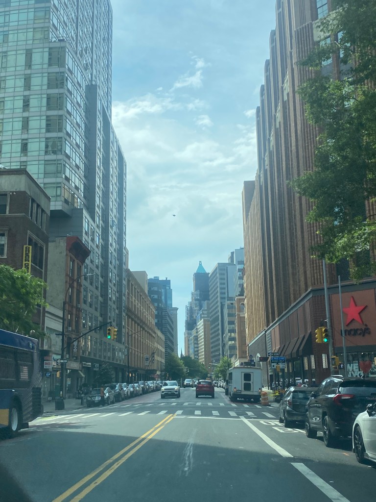
The area surrounding Queens Borough Hall in the Kew Gardens area of Queens has a high activity density and is bustling with vehicular and pedestrian traffic daily. The community is home to multiple important borough offices, such as Queens Borough Hall and Queens County Criminal Court. In addition a school known as Archbishop Malloy High School, with about 1,560 students is located in the area. The community is served by the E and F trains at both the Kew Gardens-Union Tpke and Briarwood stations, the LIRR at the Kew Gardens station, and a plethora of bus routes that traverse Queens. Major roadways such as the Van Wyck Expressway(I-678), the Grand Central Pkwy, the Jackie Robinson Pkwy, and Queens Blvd also pass through the area, making the community easily accessible by car from throughout Queens and the New York Metropolitan Region. As many of the areas surrounding Kew Gardens lack subway access and have high car ownership rates, many people might choose to drive to one of the subway/commuter rail stations and park their vehicles, and more might do it in the future upon the implementation of congestion pricing below 60th street in Manhattan.

                  As you might expect, just like in other areas of the city, parking is likely hard to come by due to the area’s connection to major vehicular thoroughfares and key destinations. As congestion tends to be high on both the Queens Blvd service road as well as local residential streets, cars searching for parking likely contribute to this congestion, contributing to slow travel speeds for both those in search of parking as well as through traffic.

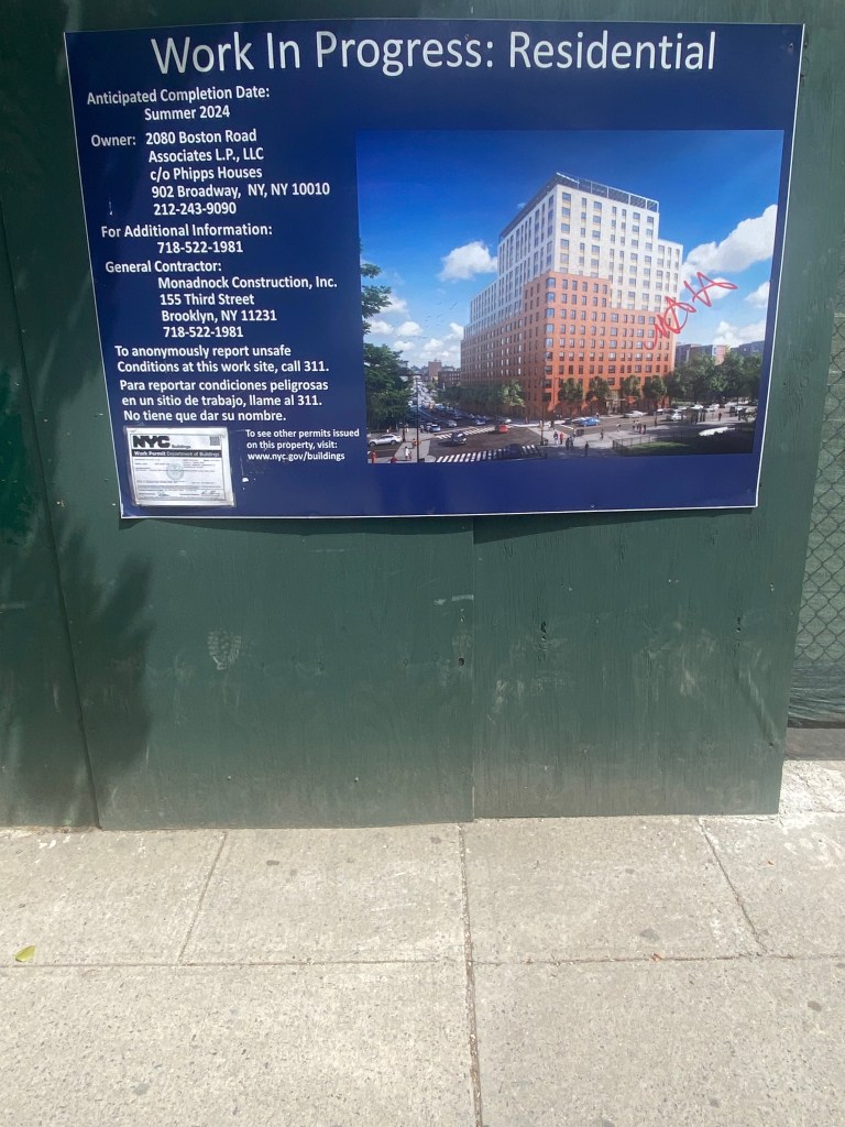
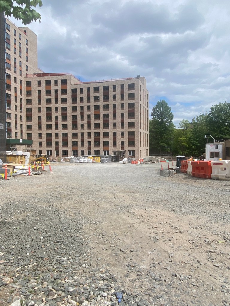
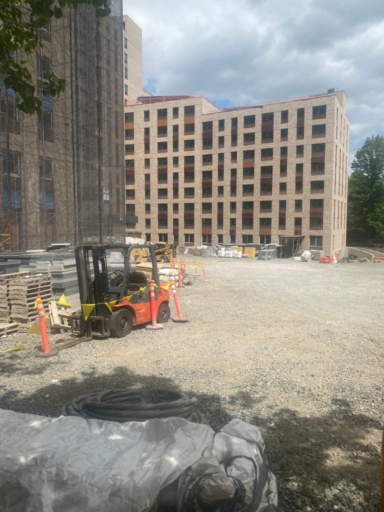
                  Hence, to help ease parking issues in the community, the NYCDOT recently constructed a new municipal parking garage at 80-25 126th St, located on 126th St between the Grand Central Pkwy eastbound service road and 82nd Ave near Queens Blvd.  The garage offers 600 total spaces, including, 30 ADA-accessible spaces and 40 Bicycle spaces. The ADA-accessible spaces will be especially critical for those who need it considering that it likely is already difficult to find parking near major destinations in the community and the garage is near the ADA-accessible Kew Gardens-Union Tpke(E,F) station. The bicycle spaces will help those who choose to cycle to the area and take advantage of nearby cycling infrastructure such as the protected bike lanes on Queens Blvd and the expansive networks of bike trails in the nearby Forest and Flushing Meadows Parks respectively.

New parking garage at 80-25 126th St.

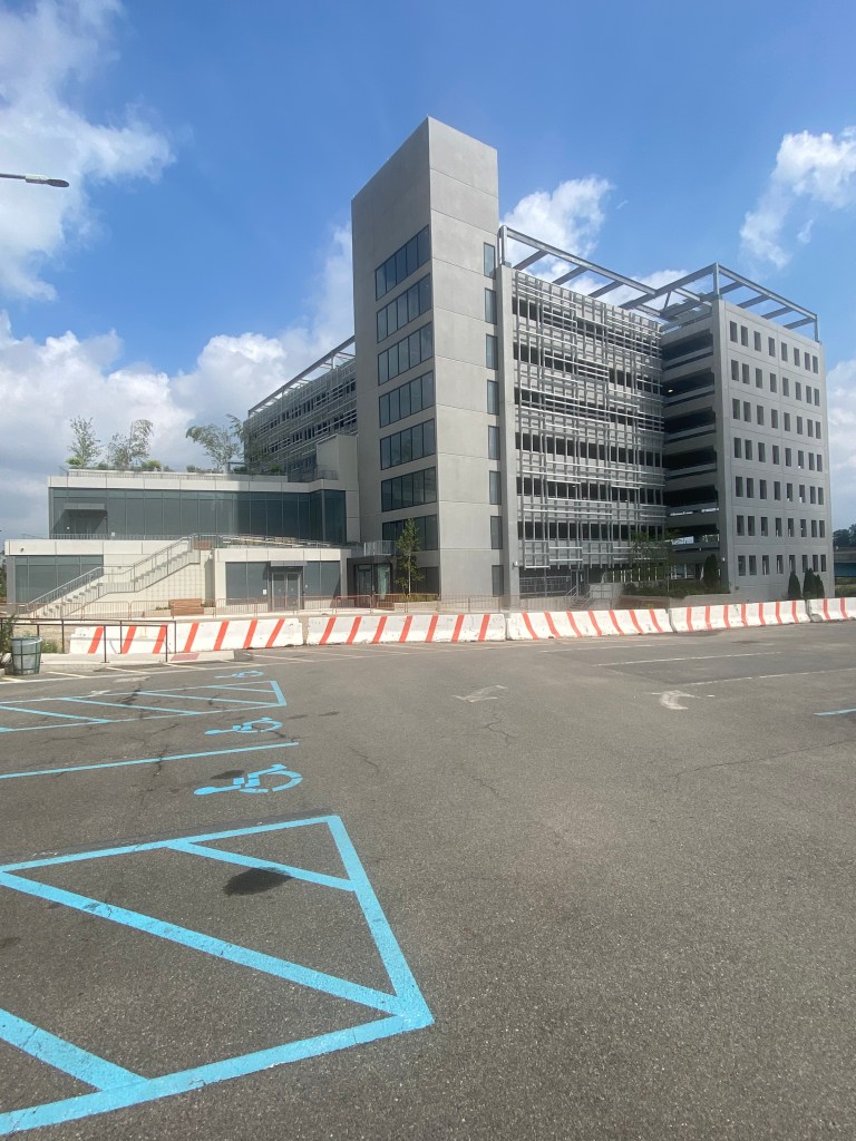
                  The garage also includes 34 electric vehicle(EV) charging spaces, with 3 of them offering DC Fast chargers that allow EV owners to charge battery-electric vehicles(BEV) from empty to 80% in 20 minutes to an hour, which makes them among the fastest EV chargers out there. While the also common Plug-in hybrid electric vehicles(PHEV) generally do not work with DC Fast chargers and the rest of the chargers in the garage will be the EV standard, most EV owners charge their vehicles at home, and thus they will likely not rely on the parking garage for their regular charging regimens. However, the Level 2 charging stations that can charge from empty to 80 percent in BEVs in 4-10 hours and PHEV’s for 1-2 hours respectively, can still be useful to help give EV motorists the opportunity to give their vehicles and extra boost if needed for a specific situation or for charging when the motorist is parking for a long period of time for purposes such as a long outing, work or to commute somewhere else with the subway or LIRR.

                     In addition to making parking available for all, the parking spaces will have an impact in the community beyond parking and even motorists as a whole. As less cars will likely be circling the neighborhood for parking, the will mean less congestion for other road users, which should speed up travel times for users of local roads. This is especially important given the high rates of congestion surrounding streets near Queens Borough Hall at most hours of the day including primarily residential ones, according to Google Maps’ traffic forecast. As a significant amount of area residents own vehicles and many parts of Queens and nearby Nassau County are hard to get to by mass transit, less congestion on residential streets will make it much easier for residents to make trips by personal vehicle. Less congestion on busy streets such as Queens Blvd and Kew Gardens Rd also benefit small businesses that benefit from their customers being able to pull up close to them, rather than those spots being taken for long periods for time by those going to the nearby offices or even subway stations who might not return for many hours upon parking.

               While that parking garage itself will likely serve as an uncontroversial solution to a common transportation issue in reference to parking, the garage was built as part of a bigger, non-transportation based project that is anything but. The parking garage was the first step as part of a project to build a new 886-bed jail at the site of what is currently the shuttered Queens Detention Complex as well as the east side of the former surface parking lot. It is worth noting that there will also be a smaller, underground 305-space parking lot for jail staff, so all of the parking in the recently finished garage will be for public use. Hence, the only way that the project’s ability to mitigate parking demand can be diminished is if a high number of people visiting inmates daily take up a disproportionate amount of spots. 

Former Queens Detention Complex shown on July 15th 2023 is set for demolition this summer.
Signage outside of former Queens Detention Complex regarding demolition this summer.

                  According to New York City Department of Corrections data from July-September 2012 when there were about 10,000 inmates on Rikers Island on a given day and there were about 1,700 total visitors on a given day. This would mean that 17% of inmates had visitors assuming each inmate that had a visitor each day only had one. However, assuming inmates in the new facility receive visitors at a similar rate and 46% of those visitors have cars that would mean that about 69 spaces out of the 600 in the garage would be of those visiting inmates. I used 46% for this estimate as 46% of NYC households have a car, and an inmate could have visitors from anywhere in the city. Since the NYCDOC currently operates buses from two central NYC sites to Rikers Island for those intending to visit inmates with plans to expand, it is likely that many if not most visiting the Island live in locations throughout the City of New York. While Rikers Island is known for its remote location, the bridge to the Island is easily accessible by car via the Brooklyn-Queens Expressway(I-278) and Grand Central Pkwy. Thus, visiting inmates by car likely will not be significantly impacted in most cases by those visits occurring at the new Queens Jail.

                   The jail is part of a controversial plan to replace the notoriously troubled Rikers Island with borough-based jails in each of the five boroughs. Despite the plan for the jail in Queens being rejected by Queens Community Board 9 on the grounds that the jails should not be located in residential areas, the city still plans to move forward. 

                   The city states that all of the new borough-based jails will serve as “civic assets for all New Yorkers” and “must relate to the city it is in and create a sense of place for the citizens it serves,” according to its website regarding the plan to close Rikers.  In the case of the Queens jail, the plan includes constructing a two-floor community space with multiple verdant outdoor terraces attached to the parking garage. Given New York’s bail reform laws passed in 2020, leading to many people awaiting trial for misdemeanor and even some felony offenses will likely not be waiting in jail for their trials even with the recent changes to the law made by NY Gov. Kathy Hochul and most individuals in the borough-based jails will likely be those accused of violent offenses, those facing charges in multiple incidents or serving short sentences and thus residents and area visitors may be skeptical of the immediate surroundings of the jail becoming such a public and even inviting area. 

                  As of now, a lot more New Yorkers live, work, and go to school near correctional facilities than you would imagine. A study done by the Independent Commission on New York City Criminal Justice and Incarceration Reform in May 2019 showed that there are 11 detention facilities in New York City outside of the eight already on Rikers Island, and those facilities have a combined 158,000 people living within a 5-minute walk of the facilities and 430,000 people living within a 10-minute walk of them. The study found not only that property values and crime rates were not adversely impacted by the correctional centers, property values in certain areas, such as Downtown Brooklyn, increased, including a 55% increase in a five-minute walking distance from the Brooklyn Detention Complex(BKDC) since it was reopened in 2012. The BKDC has since been closed in 2020 and will be the site of Brooklyn’s new borough-based jail.

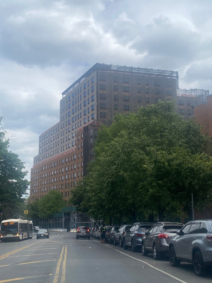
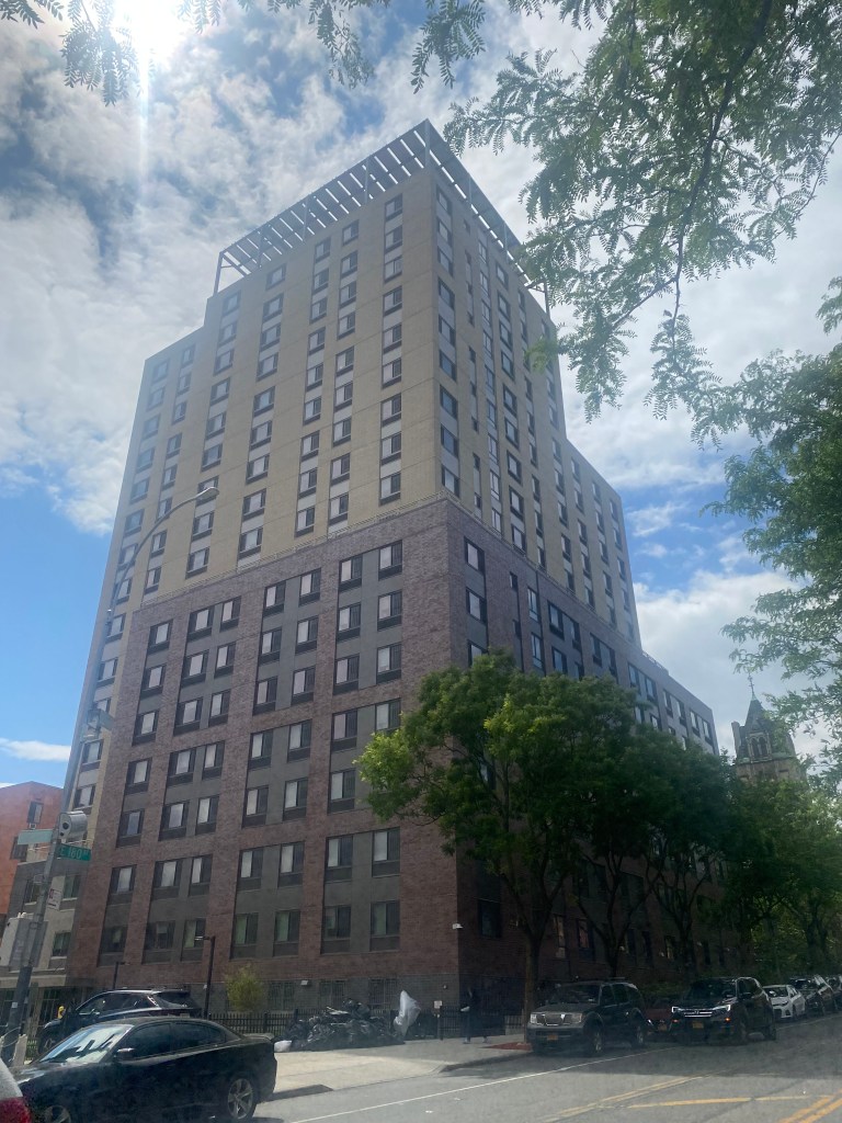
                   While this was not stated in the studies, many of the facilities are located in growing communities such as the South Bronx, Long Island City, Downtown Brooklyn and Sunset Park/Industry City. There are a plethora of examples of major developments near the detention centers such as the Industry City arts hub near the MDC Brooklyn(Brooklyn’s federal prison) and the recently renovated office complex known as the Falchi Building in Long Island City near the state-operated Queensboro Correctional Facility. In the South Bronx, the Horizon Juvenile Center which houses some of the highest risk juvenile delinquents and offenders in the city is located directly across the street from the South Bronx Educational Campus which includes two high schools. A new elementary school, PS. 487X is also being constructed adjacent to the South Bronx Campus and is slated to open for the 2024-25 school year. Thus, while many community members are likely skeptical of the current spatial arrangements near the new Queens jail; there is a chance that people will greatly benefit from the community spaces and perception of the space may change in the future given the outcomes of development around correctional facilities in other boroughs.

                  As the parking lot portion of the project has been completed and demolition of the former Queens Detention Complex is set for this summer, this project will likely spur many discussions on how jails and the areas around them can be a part of our communities and may impact how development is perceived around correctional facilities. 

Works Cited

“Frequently Asked Questions.” Archbishop Molloy High School, https://www.molloyhs.org/apps/pages/index.jsp?uREC_ID=747416&type=d&pREC_ID=1157328. Accessed 18 July 2023.

New York City Department of City Planning-Transportation. “Car Ownership in NYC.” Tableau, 24 November 2022, https://public.tableau.com/app/profile/dcptransportation/viz/ACSProfiles/Dashboard1. Accessed 18 July 2023.

New York City Department of Transportation. “NYC DOT – Municipal Parking Facilities.” NYC.gov, 2023, https://www.nyc.gov/html/dot/html/motorist/parkinglist.shtml#queens. Accessed 18 July 2023.

Google Maps. “Google Maps-Traffic.” Google, https://www.google.com/maps/@40.7137044,-73.8311183,16z/data=!5m1!1e1?entry=ttu. Accessed 18 July 2023.

New York City Department of Corrections, et al. COMMUNITY BOARD 9 LAND USE COMMITTEE, 12 April 2021, https://rikers.cityofnewyork.us/wp-content/uploads/20210325_QNCB9-_Presentation_Updated_04_12_2021.pdf. Accessed 18 July 2023.

New York City Department of Corrections. “NYC DOC at a GLANCE.” NYC.gov, 2012, https://www.nyc.gov/html/doc/downloads/pdf/doc_at_a_glance.pdf. Accessed 18 July 2023.

New York City Department of Corrections. “Visitor Transportation.” NYC.gov, 2023, https://www.nyc.gov/site/doc/inmate-info/visitor-transportation.page. Accessed 18 July 2023.

Kaplan, Dana. “COMMUNITY BOARD NO. 9.” Forest Hills Post, 14 May 2019, https://foresthillspost.com/wp-content/uploads/sites/22/2019/05/CB9-Resolution-Opposing-Borough-Based-Jails-Letterhead.pdf. Accessed 18 July 2023.

City of New York. “NYC Borough-Based Jails – Rikers.” Closing Rikers Island, 2023, https://rikers.cityofnewyork.us/nyc-borough-based-jails/. Accessed 18 July 2023.

Reisman, Nick. “Once again, New York’s bail law is set to change.” Spectrum News, 28 April 2023, https://spectrumlocalnews.com/nys/central-ny/ny-state-of-politics/2023/04/28/once-again–new-york-s-bail-law-is-set-to-change. Accessed 18 July 2023.

Independent Commission on New York City Criminal Justice and Incarceration Reform. “More Just NYC – Jail Impact Study.” Squarespace, May 2019, https://static1.squarespace.com/static/5b6de4731aef1de914f43628/t/5cf7bd74342c7a0001525284/1559739765822/NYC+Detention+Facilities+Analysis+%28May+2019%29-Final.pdf. Accessed 18 July 2023.

Brendlen, Kirstyn. “City, contractors get ready to begin demolition at Brooklyn Detention Complex • Brooklyn Paper.” Brooklyn Paper, 21 February 2022, https://www.brooklynpaper.com/prepare-demolition-at-brooklyn-jail/. Accessed 18 July 2023.

“The Falchi Building – 31-00 47th Avenue in Sunnyside, Long Island City, NY.” VTS Marketplace, 2023, https://marketplace.vts.com/building/the-falchi-building-long-island-city-ny. Accessed 18 July 2023.

New York City Administration for Children’s Services. “ACS – Secure Detention.” NYC.gov, 2023, https://www.nyc.gov/site/acs/justice/secure-detention.page. Accessed 18 July 2023.

“Bronx Four Story School Milestone.” Forte Construction Corp, 18 April 2022, https://www.fortecc.com/post/ps-487-milestone. Accessed 18 July 2023.

Escalators at Iconic Lower Manhattan Subway Station Are Being Replaced

By Joseph Morales

The Bowling Green station on the 4,5 lines in the Financial District is one of New York City’s most historic subway stations, having been in operation for over 115 years. Since opening in 1905, the station has provided access to many of New York’s most famous attractions and key destinations. These include major office buildings, Battery Park, the National Museum of the American Indian, the Staten Island Ferry, the ferries to Ellis Island, and the Statue of Liberty. The station is mainly known by New Yorkers for its nontraditional red walls on the inside as well as its two unique entrances. One of these entrances is the station headhouse or control house, which has been used since the station’s opening in 1905 and is considered a designated NYC landmark and is on the National Register of Historic Places. The other is an escalator surrounded by a glass canopy that, when riding, feels like you’re getting a grand entrance into the neighborhood, with an immersive view of the MTA headquarters, 2 Broadway, greeting you as you come above ground. The canopy opened in the station in 2007, 102 years after its opening.

Read More »

Massive New Housing Redevelopment in The Bronx Could Become A Model For Affordable Transit-Oriented Development

By Joseph Morales

The Lambert Houses is a large affordable housing development with several hundred units in the West Farms section of The Bronx just blocks from the Bronx Zoo. The development is owned and operated by Phipps Houses, New York City’s largest and oldest nonprofit developer, with developments across the Bronx, Manhattan, Queens, and Brooklyn. Phipps also operates a social services affiliate, Phipps Neighborhoods, which facilitates youth, community, and economic development in the South Bronx. The Lambert Houses are also located adjacent to the West Farms Sq-E Tremont Av(2,5) and E 180th St subway station, as well as near the Bx9, Bx21, Bx36, and Bx40/42 buses, providing residents with ample access to communities across the Bronx, Queens, and Manhattan via public transit. The complex is also a short walk from the E 180th St(2,5) station, where the rush hour 5 express trains stop, allowing for even faster commute times to and from the South Bronx and Manhattan.

                         The development was constructed between 1970 and 1973, so the Lambert Houses have been a staple in the West Farms Community for about 50 years. However, given the development’s age, it’s been known for many issues that adversely affect one’s quality of life, including, according to a description by the Bronx Times, “outdated structural and mechanical systems, poorly designed open space within a superblock layout, and security issues created by a maze-like series of buildings, many interconnected by narrow hallways, with 14 separate addresses.” 

                         Thus, Phipps Houses is currently working on a 15-year, $600 million redevelopment of the complex to replace all of the buildings in the Lambert Houses complex with larger and more modern buildings to make for a better housing complex for residents. The number of affordable homes in the Lambert Houses will increase by nearly 1,000 to 1,665, and current Lambert Houses residents will be relocated to new buildings as well as throughout the development as the construction process continues. 728 of the units will be reserved for households that qualify for Section 8 rent assistance, while the rest will be available for those at various levels of the area median income(AMI). The first phase was already completed in August 2019 with an 18-story, 163-unit building at East 180th St between Boston Rd and Vyse Avenue at 988 E 180th St. The building includes 113 units reserved at the time by previous Lambert Houses residents and another 49 for other low-income households selected by the Housing Connect lottery. According to an NYC Department of Housing Preservation and Development(HPD) press release, this building was financed through the HPD and the NYC Housing Development Corporation(HDC)’s ELLA program for extremely low-income households in addition to the  Mandatory Housing Inclusion program so that the homes will be permanently affordable to residents.

988 E 180th St as seen from the intersection of E 180th St/Bryant Av.

                       Now, Phipps Houses is working on the second phase of the project, which includes the construction of a 16-story, 321-unit residential building on Boston Rd between E 179th and E 180th Sts at 2080 Boston Rd with 279 units for current Lambert Houses residents and 42 units for those who have recently homeless. The building will include several amenities such as a gym, children’s room, bike room, and more. The first phase of the project, along with this phase, is, being designed by Dattner Architects, who have designed several notable Bronx buildings such as the Bronx Library Center on Kingsbridge Rd, the state-of-the-art research building known as the Manne Institute at the Bronx High School of Science and the Second Farms residential building just blocks from the Lambert Houses. Monadnock Construction, Inc, which has been operating for 48 years and considers affordable housing “a cornerstone of our work” according to its company profile, was responsible for building phase 1 and will also be responsible for building phase 2 of the project.

The Stanley Manne Research Institute at The Bronx High School of Science as seen above was designed by Dattner Architects.
Poster details work being done on the second phase of the Lambert Houses redevelopment on 2080 Boston Rd.
Construction site of second phase of Lambert Houses Redevelopment at 2080 Boston Rd.
A view of the construction site of the second phase of the Lambert Houses Redevelopment at 2080 Boston Rd.
2080 Boston Rd as seen from E 180th St/Bryant Av.

                        In addition to providing better homes for residents, the project aims to better integrate the development into the streetscape and make the environment as a whole better for both residents and visitors. This will occur through the inclusion of new retail and community facilities. However, it has yet to be specified as to when, how, or where in the redevelopment most of this will take place. The only non-residential facility that space has been allotted for the construction of is a space for the School Construction Authority(SCA) to build a school should the need come to fruition.

                   Streetscape improvements will help to improve mobility around the neighborhood, not only for residents but for anyone who traverses the area. This is because it would help people feel safer and increase the neighborhood’s economic vitality should new retail facilities attract customers. In addition, the improvements would help area businesses to take better advantage of the benefits of being close to a mass transit hub and a major cultural institution in the Bronx Zoo. Additionally, if more people feel safe and comfortable walking in the community, they may be more inclined to visit the Bronx Zoo using mass transit. This might lead to increased zoo patronage and less congestion since the zoo is visited by people from across the city and region. 

                     This project has the potential to not only be an incredibly critical social infrastructure project, but it has the opportunity to be a model to other cities around America as to how to construct affordable transit-oriented development that people from a diverse range of incomes can benefit from. Transit-oriented development is a form of development that is centered around public transport and can consist of residences, businesses, and other destinations that can all be accessed within walking distance of each other. Affordable transit and commodities are critical for residents of New York City and especially The Bronx, where there is a poverty rate of 26.4%, according to U.S Census figures. In addition, since many Bronxites and other lower-income New Yorkers work blue-collar jobs with inflexible and odd hours, having transit and basic needs within walking distance of home is critical to ensure that these New Yorkers can access necessities and mobility given their busy schedule. 

                     While other locations in New York offer convenient access to a subway or bus line or even both, most locations are not accessible by multiple lines, express subway services as well as multiple bus routes that traverse different parts of the city, including a limited stop and select bus service route. The select bus service route available in West Farms is unlike other routes as the  Q44-SBS travels well into Queens from The Bronx, providing residents with access to another borough in which one other bus route travels to and from The Bronx. That route, the Q50-LTD, travels to Queens from the Eastern Bronx and would likely not be a practical commuting option for West Farms residents. 

                   The premium transportation access offered near the Lambert Houses compared to similarly affordable neighborhoods is not only premium, but it is also almost unheard of as a lot of housing offered near subway stations featuring even one line is often higher than rents in other places. According to SpatilityBlog, median rents decrease between 9-15% in all boroughs when one lives at least a 10-minute walk from a subway station. It is important to consider data for all boroughs, as when one is looking for affordable housing, the process is often selective. This is because often, there are thousands of applications for affordable units at any given location, making affordable housing difficult to obtain regardless of transit access in the area. When looking up options to apply for any affordable housing lotteries on the NYC Housing Connect website, I found that only 38 rental properties were available to apply to, with 11 in The Bronx, 18 in Brooklyn, 3 in Manhattan, 6 in Queens and none in Staten Island as of June 30th, 2023.  Competition in reference to purchasing an apartment is also typically stiffer in Real Estate for apartments closer to the subway. Thus, it would not be surprising if it was even more challenging to find affordable housing in these areas. 

                     Many(but not all) NYCHA(New York City Housing Authority) developments are located in close proximity to subway stations across the five boroughs. However, not only are they also difficult to get into with the Coalition For The Homeless saying on their website, “…it is impossible to predict how long an applicant might be on the waiting list before being reached for an apartment offer,” but they are notorious for poor living conditions such as leaking issues, dilapidated heating systems, mold, unreliable elevators and countless other issues throughout residences.

                     The only thing that some residents might dislike that will be different in the new development, with the exception of taller buildings, will be that there will be 265 fewer parking spots in the new development than there are currently. As 36% of residents in the PUMA(Public Use Microdata Area) in which the development is located have a car, and new residents may be entering from throughout the borough and the city, they may have a variety of mobility needs and thus parking may be hard to come by, particularly with the new and existing businesses, schools and the Bronx Zoo leading to a high demand for parking in the area. Despite the plethora of transit access in the community, many might still use private vehicles to get to places inaccessible by transit, such as much of New York’s suburbs, to run errands or to transport younger children and older people, among other purposes. The complex is also located in close proximity to several major roadways, such as the Bronx River Pkwy, Cross Bronx Expwy, and Sheridan Blvd, which provide ample access to many regional destinations via automobile. However, both current NYC Mayor Eric Adams and former mayor Bill De Blasio’s affordable housing plans “Get Stuff Built” and “Housing New York: A Five-Borough, Ten-Year Plan,” respectively, both call for reductions of stringent parking requirements that increase construction costs and often go unused, particularly in areas with convenient transit access. Hence, it will be interesting to see what happens to the new parking spaces and whether this will lead to parking issues as the construction of the development continues. 

                    The Lambert Houses redevelopment is one of multiple significant affordable housing developments that have or will take place in the West Farms area. The Second Farms Building, also known as 1932 Bryant, is a 15-story, 319-unit affordable housing building located on a large land parcel directly between Bryant Ave, E Tremont Ave, and Boston Rd. The building also includes a Pioneer Supermarket and shared co-working space for tenants, which can be useful during the era of working from home. 50% of the housing units are for neighborhood residents, while 5% are reserved for those with mobility disabilities and municipal employees, respectively, and 2% are for the visually impaired. While it is good that housing is reserved for those with mobility disabilities as many apartment buildings are without elevators in NYC, unfortunately, the West Farms Sq-E Tremont Av station is not ADA-accessible, and there is no immediate plan to make it accessible as part of the MTA’s 2020-24 capital plan. However, these residents are still a short 10-minute bus ride away from the ADA-accessible E 180th St station, which is one subway stop away via the Bx40/42 or Bx21 buses, which still provides them with more convenient access to an ADA-accessible subway station than many locations. There is also storage in the building for up to 160 bicycles, making it convenient bike storage for anyone who wants to take advantage of the numerous bike trails in the area, such as the nearby Bronx Park, Crotona Park, and Starlight Park, which provide connections to other communities throughout The Bronx. The building also includes outdoor recreation spaces for the enjoyment of residents. Several other developments with over ten stories, 100 affordable housing units, and resident amenities similar to the others mentioned have also opened in the area in recent years, such as 1923 West Farms Rd and 913 E Tremont Avenue. 

Second Farms building as seen on the corner of Boston Rd/E Tremont Av. Note: Building is significantly wider than what is seen from this perspective.

                        The West Farms neighborhood has come a long way since affordable housing developments began to be built in droves throughout the community. As an indicator, these Google Street View images show the neighborhood as seen from the Cross Bronx Expwy in August 2016 compared to March 2022. When comparing the images, you can see several notable structures such as P.S 6X The West Farms School, a portion of the 1010 E 178th St NYCHA Development, and even the elevated subway line above Boston Rd where the 2 and 5 trains run are no longer visible. As the neighborhood population increases in density due to the influx of affordable development, the neighborhood can become an example where residents can enjoy convenient access to transit, quality residential amenities, and the benefits of a walkable community at an affordable price. It may even be possible that more developments like the Lambert Houses and the other developments in the West Farms community can be the key to solving New York’s housing crisis.

Works Cited

“Phipps Houses closes on 2nd phase of Lambert Houses redevelopment – Bronx Times.” Bronx Times, 12 January 2022, https://www.bxtimes.com/lambert-houses-redevelopment/. Accessed 1 July 2023.

“Properties | Phipps.” Phipps NY, 2023, https://www.phippsny.org/properties/. Accessed 1 July 2023.

“Donations | Phipps.” Phipps NY, 2023, https://www.phippsny.org/donations/. Accessed 1 July 2023.

New York City Department of Housing Preservation and Development. “First Phase of Lambert Houses Ribbon Cutting | City of New York.” NYC.gov, 22 November 2019, https://www.nyc.gov/site/hpd/news/103-19/the-city-joins-phipps-houses-celebrate-completion-the-first-phase-lambert-houses#/0. Accessed 1 July 2023.

“Projects — Dattner Architects.” Dattner Architects, 2023, https://www.dattner.com/projects/. Accessed 1 July 2023.

“Company Profile – Monadnock.” Monadnock Construction, 2023, https://moncon.com/company-profile/. Accessed 1 July 2023.

United States Census Bureau. “Bronx County, New York.” Census Bureau, 2022, https://www.census.gov/quickfacts/fact/table/bronxcountynewyork/PST045222. Accessed 1 July 2023. 

Stringer, Scott, and NYC Comptroller’s Office-Bureau of Policy and Research. “Beyond Rush Hour: COVID-19 and The Future of Public Transit.” nyc.gov, October 2021, https://comptroller.nyc.gov/wp-content/uploads/documents/Beyond-Rush-Hour.pdf. Accessed 1 July 2023.

“What is TOD?” Institute for Transportation and Development Policy, 2023, https://www.itdp.org/library/standards-and-guides/tod3-0/what-is-tod/. Accessed 1 July 2023.

Owner. “Saving on Rent in NYC: How to Save Money by Living Just 10 minutes away from the Subway?” Spatiality Blog, 22 June 2023, https://spatialityblog.com/save-money-living-10-minutes-away-from-subway/. Accessed 1 July 2023.

NYC Housing Connect, 2023, https://housingconnect.nyc.gov/PublicWeb/. Accessed 1 July 2023.

“Getting Placed in Public Housing and Section 8.” Coalition For The Homeless, https://www.coalitionforthehomeless.org/get-help/im-in-need-of-housing-old/public-housingsection-8/getting-placed-in-public-housing-and-section-8/. Accessed 1 July 2023.

Zaveri, Mihir. “As Thousands Fall Behind on Rent, Public Housing Faces ‘Disaster.’” The New York Times, 23 January 2023, https://www.nytimes.com/2023/01/23/nyregion/rent-crisis-public-housing.html. Accessed 1 July 2023.

New York City Department of City Planning. “Car Ownership in NYC.” Tableau, 24 November 2022, https://public.tableau.com/app/profile/dcptransportation/viz/ACSProfiles/Dashboard1. Accessed 1 July 2023.

Torres, Maria. “Get Stuff Built.” NYC.gov, 8 December 2022, https://www.nyc.gov/assets/home/downloads/pdf/press-releases/2022/GetStuffBuilt.pdf. Accessed 1 July 2023.

Blasio, Bill De, and Alicia Glen. “Housing New York: A Five-Borough, Ten-Year Plan.” NYC.gov, May 2014, https://www.nyc.gov/assets/buildings/pdf/housing_plan.pdf. Accessed 1 July 2023.

“Second Farms — Dattner Architects.” Dattner Architects, 2023, https://www.dattner.com/projects/view/second-farms/. Accessed 1 July 2023.

Metropolitan Transportation Authority. “Capital Plan 2020-24.” MTA, Q1 2023, http://web.mta.info/capitaldashboard/CPDPlan.html?PLN=8&AGY=a. Accessed 1 July 2023.

Which NYC Bus Routes Should Become Free?

By Joseph Morales

Public transportation is the backbone and lifeblood of New York City, as millions of New Yorkers as well as visitors, rely on MTA subways and buses to traverse the city on a daily basis. According to data from the NYC Department of City Planning, 46% of residents across the five boroughs do not even own vehicles, making them entirely dependent on mass transit for getting around. Even with many office workers continuing to work on hybrid or remote schedules, the subway and bus systems served 84.3 million and 33.2 million paid riders, respectively, in February 2023, according to data from the NYC Comptroller’s office. According to the MTA website, the agency counts a rider as one who has paid the fare or used a Student MetroCard to board a subway train or bus route. Employees and those who make subway transfers without exiting the system are omitted from ridership counts.

Read More »

Bus Service and Pedestrian Safety Improvements Are Coming To Major Street In Downtown Brooklyn

By Joseph Morales

Livingston Street is a major commercial and office corridor in the heart of Downtown Brooklyn. Many important borough offices are located on or near the corridor, such as the Kings County Courts and Brooklyn Borough Hall. Major agencies such as the New York City Department of Education and the MTA also have offices in the area. In addition, the corridor is located near multiple large educational institutions such as Long Island University-Brooklyn, the nearly 6,000-student Brooklyn Technical High School, and the Brooklyn Law School. The corridor also has ample access to public transit, with nearby access to over ten subway lines and a plethora of bus lines that serve about 50,000 riders on a typical weekday, according to NYCDOT statistics. Transit significantly helps Downtown Brooklyn to thrive as visitors to and from the area often come from throughout Brooklyn and the New York Metropolitan Region. In addition, only 33% of households in the Downtown Brooklyn area have access to a vehicle, according to NYC Department of City Planning data; thus, transit is critical to the livelihoods of area residents.

                  As you might expect, congestion along the corridor is common. Thus, buses are known to be excruciatingly slow, as bus speeds tend to average around five mph in both directions on a typical basis. As Livingston St is an artery for bus routes that travel throughout Brooklyn, delays here significantly affect riders boroughwide regardless of whether or not they are traveling to Downtown Brooklyn. This effect is even more dramatic for Livingston St than for other bus service arteries across the city, given the large geographic size of Brooklyn and the fact that the congestion is more prevalent across more of Brooklyn than other boroughs. One of the busiest routes on Livingston St is the B41-LCL/LTD, which travels about 7.5-9.0 miles to the southern end of Flatbush Av at Kings Plaza or Bergen Beach, it is the 10th busiest bus route in the city in 2020 and 2021 and is proposed to become a Select Bus Service(SBS) route as part of the Brooklyn Bus Network Redesign according to the Draft Plan. Delays here also have a more widespread impact on bus service here than on other bus service arteries in the city, given the large geographic size of Brooklyn and the fact that the congestion is more prevalent across more of Brooklyn than other boroughs. There are bus lanes on the corridor, with the eastbound lanes being offset from the curb and the westbound lanes being curbside. However, according to an NYCDOT presentation, vehicles often block these lanes, rendering them less effective than is desirable.

                      Thus, the NYCDOT has a unique plan for speeding up buses along the corridor. The plan includes adding two bus lanes in both directions on the south curb of the street for buses to move in both directions from Hoyt St to Flatbush Av. All other vehicles on Livingston would be restricted to traveling westbound only in mixed travel lanes on the opposite side of the street. Vehicles would, however, be allowed to travel eastbound between Smith St and Gallatin Pl to preserve vehicular access to the Metrotech corporate and academic campus(also known as Brooklyn Commons). Given the proposed geometry of the design and the fact that the westbound lane would protect the eastbound lane on the left side of the street, the odds of vehicles blocking the lanes would likely be slim to none. In addition to improving travel times for bus riders, this part of the project may result in faster travel speeds for westbound vehicular traffic as larger buses would not frequently be entering and reentering traffic. Between Gallatin and Boerum Pl, the bus lanes will essentially remain as is. Due to construction at the MTA office building and former headquarters, there will be no construction west of Smith St; as of now.

Livingston St, where bus lane changes will be made. Though this is a Sunday and the bus lanes are not active, the amount of cars parked in the bus lanes makes one wonder what the lanes must look like during the week.

                       One of the likely concerns with this project is how westbound buses will cross from one side of the street to another to move from the curbside bus lanes to the offset ones due to possible conflicts with westbound car traffic or pedestrians attempting to cross the street midblock, as the NYCDOT did not indicate any plans to prevent pedestrians from crossing here or mitigate motor vehicle conflicts in this situation in their presentation. The city will likely not resort to enforcing its relatively unrecognized jaywalking law that prohibits pedestrians from crossing streets outside of crosswalks, as many have claimed that enforcement of this law has been disproportionately targeted toward people of color. Additionally, jaywalking enforcement here would likely lead to questions on why similar enforcement does not exist elsewhere, especially in other busy areas such as Midtown Manhattan, where pedestrians crossing against signals frequently leads to motorist/pedestrian conflicts. 

Livingston St between Hoyt St and Gallatin Pl where bus lanes will switch from one side of the curb to another.

                       A more common concern with bus lane projects that the NYCDOT may encounter here is concerns over the loss of parking in a neighborhood where parking is already at an extreme premium, and many pay high prices to park their cars in garages.  However, this argument will likely be weaker and/or less prevalent here as the vast majority of residents and travelers to the area do not drive. In addition, as many drivers to the area come from outside of Brooklyn and even New York City as a whole, there would likely be less momentum in any campaign to preserve parking spaces. However, due to the commercial and residential density of the corridor, the NYCDOT still is considering metered commercial vehicle spots to assist businesses with loading activities as most businesses receive deliveries via box truck between the hours of 7 AM to 5 PM, according to the NYCDOT’s presentation to Brooklyn Community Board 2. 

                    Another issue that the bus lanes may encounter is that while traffic flow on Livingston St westbound might improve, congestion on Schermerhorn St eastbound is projected to increase initially, according to the NYCDOT, as traffic that would have otherwise used Livingston Street uses Schermerhorn as an alternative. However, the NYCDOT said in its presentation that they would convert Schermerhorn from one-way westbound to eastbound between Boerum Pl and Smith St and consider potential improvements to Schermerhorn St if necessary to alleviate congestion. Currently, the NYCDOT projects that Schermerhorn St and Atlantic Ave will serve as the two main alternate routes for eastbound travel. However, one thing that may work in drivers’ favor regarding avoiding congestion is that Downtown Brooklyn has a robust number of side streets parallel to Livingston St. Thus, many will likely find alternate routes to Livingston that take them not much longer, if at all, to get to their final destinations, including the ones the NYCDOT has proposed. They also stated that as they have seen in past projects, drivers will likely disperse among multiple alternate routes, choose to drive during off-peak hours, and some may even choose to take mass transit.

                   The extent to which motorists switch to mass transit will likely be an interesting question as drivers to Downtown Brooklyn have likely already endured immense levels of congestion and difficulty parking that have not yet led to them making the switch. Given that Downtown Brooklyn is a regional destination in a less central location than many core parts of Manhattan, the number of people who switch to mass transit here may be limited as many who travel to Downtown Brooklyn by car likely live in various parts of NYC or elsewhere that have little access to reliable transit services to Downtown Brooklyn. Also, drivers who commute to work in the area may have limited options for driving during peak hours.

                    Like with many of their projects, the NYCDOT is aiming to make pedestrian safety improvements on the corridor in addition to bus service improvements, as Livingston St is designated as a Vision Zero Priority Corridor due to having a high number of pedestrians KSI(killed or seriously injured). According to data presented by the NYCDOT to Brooklyn Community Board 2, 21 out of 22 pedestrian injuries on Livingston St between 2016-2020 were due to turning vehicles striking pedestrians crossing with the right of way, and 15 of these were in the midst of left turns. 

                         Thus, the NYCDOT has decided to add bus boarding islands and left turn bays on Livingston St at Nevins St and Hoyt St, respectively, to increase pedestrian and bus rider safety. Bus boarding islands can help increase pedestrian safety by providing them more space on the roadway and helping to improve bus speeds as buses would not have to pull up to the sidewalk to pick up passengers. In addition, these islands will include fences, bollards, and leaning bars for the comfort of riders, which can come in handy during long waits for buses. As for the left turn bays, these are designated areas where all left turns at an intersection are mandated to occur. In these cases on Livingston St, the cars turning left will have a traffic signal completely separate from other vehicles. They prove to be effective as, according to an NYCDOT study done in August 2016 on left turns, left turn bays with signals led to a 33% decrease in pedestrian and cyclist injuries at the intersections where they were implemented. In addition to the safety aspect, the left turn bays will prevent turning vehicles from interfering with bus speeds as they will have a space separate from the bus lanes to make a turn.

The intersection of Livingston St/Nevins St where bus boarding islands and a left turn bay will be added.

                         Another pedestrian safety element the NYCDOT plans to add to Livingston St is concrete pedestrian islands, which reduce crossing distances and provide pedestrians with more physical protection from vehicles. They are proposed for Livingston St intersections with Elm Pl and Flatbush Av, respectively. According to the Federal Highway Administration, pedestrian islands can help reduce pedestrian crashes by as much as 32% as they reduce crossing distances and provide pedestrians with more physical protection from vehicles. Painted curb extensions are proposed for this intersection as well as for intersections along Livingston St with Flatbush Ave, Hanover Pl, Bond St, and Gallatin Place, which will also help improve pedestrian safety by shortening crossing distances and providing pedestrians with more safe space in the roadway. The NYCDOT is considering adding partnering with a local art sponsor to add the artwork to the painted section. In addition, the agency plans to partner with the Parks Department to install trees on the north curb and planters throughout the corridor to beautify the streetscape. 

                       The NYCDOT plans to begin work on the project this summer, and the agency plans to make adjustments as needed. They might also consider making improvements west of Smith St upon the completion of construction at the MTA building. As the NYCDOT has done these types of bus service/pedestrian projects citywide, one may wonder how much of a difference it can make for all road users when streets are redesigned.

Works Cited

“Brooklyn Technical High School (13K430).” NYC MySchools, 2023, https://www.myschools.nyc/en/schools/high-school/13K430. Accessed 23 June 2023.

New York City Department of Transportation. “Livingston Street Transit Priority Study – Community Board 2 – May 18, 2023.” NYC.gov, 18 May 2023, https://www.nyc.gov/html/dot/downloads/pdf/livingston-st-bus-priority-study-cb2-may2023.pdf. Accessed 23 June 2023.

“New York City Transit – Subway and bus ridership for 2020.” MTA, 2021, https://new.mta.info/agency/new-york-city-transit/subway-bus-ridership-2020. Accessed 23 June 2023.

“New York City Transit – Subway and bus ridership for 2021.” MTA, 2022, https://new.mta.info/agency/new-york-city-transit/subway-bus-ridership-2021. Accessed 23 June 2023.

Metropolitan Transportation Authority. “Brooklyn Bus Network Redesign Draft Plan.” mta.info, 1 December 2022, https://new.mta.info/document/101521. Accessed 23 June 2023.

New York City Department of Transportation. “Livingston Street Transit Priority Study – Community Board 2 – May 18, 2023.” NYC.gov, 18 May 2023, https://www.nyc.gov/html/dot/downloads/pdf/livingston-st-bus-priority-study-cb2-may2023.pdf. Accessed 23 June 2023.

Knispel, Jay S. “Is Jaywalking Permissible in New York? – New York, NY – Law Offices of Jay S. Knispel Personal Injury Lawyers.” NYC Personal Injury Lawyer, 24 February 2023, https://jknylaw.com/blog/is-jaywalking-permissible-in-new-york/. Accessed 23 June 2023.

Chasan, Aliza. “About 90 percent of all jaywalking tickets issued to Black and Latino pedestrians in NYC.” PIX11, 28 January 2020, https://pix11.com/news/local-news/about-90-percent-of-all-jaywalking-tickets-issued-to-black-and-latino-pedestrians-in-nyc/. Accessed 23 June 2023.

New York City Department of Transportation. “DON’T CUT CORNERS-LEFT TURN Pedestrian & Bicyclist Crash Study.” NYC.gov, August 2016, https://www.nyc.gov/html/dot/downloads/pdf/left-turn-pedestrian-and-bicycle-crash-study.pdf. Accessed 23 June 2023.

Federal Highway Administration. “Pedestrian Refuge Island Safe Transportation for Every Pedestrian Countermeasure Tech Sheet.” FHWA Highway Safety Programs, June 2018, https://safety.fhwa.dot.gov/ped_bike/step/docs/techSheet_PedRefugeIsland2018.pdf. Accessed 23 June 2023.

The Port Authority of New York and New Jersey Is Calling On High School Students To Solve Critical Challenge In The Holland and Lincoln Tunnels

By Joseph Morales

*​​The robotics teams discussed in this article are used as examples only, and these teams have not publicly indicated any intent or desire to participate in the PANYNJ challenge as of the time this article was published.

The Lincoln and Holland Tunnels are among the most critical transportation arteries in the NY-NJ-CT tri-state area, as they are the primary connections between New Jersey and the Manhattan Central Business District. Thus, it is no surprise they are both among the busiest road tunnels in the world, each carrying over 100,000 vehicles daily. In addition, both tunnels carry a plethora of trucks transporting goods throughout the U.S. as well as public and private transport buses that carry riders from commuters to long-distance travelers throughout the tri-state region and beyond.

Read More »

Significant Micromobility Improvements Are Coming To Eastern Queens, Including An E-Scooter Pilot and Bike Lane Network

By Joseph Morales

*To get to information on bike network, either scroll down or press ctrl-f and search :

Most New Yorkers consider Eastern Queens to represent areas of Queens east of the Whitestone/Van Wyck Expressways(I-678). Eastern Queens has a diverse range of neighborhoods, from the bustling business districts of Downtown Flushing and Jamaica, which are among the busiest in the city outside of Manhattan, to the lower-density residential areas of Bayside and Douglaston. Eastern Queens is also among the most ethnically diverse areas of the city, with people from Asia to Latin America and everywhere in between making up a substantial portion of the population.

Read More »

I-95 Collapse in Philly Set To Disrupt Travel Around The Northeast. How Could New York Prevent Similar Incidents?

By Joseph Morales

Interstate 95 is the main interstate highway running along the east coast of the United States. It is the longest north-south interstate in the country, and it runs through 15 states, about 1,924 miles from Miami, Florida, to the Canadian border in Houlton, Maine. In addition, it is also one of the most densely populated interstate corridors in the U.S as it not only passes through a plethora of major cities such as New York City, Boston, and Miami but only five counties along the route are considered completely rural according to a USA Today article published in 2004, indicating that the highway connects many people is vital to many metropolitan regions throughout the East Coast. 

                   Due to Interstate 95 not only passing through so many major metropolitan areas but also being one of if not the main highways in the regions it passes through, many Americans use the highway for various purposes, from commuting, to errands, to road trips and so much more. In the case of Philadelphia, Interstate 95(Delaware Expwy) serves as one of three major expressways in the Philly region, with the Delaware Expwy being the only one that runs from the northeastern areas of the city and through the city’s core and into its southern suburbs towards the state of Delaware. It is also the only expressway with access to each of Philadlephia’s three major New Jersey Crossings which are the Walt Whitman Bridge(I-76), the Benjamin Franklin Bridge(I-676), and the Betsy Ross Bridge(NJ-90). 

                    Unfortunately, on Sunday, June 11th, 2023, an overpass of the Delaware Expwy in Northeastern Philadelphia at Exit 30 Cottman Avenue collapsed after a tractor-trailer carrying 8,500 gallons of gasoline flipped over and crashed into a wall before proceeding to explode. This ignited a fire that led to the northbound side of the overpass. The southbound side also was heavily damaged and will need to be demolished, according to the Philadelphia Inquirer. The overpass may have been particularly susceptible to such an incident it is made with steel girders, which can face decreased strength when faced with extreme heat. Usually, the concrete roadway prevents a fire from occurring, but on this overpass, the steel was exposed, leading it to melt.

                     Sadly, a body was recovered from the scene, and relatives believe that it is the body of former army veteran 53-year-old Nathaniel Moody, who was delivering gasoline to a Northeast Philly gas station. The Philadelphia County Medical Examiner and Coroner’s Office determined that he died of blunt trauma to the head as well as thermal and inhalation injuries.

                  As a result of the crash, this segment of the highway, which carried over 160,000 vehicles daily, must be completely reconstructed, which is expected to take months. The project has and is expected to have a draconian adverse effect on traffic flow throughout the Philly region, given how important of a travel artery the Delaware Expwy is. In addition, traffic is expected to reach horrendous levels on the local streets of Northeastern Philadelphia as many cars and trucks are forced to exit Interstate 95 and take alternate routes; many of these will cut through busy, densely populated neighborhoods similar to those seen in mixed-use areas of The Bronx, Brooklyn, and Queens. Since 26% of Philadelphians take mass transit to work, according to the CONNECT: Philadelphia’s Strategic Transportation Plan published in October 2018, slower public bus speeds will likely affect transit riders more than vehicles as bus riders have fewer alternate route options.

Also, like in many areas of New York City, areas of Philadelphia nearest Interstate 95, including the areas nearest the collapse, tend to have some of the highest rates of childhood asthma hospitalizations in the city, according to data published by the Philadelphia Department of Public Health in the city’s Community Health Assessment known as “Health of The City” published in 2021. Thus, the impact of a dramatic increase in vehicular and truck traffic around the highway for such a prolonged period of time can result in increased pollution that can have a detrimental impact on the health of residents.

                     The amount of congestion might also be so extreme that goods may cost more for consumers in the northeast as trucks are forced to take longer and more expensive routes due to the reconstruction. According to supply chain management professor Nada Sanders of Northeastern University, the effects could be felt on a national level, given how important of an artery Interstate 95 is and that detours could be as much as over 40 miles for some travelers. In addition, the collapse could have effects on prices outside of the East Coast because many supplies transported along I-95 are used to construct infrastructure, products, and other goods. Thus, manufacturers will likely horde these materials leading them to cost more regardless of where they are purchased. Food items can also be affected as longer routes around the I-95 corridor could lead to more food spoiling, and thus, less food would be readily available, which would, in turn, mean higher prices. 

                      Given the severity and potential impact the collapse is having on the Philadelphia area as well as the northeast region as a whole, one may wonder how such an incident can be prevented in the New York area. As traffic has already reached significantly higher levels in all parts of Philadelphia this week following the collapse, one can only imagine what would happen if something similar happened in New York City, given its population density is substantially higher than that of Philadelphia. 

                      This may lead one to question the risk of a similar collapse on New York City’s expressways, especially the New England Thruway and Cross Bronx Expressway in The Bronx, which are both parts of Interstate 95. As for highway construction, Interstate 95 was constructed separately in both New York and Pennsylvania, and segments of I-95 in both states are managed by their respective state transportation department. While it is unclear if the driver of the gasoline truck did anything illegal prior to crashing, both states have similar HAZMAT CDL endorsement requirements in order to transport hazardous materials such as gasoline. In addition, both the cities of New York and Philadelphia have permit requirements necessary to transporting hazardous materials through their respective cities. 

                   NYC even has more specific requirements, such as specific hours and routes one must take while transporting hazmat materials. In some cases, the FDNY commissioner can, at his or her discretion, order that a vehicle carrying hazardous material be escorted for safety reasons. It is unclear if Philadelphia has similar requirements beyond a state license and municipal permit.

                     The one issue of concern for New York City may be that exposed steel, which played a major role in the Philly collapse, is prevalent throughout NYC’s expressways, including at key intersections such as the Bruckner Interchange and the BQE/LIE(I-278/1-495) interchange in Queens according to Google Maps Street View imaging taken between February 2022 and April 2023. In Philadelphia, as the overpass was at a standard exit location onto a local street at 6AM on a Sunday, police officers and emergency personnel were able to promptly able to close off the area, and thus, no one was injured or killed except the driver of the truck that died in the explosion. A responding police officer could even be heard as he was approaching the scene on a dispatch radio recording obtained by ABC6 Action News Philadelphia saying, “We need this off-ramp shutdown. I have no idea what is on fire.”

                       If something of this magnitude were to occur in any busy NYC location, such as the ones mentioned, the situation would likely be far more severe, and the aftermath would look like one from a horror movie, given the size and height of the NYC expressway overpass and the activity density surrounding them. In addition, given the amount of congestion on NYC expressways often at many times of day, first responders would likely have less time to get to a fire situation, and thus the number of casualties would likely be much higher. Traffic in many areas could also become enter a state of near paralysis should a similar highway closure occur, as NYC has similar or even less expressway coverage than Philadelphia in some areas. This would lead to bus routes becoming even slower, which could have a more draconian effect on NYC bus service as even fewer New Yorkers own cars than Philadelphians, and as it stands, many routes citywide already struggle with slow speeds, reliability, and overcrowding.

Any supply chain issues that would transpire would also be much worse and widespread nationwide due to the number of warehouses and companies citywide that rely on the expressways to transport goods, as well as the amount of food that is transported to and from the rest of the country via hubs through the Hunts Point Food Market in The Bronx. Issues resulting from vehicle noise in areas near any collapsed expressway would also likely be worse than they ever have been before.

                      The main solution the city and state can consider to fireproof highways and expressways is known as intumescent paint. Intumescent paint is a form of reactive paint that, according to the UK fire protection company FireSealsDirect, “…swells up or intumesces to many times its original thickness when exposed to high temperatures, like in the event of a fire.” Dr. Abi Abgyahere, a longtime structural engineer and civil engineering expert from Drexel University, told ABC6 Action News that while the material is expensive, he recommended it be used on bridges and overpasses to prevent incidents such as the I-95 collapse.

                        However, while it is unclear how much such a project would cost for any given bridge or overpass, some engineers have pointed out fireproofing measures in general as being prohibitively expensive to prevent such a rare occurrence. While engineers are generally taught to plan for the worst-case scenarios when designing structures, it is often not seen as cost-effective to spend a significant amount of resources attempting to prevent, say, tsunamis on the East Coast from significantly damaging structures. 

                        In reference to the risk of highways collapsing due to fires, NYC consulting bridge engineer Andrew W. Hermann told The New York Times in 2007 that “The probability of these things happening are pretty low. “The cost to protect every overpass would be outrageous.”  

In Oakland, California, in 2007, a similar situation to the one that happened in Pilly occurred when a burning gasoline truck crashed and exploded. With regard to the incident, Loring A Wyllie Jr.,  a San Francisco area engineer, also told The New York Times, “We worry about the seismic things in California.” “I never thought about a fire doing that.” These types of perspectives also remained the norm after two similar incidents in our area involving structural damage to highways. This included when I-95 in Bridgeport, CT, buckled after a truck with heating oil was burning and when traffic lanes buckled following a trash fire that twisted the steel supporting them on Interstate 78 in Newark, NJ, in August 1989.

                        As the I-95 collapse in Philadelphia cost a man his life and is causing unprecedented levels of congestion throughout the Philadelphia region, many may be more concerned about how to prevent similar incidents in their communities. Given the magnitude of the incident, cities across America, including New York, may be more inclined to invest not just in protecting highway infrastructure from fires but from any sort of damage or incident that could hamper their ability to safely transport millions of New Yorkers throughout the New York Tri-State area.

Works Cited

Stark, Edward. “FHWA Route Log and Finder List Table 3: Interstate Routes.” fhwa.gov, 27 January 2022, https://www.fhwa.dot.gov/planning/national_highway_system/interstate_highway_system/routefinder/table03.cfm#content. Accessed 15 June 2023.

El Nasser, Haya. “Small-town USA goes ‘micropolitan.’” USA Today 30, 27 June 2004, http://usatoday30.usatoday.com/money/economy/2004-06-27-rural_x.htm. Accessed 15 June 2023.

Alvarez, Alejandro A. “I-95 South bridge to be demolished; Philly collapse site declared a disaster; PennDot reopens more of I-95.” Philadelphia Inquirer, 12 June 2023, https://www.inquirer.com/news/live/i95-collapse-philadelphia-bridge-fire-map-news-update-20230612.html#card-234475131. Accessed 15 June 2023.

Mitman, Hayden, et al. “Family identifies truck driver found dead in rubble of I-95 collapse.” NBC10 Philadelphia, 13 June 2023, https://www.nbcphiladelphia.com/news/local/family-identifies-truck-driver-found-dead-in-rubble-of-i-95-collapse/3584144/. Accessed 15 June 2023.

Fox 29 Philadelphia. “I-95 collapse: Medical examiner confirms identity, cause of death of tanker truck driver.” Fox 29, 14 June 2023, https://www.fox29.com/news/i-95-collapse-medical-examiner-confirms-identity-cause-of-death-of-tanker-truck-driver. Accessed 15 June 2023.

Salahieh, Nouran, et al. “Body pulled from wreckage of collapsed section of I-95 in Philadelphia identified as truck driver, official says.” CBS 58, 13 June 2023, https://www.cbs58.com/news/officials-work-to-identify-remains-recovered-from-the-wreckage-of-the-i-95-collapse-in-philadelphia-as-demolition-work-begins. Accessed 15 June 2023.

2021 Health of The City: Philadelphia’s Community Health Assessment, and Department of Public Health-City of Philadelphia. “2021 Health of the City.” Phila.gov, 18 July 2022, https://www.phila.gov/media/20220718132807/HealthOfTheCity-2021.pdf. Accessed 15 June 2023.

Mello, Cody, et al. “I-95 Bridge Collapse Presents Supply-Chain Crisis.” Northeastern Global News, 14 June 2023, https://news.northeastern.edu/2023/06/14/i-95-bridge-collapse/. Accessed 15 June 2023.

“New York DMV | Get a hazardous materials (HazMat) endorsement.” New York DMV, 7 February 2022, https://dmv.ny.gov/commercial-drivers/get-hazardous-materials-hazmat-endorsement. Accessed 15 June 2023.

Pennsylvania Department of Motor Vehicles. “HAZMAT Endorsement – Commercial Driver.” DMV, 2023, https://www.dmv.pa.gov/Driver-Services/Commercial-Driver/Hazmat-Endorsement/Pages/default.aspx. Accessed 15 June 2023.

Fire Department City of New York. “per-transportationhazardousmaterials.” NYC.gov, 2023, https://www.nyc.gov/site/fdny/business/all-certifications/per-transportationhazardousmaterials.page. Accessed 15 June 2023.

Philadelphia Department of Licenses and Inspections. “Get a Hazardous Materials License | Services | City of Philadelphia.” Phila.gov, 4 January 2023, https://www.phila.gov/services/permits-violations-licenses/get-a-license/business-licenses/other-businesses/get-a-hazardous-materials-license/. Accessed 15 June 2023.

Fire Department City of New York. “State: New York State Agency: POC: Address: Phone: Web Address: New York City Fire Dept. Sandy Camacho Bureau of Operations 9.” Federal Motor Carrier Safety Administration, 31 May 2018, https://www.fmcsa.dot.gov/sites/fmcsa.dot.gov/files/docs/regulations/hazardous-materials/73951/new-york0518.pdf. Accessed 15 June 2023.

Jackson, Sharifa. “Philadelphia dispatch audio captures moments before I-95 collapse.” 6ABC, 12 June 2023, https://6abc.com/philadelphia-collapse-philly-i95-overpass-bridge-tacony-pa/13370849/. Accessed 15 June 2023.

“Google Maps Street View.” Google Maps, April 2023. Accessed 15 June 2023.

“What Is Intumescent Paint? | FireSealsDirect.” Fire Seals Direct, 2023, https://www.firesealsdirect.co.uk/advice-centre/what-is-intumescent-paint-and-how-can-you-use-it/. Accessed 15 June 2023.

Vitarelli, Alicia. “Drexel University engineer explains possible cause of I-95 collapse in Philadelphia.” 6ABC, 12 June 2023, https://6abc.com/interstate-95-collapse-i-95-what-caused-in-philly-drexel-university/13373682/. Accessed 15 June 2023.

Archibold, Randal C. “Fireproofing of Most Overpasses and Bridges Is Costly and Rare (Published 2007).” The New York Times, 1 May 2007, https://www.nytimes.com/2007/05/01/us/01bridge.html. Accessed 15 June 2023.

News 12 Staff. “I-95 collapse in PA similar to I-95 overpass collapse in Bridgeport in 2004.” News 12 Connecticut, 12 June 2023, https://connecticut.news12.com/i-95-collapse-in-pa-similar-to-i-95-overpass-collapse-in-bridgeport-in-2004. Accessed 15 June 2023.

Maritime Worker Shortages Severely Impact Staten Island Ferry Service. How Can The City Address This Issue?

By Joseph Morales

Ferries are a critical aspect of New York City’s transportation network. Despite opening just a few years ago, the NYC Ferry network transported 1 million riders to destinations across the city during the first quarter of 2023 across six routes and 25 ferry piers in all five boroughs.

                   However, the most popular ferry and undoubtedly the most decorated ferry in the New York City area is the world-renowned Staten Island Ferry. Separate from the NYC Ferry system, the Staten Island Ferry, operated by the NYCDOT, transports over 12 million riders annually and has been run since 1905, according to the agency. The service is free and on-time performance in 2022 was 94%, making the service a critical connection for Staten Islanders to Manhattan as the borough is the only one without a direct subway or rail connection to Manhattan. The service also helps Staten Islanders avoid shelling out $6.75 per ride to take an express bus, as those costs can accumulate on a passenger over time.

Read More »

Can HOV Lane Expansion Ease Congestion on the Staten Island Expressway?

By Joseph Morales

The Staten Island Expressway(SIE) is the busiest highway on Staten Island. The expressway is the only east-west highway in the borough. It connects directly to both the Verrazano-Narrows Bridge to Brooklyn at its eastern end and the Goethals Bridge to Elizabeth, NJ, at the western end. Thus, many Staten Islanders use it to get outside of the borough and to either one of the NJ-NY tunnels or the Brooklyn-Manhattan crossings to get into Manhattan. In addition, to being the only cross-borough expressway in Staten Island, the expressway connects to the West Shore and Dr. Martin Luther King Jr Expwys(both part of NY-440), providing access to destinations throughout the borough as well as the Bayonne Bridge and Outerbridge Crossings respectively that connect to other areas of NJ. The SIE also traverses near some of the borough’s most densely populated neighborhoods, such as areas of the North Shore as well as the St. George area, which includes the Staten Island Ferry. This is important as 83% of Staten Island households have a car, and therefore more Staten Islanders rely on cars to get around their borough than residents of other boroughs.

Thus, it is no surprise that the SIE is the most congested highway in the borough, and there has been bipartisan political support for several improvements throughout the years.

Read More »