People get around Staten Island using various modes of transportation. According to data from the NYC Department of City Planning, Staten Island is the city’s most car-dependent borough as 83% of households have access to a vehicle. Nonetheless, this still leaves 17% of households and many more youth that primarily get around via walking and mass transit. Many other Staten Islanders also bike to take advantage of the borough’s verdant landscape.
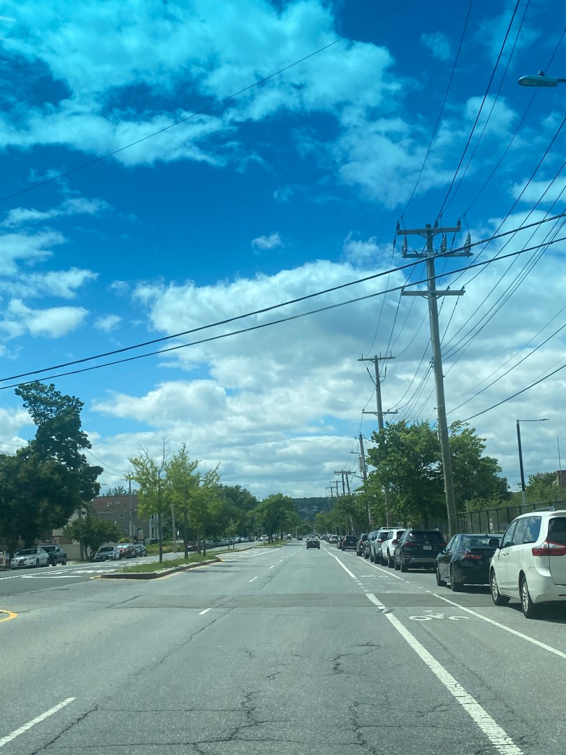
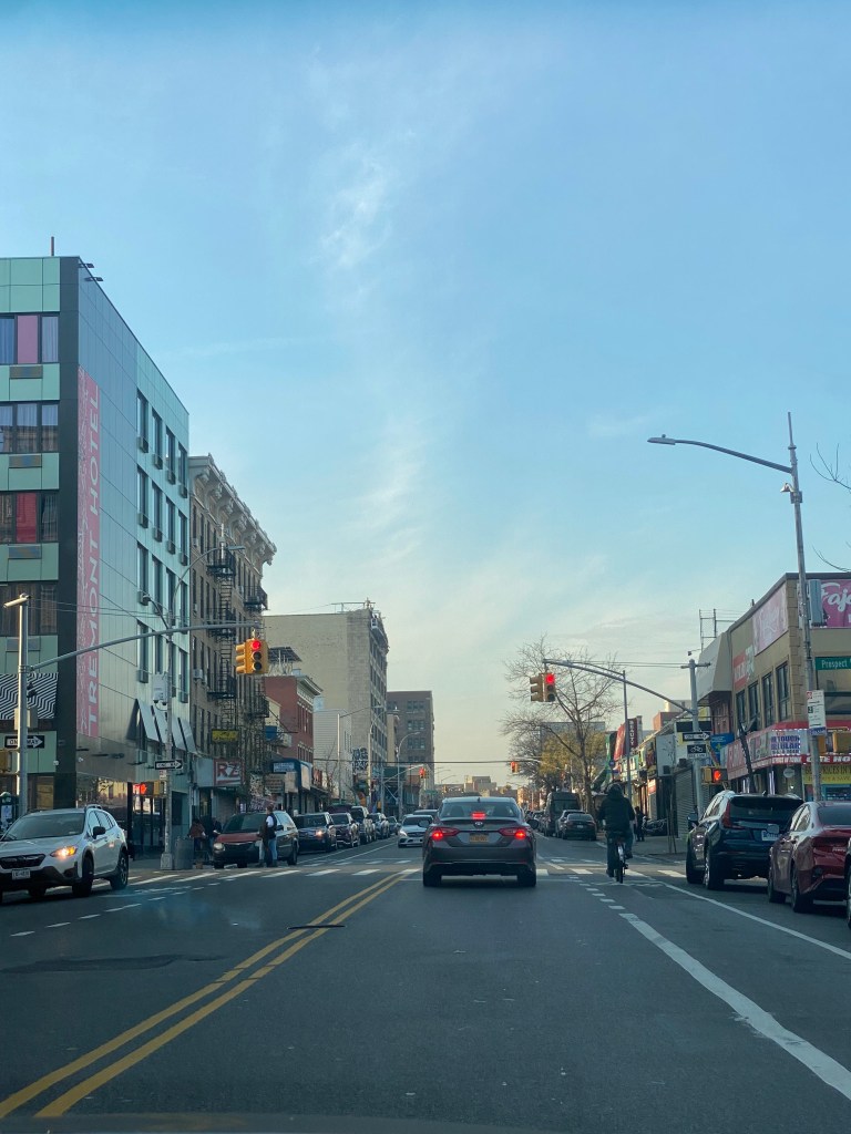
Tremont Avenue in The Bronx is one of the busiest east-west streets in the borough. In addition, it is one of The Bronx’s longest streets at about 7 miles between the Throggs Neck and Morris Heights neighborhoods. The street crosses the entire borough and connects to several other major corridors such as White Plains Rd, Third Ave, and University Ave. Tremont Ave also runs parallel, to the Cross Bronx Expwy, which provides drivers an alternative to one of the most congested highways in the Northeast. In addition, Tremont Avenue provides access to several major destinations such as the River Park Towers and Crotona Park. Every subway route in The Bronx has a stop on or within a 3 minute walk of Tremont Ave. Additionally, Tremont Ave is served by the Metro-North’s Harlem and New Haven Lines at the Tremont Station. As for buses, Tremont Ave is served by the Bx40, Bx42 and Bx36 routes, that provide connections to various communities across the Bronx with the Bx36 going to Washington Heights, Manhattan.
As you can imagine, Tremont Avenue is known for its congestion that leads to slow travel speeds especially for bus riders. Tremont Avenue is especially known for slow bus speeds between University Avenue and Boston Rd. During rush hours, buses average speeds of less than 5 to 8 mph in most sections in both directions. As 29,000 ride the bus through here daily and 72% of nearby residents do not own a car according to the NYCDOT, bus service here is critical to people getting around. Unfortunately, Tremont Avenue’s high volume also in part contributes to safety risks. Between 2016-2020, 1,100 were injured in crashes on Tremont with 215 of them being pedestrians. The intersections of Tremont Ave and the Grand Concourse, Anthony Ave and Boston Rd are considered Vision Zero Priority Intersections respectively.
Due to the slow bus speeds and safety conditions, the New York City Department of Transportation(NYCDOT), is developing a plan to improve Tremont Ave between Boston Rd and University Ave for all road users. The agency has already taken several steps in order to so. In 2016, the agency added a combination of traditional and shared bike lanes, curb extensions and better lane markings for the purpose of improving safety for cyclists between Boston Rd and Tremont’s western terminus at Sedgwick Ave. As for bus speeds, the MTA and NYCDOT proposed adding Select Bus Service to Tremont as part of the 2017 Bus Forward Plan. This would have included the addition of off-board fare collection and likely bus lanes. There has been no discussion of SBS implementation during the recent Bronx Bus Network Redesign or the NYCDOT’s current project.
As for what the NYCDOT’s current plans are, it seems like anything is on the table. In their recent presentation to Bronx Community Advisory Board 1, they showed their transit toolkit which included everything from curbside bus lanes to transit-exclusive busways. In addition, they demonstrated bus boarding islands and pedestrian islands that could help shorten crossing distances for pedestrians and have them wait for the bus in safer places. They also presented ways to make the bus stop more comfortable for riders, through means like benches and leaning bars.
Given how slow buses on Tremont, it would not be surprising to see the NYCDOT propose almost any of the street additions they presented to the Community Advisory Board. The most significant change, a busway, is already in place on the nearby 181st St in Washington Heights. The nearby Fordham Rd in The Bronx , was also slated to get a busway, but it was nixed due to opposition from local businesses and the lack of alternatives for drivers could have resulted in gridlock conditions of nearby side streets. As busways have usually only been on the absolute slowest corridors, a busway on Tremont Ave does seem to be unlikely. While Tremont’s speeds are as slow as some busway corridors have been in some spots, it is just not as consistently slow as corridors like 181st St have been. Busways are likely saved for the slowest corridors due to opposition they have received in nearly each instance from drivers and businesses due to the inability to drive and park on the corridor. As cars often double park to access the various retail stores on Tremont, a busway will likely not sit well with many road users.
Several cars double parked on a Sunday Afternoon at E Tremont Av/Mapes AvMultiple cars parked in bike lane on E Tremont Av/Crotona Av
While a busway may not work, the NYCDOT will almost certainly propose some sort of bus lane for the corridor. A center running bus lane is likely unfeasible as the corridor is not as wide as those such as E 161st St where center running lanes have been implemented. However, an offset or curbside bus lane definitely has a significant chance of being proposed. A curbside lane is exactly what it sounds like while an offset lane, is the use of the rightmost travel lane as a bus lane. Both may generate opposition from drivers due to either the loss of road space or parking space depending on which setup the NYCDOT wants to go with. Regardless, the NYCDOT will likely go with the curbside lane due to the street having only one travel, parking and in some parts a bike lane in each direction. In a presentation to Manhattan Community Board 3 regarding another bus improvement project, the agency said that curbside bus lanes were reserved for narrower corridors while offset bus lanes are set for corridors with more space. Therefore, this is likely the NYCDOT’s best chance at striking a balance between the needs of motorists and bus riders.
Tremont Avenue at Prospect Ave with one travel lane and one bike lane in each direction.
Outside of bus lanes, the NYCDOT is considering adding Transit Signal Priority(TSP) to Tremont so that buses either have extended or early green lights so that buses could proceed faster through intersections. This could definitely be helpful as TSP on five busy routes citywide sped up buses by an average of 18% according to NYCDOT data. Additionally, the NYCDOT and the MTA have already worked to install ABLE cameras on the Bx36 route that runs along the corridor due to enforce the bus lanes and busways respectively on University Ave in The Bronx and 181st St in Manhattan. Even without Tremont Ave bus lanes, the cameras already help improve reliability on Tremont Ave by but it already helps improve overall reliability on Tremont Ave by preventing the bus from being late to Tremont Ave riders due to congestion in other areas.
In regards to bus stops, any of the items in the NYCDOT’s toolkit are likely feasible at most stops along the corridor. In some cases, benches and leaning bars may be subject to spatial constraints, but they nonetheless could become a common sight. The most significant obstacle to getting bus stop upgrades will almost certainly be the city’s budget cuts, initiated by Mayor Eric Adams due to the migrant crisis among other issues. The cuts have even gotten to the point where the New York City Department of Parks and Recreation is maintaining less trash bins and cutting back substantially on park cleaning and maintenance. Given the NYCDOT’s commitment to street improvement projects across the city despite the cuts, small bus stop upgrades will likely not be the agency’s priority.
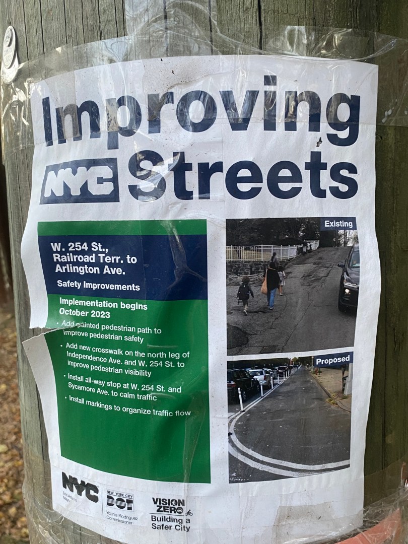
In addition, most of the NYCDOT’s pedestrian toolkit should be able to come in handy. While bus boarding islands may be difficult due to spatial constraints, smaller pedestrian islands could help to reduce crossing distances and improve safety. Data from the Federal Highway Administration shows that these islands can help to reduce pedestrian crashes by 32%, indicating their effectiveness. The NYCDOT is also considering left and right turn bays at select intersections for drivers to make their turns. Left turns are notoriously dangerous as they involve drivers turning at a higher radius and speed coupled with crossing oncoming traffic. A 2016 study from the NYCDOT shows that left turn bays reduced pedestrian and cyclist injuries by 15%, meaning these bays could help to save lives on the road.
All in all, the NYCDOT’s decision on what to implement on Tremont Ave will likely depend on the needs of the community as well as the risks and benefits of each decision. As the corridor varies in population and commerical density, the NYCDOT broke it into five sections to determine which solutions fit best in each area. This may mean bus lanes or certain types of bus lanes in some spots or not others. This could also determine which pedestrian safety additions are pertinent to which intersections. Since most major decisions will include maintaining space for motorists or adding space for buses and pedestrians, any choices will likely not make everyone happy. The fact that people frequently access Tremont Ave by all modes will make these decisions even more difficult. As the NYCDOT is looking to make large scale improvements, hopefully they come to a solution that benefits all road users for years to come.
New York City Department of transportation. “DOT Press Releases – DOT Releases Status Report on “Transit Signal Priority” Technology Used To Speed MTA Buses.” NYC.gov, 24 July 2017, https://www.nyc.gov/html/dot/html/pr2017/pr17-055.shtml. Accessed 30 December 2023.
The Riverdale station on the Metro-North’s Hudson Line is located in the serene Riverdale section of The Bronx. The station is the closest rail station of any kind to the College of Mount Saint Vincent. As the station is nearly two miles from the subway, many Riverdale residents rely on the Metro-North in order to get to Manhattan. In addition, the line also provides direct access to nearby Westchester County and popular reverse commuting destinations such as Yonkers and Tarrytown.
Livingston Street is a major commercial and office corridor in the heart of Downtown Brooklyn. Many important borough offices are located on or near the corridor, such as the Kings County Courts and Brooklyn Borough Hall. Major agencies such as the New York City Department of Education and the MTA also have offices in the area. In addition, the corridor is located near multiple large educational institutions such as Long Island University-Brooklyn, the nearly 6,000-student Brooklyn Technical High School, and the Brooklyn Law School. The corridor also has ample access to public transit, with nearby access to over ten subway lines and a plethora of bus lines that serve about 50,000 riders on a typical weekday, according to NYCDOT statistics. Transit significantly helps Downtown Brooklyn to thrive as visitors to and from the area often come from throughout Brooklyn and the New York Metropolitan Region. In addition, only 33% of households in the Downtown Brooklyn area have access to a vehicle, according to NYC Department of City Planning data; thus, transit is critical to the livelihoods of area residents.
As you might expect, congestion along the corridor is common. Thus, buses are known to be excruciatingly slow, as bus speeds tend to average around five mph in both directions on a typical basis. As Livingston St is an artery for bus routes that travel throughout Brooklyn, delays here significantly affect riders boroughwide regardless of whether or not they are traveling to Downtown Brooklyn. This effect is even more dramatic for Livingston St than for other bus service arteries across the city, given the large geographic size of Brooklyn and the fact that the congestion is more prevalent across more of Brooklyn than other boroughs. One of the busiest routes on Livingston St is the B41-LCL/LTD, which travels about 7.5-9.0 miles to the southern end of Flatbush Av at Kings Plaza or Bergen Beach, it is the 10th busiest bus route in the city in 2020 and 2021 and is proposed to become a Select Bus Service(SBS) route as part of the Brooklyn Bus Network Redesign according to the Draft Plan. Delays here also have a more widespread impact on bus service here than on other bus service arteries in the city, given the large geographic size of Brooklyn and the fact that the congestion is more prevalent across more of Brooklyn than other boroughs. There are bus lanes on the corridor, with the eastbound lanes being offset from the curb and the westbound lanes being curbside. However, according to an NYCDOT presentation, vehicles often block these lanes, rendering them less effective than is desirable.
Thus, the NYCDOT has a unique plan for speeding up buses along the corridor. The plan includes adding two bus lanes in both directions on the south curb of the street for buses to move in both directions from Hoyt St to Flatbush Av. All other vehicles on Livingston would be restricted to traveling westbound only in mixed travel lanes on the opposite side of the street. Vehicles would, however, be allowed to travel eastbound between Smith St and Gallatin Pl to preserve vehicular access to the Metrotech corporate and academic campus(also known as Brooklyn Commons). Given the proposed geometry of the design and the fact that the westbound lane would protect the eastbound lane on the left side of the street, the odds of vehicles blocking the lanes would likely be slim to none. In addition to improving travel times for bus riders, this part of the project may result in faster travel speeds for westbound vehicular traffic as larger buses would not frequently be entering and reentering traffic. Between Gallatin and Boerum Pl, the bus lanes will essentially remain as is. Due to construction at the MTA office building and former headquarters, there will be no construction west of Smith St; as of now.
Livingston St, where bus lane changes will be made. Though this is a Sunday and the bus lanes are not active, the amount of cars parked in the bus lanes makes one wonder what the lanes must look like during the week.
One of the likely concerns with this project is how westbound buses will cross from one side of the street to another to move from the curbside bus lanes to the offset ones due to possible conflicts with westbound car traffic or pedestrians attempting to cross the street midblock, as the NYCDOT did not indicate any plans to prevent pedestrians from crossing here or mitigate motor vehicle conflicts in this situation in their presentation. The city will likely not resort to enforcing its relatively unrecognized jaywalking law that prohibits pedestrians from crossing streets outside of crosswalks, as many have claimed that enforcement of this law has been disproportionately targeted toward people of color. Additionally, jaywalking enforcement here would likely lead to questions on why similar enforcement does not exist elsewhere, especially in other busy areas such as Midtown Manhattan, where pedestrians crossing against signals frequently leads to motorist/pedestrian conflicts.
Livingston St between Hoyt St and Gallatin Pl where bus lanes will switch from one side of the curb to another.
A more common concern with bus lane projects that the NYCDOT may encounter here is concerns over the loss of parking in a neighborhood where parking is already at an extreme premium, and many pay high prices to park their cars in garages. However, this argument will likely be weaker and/or less prevalent here as the vast majority of residents and travelers to the area do not drive. In addition, as many drivers to the area come from outside of Brooklyn and even New York City as a whole, there would likely be less momentum in any campaign to preserve parking spaces. However, due to the commercial and residential density of the corridor, the NYCDOT still is considering metered commercial vehicle spots to assist businesses with loading activities as most businesses receive deliveries via box truck between the hours of 7 AM to 5 PM, according to the NYCDOT’s presentation to Brooklyn Community Board 2.
Another issue that the bus lanes may encounter is that while traffic flow on Livingston St westbound might improve, congestion on Schermerhorn St eastbound is projected to increase initially, according to the NYCDOT, as traffic that would have otherwise used Livingston Street uses Schermerhorn as an alternative. However, the NYCDOT said in its presentation that they would convert Schermerhorn from one-way westbound to eastbound between Boerum Pl and Smith St and consider potential improvements to Schermerhorn St if necessary to alleviate congestion. Currently, the NYCDOT projects that Schermerhorn St and Atlantic Ave will serve as the two main alternate routes for eastbound travel. However, one thing that may work in drivers’ favor regarding avoiding congestion is that Downtown Brooklyn has a robust number of side streets parallel to Livingston St. Thus, many will likely find alternate routes to Livingston that take them not much longer, if at all, to get to their final destinations, including the ones the NYCDOT has proposed. They also stated that as they have seen in past projects, drivers will likely disperse among multiple alternate routes, choose to drive during off-peak hours, and some may even choose to take mass transit.
The extent to which motorists switch to mass transit will likely be an interesting question as drivers to Downtown Brooklyn have likely already endured immense levels of congestion and difficulty parking that have not yet led to them making the switch. Given that Downtown Brooklyn is a regional destination in a less central location than many core parts of Manhattan, the number of people who switch to mass transit here may be limited as many who travel to Downtown Brooklyn by car likely live in various parts of NYC or elsewhere that have little access to reliable transit services to Downtown Brooklyn. Also, drivers who commute to work in the area may have limited options for driving during peak hours.
Like with many of their projects, the NYCDOT is aiming to make pedestrian safety improvements on the corridor in addition to bus service improvements, as Livingston St is designated as a Vision Zero Priority Corridor due to having a high number of pedestrians KSI(killed or seriously injured). According to data presented by the NYCDOT to Brooklyn Community Board 2, 21 out of 22 pedestrian injuries on Livingston St between 2016-2020 were due to turning vehicles striking pedestrians crossing with the right of way, and 15 of these were in the midst of left turns.
Thus, the NYCDOT has decided to add bus boarding islands and left turn bays on Livingston St at Nevins St and Hoyt St, respectively, to increase pedestrian and bus rider safety. Bus boarding islands can help increase pedestrian safety by providing them more space on the roadway and helping to improve bus speeds as buses would not have to pull up to the sidewalk to pick up passengers. In addition, these islands will include fences, bollards, and leaning bars for the comfort of riders, which can come in handy during long waits for buses. As for the left turn bays, these are designated areas where all left turns at an intersection are mandated to occur. In these cases on Livingston St, the cars turning left will have a traffic signal completely separate from other vehicles. They prove to be effective as, according to an NYCDOT study done in August 2016 on left turns, left turn bays with signals led to a 33% decrease in pedestrian and cyclist injuries at the intersections where they were implemented. In addition to the safety aspect, the left turn bays will prevent turning vehicles from interfering with bus speeds as they will have a space separate from the bus lanes to make a turn.
The intersection of Livingston St/Nevins St where bus boarding islands and a left turn bay will be added.The intersection of Livingston St/Nevins St where bus boarding islands and a left turn bay will be added.
Another pedestrian safety element the NYCDOT plans to add to Livingston St is concrete pedestrian islands, which reduce crossing distances and provide pedestrians with more physical protection from vehicles. They are proposed for Livingston St intersections with Elm Pl and Flatbush Av, respectively. According to the Federal Highway Administration, pedestrian islands can help reduce pedestrian crashes by as much as 32% as they reduce crossing distances and provide pedestrians with more physical protection from vehicles. Painted curb extensions are proposed for this intersection as well as for intersections along Livingston St with Flatbush Ave, Hanover Pl, Bond St, and Gallatin Place, which will also help improve pedestrian safety by shortening crossing distances and providing pedestrians with more safe space in the roadway. The NYCDOT is considering adding partnering with a local art sponsor to add the artwork to the painted section. In addition, the agency plans to partner with the Parks Department to install trees on the north curb and planters throughout the corridor to beautify the streetscape.
The NYCDOT plans to begin work on the project this summer, and the agency plans to make adjustments as needed. They might also consider making improvements west of Smith St upon the completion of construction at the MTA building. As the NYCDOT has done these types of bus service/pedestrian projects citywide, one may wonder how much of a difference it can make for all road users when streets are redesigned.
Knispel, Jay S. “Is Jaywalking Permissible in New York? – New York, NY – Law Offices of Jay S. Knispel Personal Injury Lawyers.” NYC Personal Injury Lawyer, 24 February 2023, https://jknylaw.com/blog/is-jaywalking-permissible-in-new-york/. Accessed 23 June 2023.
University Ave is one of the busiest north-south streets in the West Bronx. Though the corridor is mainly residential, it connects several east-west arteries, such as Fordham and Kingsbridge Roads and Burnside and Tremont Avenues. The street is also home to Bronx Community College. The bus routes that run along the corridor, the Bx3 and the Bx36, cross the Washington Bridge into Manhattan and serve University Ave, providing riders with many transfer options for traveling throughout the Bronx and Manhattan via other bus and subway lines. Thus, it is no surprise that in the existing conditions report for The Bronx Bus Network Redesign, the travel pattern Burnside to Washington Heights had the 6th most trips between two TAZs (Transit Analysis Zones), and the travel pattern Morris Heights to Washington Heights ranked 20th. Both of those trip patterns are served by the Bx3 and Bx36 buses.
East Gun Hill Rd in The Bronx is one of the busiest streets in the northern section of the borough. The bustling roadway is home to many businesses. It connects several other major Bronx streets such as Eastchester Rd, Bronxwood Ave, and Webster Ave. Motorists can also connect to the Bronx River Pkwy, Hutchinson River Pkwy, and Interstate 95(New England Thruway). Multiple schools, such as JHS 144 Michaelangelo and the Evander Childs High School Campus, are along the corridor. The Montefiore Moses Hospital Campus and North Central Hospital are also near E Gun Hill Rd.
Pedestrian safety is undoubtedly a critical issue that many New Yorkers care about. Whether you get around by bus, subway, car, or another mode, a walk is at least some part of pretty much any trip around the city.
This could not be more true about the parents of New York City schoolchildren, who, no matter what neighborhood their child’s school is located in, want to ensure their children get to and from school safely. Unfortunately, streets near schools in New York City tend to be significantly more dangerous for pedestrians than other streets. According to a Streetsblog investigation, during the 8 AM hour when schools are open, there are 57% more crashes and 25% more injuries per mile on streets near schools than on other streets. It is also worth noting that many of the city’s schools are not even located on or adjacent to many of the busiest and most dangerous streets for pedestrians in most boroughs, making this disparity even more alarming.
The city commits substantial resources, from speeding cameras near schools to school crossing guards, to ensure the safety of some of its youngest pedestrians and their families. However, even though the prevalence of the resources is often considered insufficient, the city looks to numerous measures to attempt and address what is too many of its most troubling transportation issues.
One of arguably its most effective measures for improving pedestrian safety near schools is street design changes on the surrounding streets through the New York City Department of Transportation (NYCDOT), which controls NYC streets. These measures can consist of a variety of measures such as curb extensions, pedestrian islands, lane reconfigurations, and so much more to provide pedestrians with more space, change driver behavior, or improve safety.
Clove Lakes and Silver Lakes Park are among the largest parks on Staten Island and are popular recreational destinations for residents across the borough. Spanning multiple Staten Island neighborhoods, the parks have several sports fields, the Staten Island War Memorial Ice Skating Rink, and a plethora of natural beauty, including a 300-year-old tulip tree in Clove Lakes Park. The parks are also adjacent to the Staten Island Zoo. The parks are also located near several schools, Wagner College and St Johns University-Staten Island Campus. In addition to all of the valuable amenities that already make it a community asset, the park’s extensive network of walking/cycling trails connect the surrounding communities to the park and each other, allowing many Staten Island residents to experience what the park has to offer as part of their daily lives.
Now, the NYC Parks Department is taking multiple steps to improve the park’s transportation infrastructure to continue improving its connectivity to its surrounding communities. One of the major steps the agency is taking is the reconstruction of the walking/cycling trails at both parks and Hero Park, a smaller park adjacent to Silver Lakes Park. This will likely include the replacement of many trails, such as those in Clove Lakes Park near Royal Oak Road directly off of Victory Boulevard in the Royal Oak neighborhood, where a Parks Department spokeswoman told the Staten Island Advance, “Work will address damaged path areas, as well as some drainage and erosion issues, providing a more seamless experience for all parkgoers.” The Staten Island Advance also reported in reference to conditions at Clove Lakes Park in July 2020 that the trails in the park were “… in need of resurfacing and paving with more durable asphalt…”
Queens Blvd is one of the busiest streets in all of Queens, stretching from Downtown Jamaica in Southern Queens, about 7.5 miles to the Ed Koch Queensboro Bridge, which connects Queens to Midtown Manhattan and is the only way to get to Queens to Manhattan by car without paying a toll. Along the way, the Boulevard passes through many diverse neighborhoods with high population densities such as Forest Hills, Elmhurst, Woodside and Long Island City. Many major destinations are located along the corridor as well such as the Queens Center Mall and Queens Borough Hall. Many schools, hospitals, retail stores and other facilities are located along or off the bustling street as well.
The Northern Blvd corridor between 114th St and Broadway is one of the busiest stretches in East Elmhurst and Jackson Heights. The area is both a busy commercial and residential area with a plethora of small businesses with roots from all over the world. There is also a good amount of public transit along the corridor. Despite the 7 train being about 0.5 miles south, the Q66 local bus as well as 4 Queens-Manhattan express buses use the corridor. In addition, the M and R trains are located at the Northern Blvd Station which is on Northern Blvd and Broadway. Around 15,000 bus riders ride the bus along this portion of Northern Blvd on any given weekday. Public Transit and walking is a critical part of how people in the surrounding community get around in Queens Community District 3, where the corridor is located as 64% of residents here take public transit to work and 8% walk according to data from the New York City Department of City Planning. Only 50% of housing units have at least one vehicle.