New York City’s public buses are a core part of its public transportation network. While the city is known for its subways, its bus network still serves over a million riders daily among its 327 bus routes. The city’s buses are also particularly helpful in helping people get to areas where the subway just does not go.
Whether people are riding the bus to the subway, to work or school, or traveling a long distance across their borough, everyone undoubtedly wants a fast and reliable trip to their destination. In many instances, however, it is hard for the MTA to provide for the simple fact that buses have to share road space with vehicles and, thus, they routinely run in congested traffic. A report from the state comptroller’s office in March 2023 showed that MTA buses in the five boroughs rarely averaged speeds above 9 mph. In comparison, an average man runs 8 mph. On many of the MTA’s slowest routes, speeds do not average much more than 3 mph, which is the average speed of a human walk. This issue is made worse by the fact that buses tend to make a good number of stops, and thus, they must merge back into traffic every time they do, slowing travel times.
. New York City is by far one of the most transit-dependent cities in the United States, with millions of people using mass transit to get around the five boroughs on a daily basis. While the city is world-famous for its subway system, its bus system is also a crucial part of the city’s transportation network, with 5,780 vehicles serving 327 total routes across the city as of 2021.
As you might predict, having this many vehicles in one of the densest cities in America means that finding the proper space to park and maintain these buses can be a challenge. This is where the MTA’s 29 bus depots come into play, where buses, in addition to being parked and maintained, are painted, cleaned, and have their respective fare revenues collected. Unlike subway trains, cleaners do not enter buses upon a bus’s arrival at the last stop. Hence, the cleaning buses undergo at their depots is essential to keeping them as sanitary and pleasant as possible for riders. In addition, the MTA has two central maintenance facilities, the Zerega Avenue Maintenance and Training Facility in The Bronx and the Grand Avenue Central Maintenance Facility in Brooklyn.
Nassau County is one of two counties in the Long Island region of New York. Most of the county, with the exception of Long Beach, is located within one of three towns, Hempstead, North Hempstead, and Oyster Bay, which consist of many villages, such as Valley Stream, Mineola, and Massapequa. While the county is mainly suburban, many pockets of higher residential and employment densities are seen in the heart of villages, such as in the Mineola/Garden City/Westbury area along with Downtown Hempstead, as well as along certain transportation corridors such as Sunrise Hwy/Babylon LIRR Branch.
Church Ave is a major residential and commercial corridor that runs about 4 miles east-west through Central Brooklyn between the Kensington and Brownsville neighborhoods. In addition to traversing several busy neighborhoods, the corridor traverses several busy streets and roadways such as Ocean Pkwy/Prospect Expwy, Flatbush Ave, Nostrand/Bedford Ave, and Utica Ave, providing connections for motorists to travel to numerous destinations throughout Brooklyn. In addition, the street is home to several key destinations such as Prospect Park, SUNY Downstate Medical Center, and the Erasmus Hall High School Campus, which currently has about 1,994 students according to data on campus schools from MySchools NYC though the building once served over 7,000 students as a larger high school.
65/66th Street is one of the most vital corridors that runs along the Upper East/West Sides of Manhattan. The corridor is home to several major regional destinations, such as Rockefeller University, Memorial Sloan Kettering Cancer Center, the Central Park Zoo, Lincoln Center, and so much more. Additionally, the corridor is home to the 1 train on the West Side(Broadway/7th Avenue Line) and the 6 train on the East Side(Lexington Avenue Line), meaning while the corridor is well connected to the rest of the city by subway, many transit riders might utilize the M66 crosstown bus in order to access trains traveling to different parts of Manhattan and The Bronx that the other line is disconnected from. Transit is extremely imperative to people getting around along 66th Street and the surrounding communities as not only do most people traveling to Manhattan use mass transit, but only 30% of UES and 27% of UWS households own cars, according to data from the New York City Department of City Planning(NYCDCP). Thus, transit is critical to the movement of both residents and visitors in the 66th St area daily.
Public transportation is the backbone and lifeblood of New York City, as millions of New Yorkers as well as visitors, rely on MTA subways and buses to traverse the city on a daily basis. According to data from the NYC Department of City Planning, 46% of residents across the five boroughs do not even own vehicles, making them entirely dependent on mass transit for getting around. Even with many office workers continuing to work on hybrid or remote schedules, the subway and bus systems served 84.3 million and 33.2 million paid riders, respectively, in February 2023, according to data from the NYC Comptroller’s office. According to the MTA website, the agency counts a rider as one who has paid the fare or used a Student MetroCard to board a subway train or bus route. Employees and those who make subway transfers without exiting the system are omitted from ridership counts.
Livingston Street is a major commercial and office corridor in the heart of Downtown Brooklyn. Many important borough offices are located on or near the corridor, such as the Kings County Courts and Brooklyn Borough Hall. Major agencies such as the New York City Department of Education and the MTA also have offices in the area. In addition, the corridor is located near multiple large educational institutions such as Long Island University-Brooklyn, the nearly 6,000-student Brooklyn Technical High School, and the Brooklyn Law School. The corridor also has ample access to public transit, with nearby access to over ten subway lines and a plethora of bus lines that serve about 50,000 riders on a typical weekday, according to NYCDOT statistics. Transit significantly helps Downtown Brooklyn to thrive as visitors to and from the area often come from throughout Brooklyn and the New York Metropolitan Region. In addition, only 33% of households in the Downtown Brooklyn area have access to a vehicle, according to NYC Department of City Planning data; thus, transit is critical to the livelihoods of area residents.
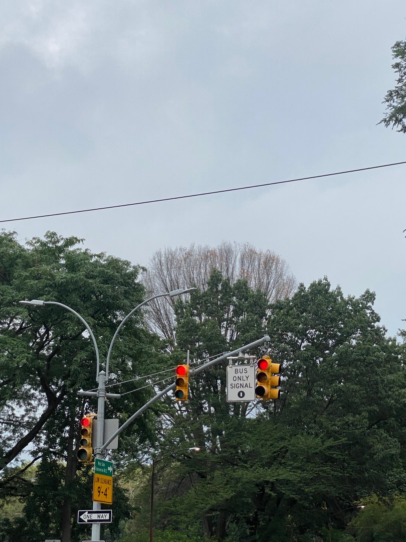
As you might expect, congestion along the corridor is common. Thus, buses are known to be excruciatingly slow, as bus speeds tend to average around five mph in both directions on a typical basis. As Livingston St is an artery for bus routes that travel throughout Brooklyn, delays here significantly affect riders boroughwide regardless of whether or not they are traveling to Downtown Brooklyn. This effect is even more dramatic for Livingston St than for other bus service arteries across the city, given the large geographic size of Brooklyn and the fact that the congestion is more prevalent across more of Brooklyn than other boroughs. One of the busiest routes on Livingston St is the B41-LCL/LTD, which travels about 7.5-9.0 miles to the southern end of Flatbush Av at Kings Plaza or Bergen Beach, it is the 10th busiest bus route in the city in 2020 and 2021 and is proposed to become a Select Bus Service(SBS) route as part of the Brooklyn Bus Network Redesign according to the Draft Plan. Delays here also have a more widespread impact on bus service here than on other bus service arteries in the city, given the large geographic size of Brooklyn and the fact that the congestion is more prevalent across more of Brooklyn than other boroughs. There are bus lanes on the corridor, with the eastbound lanes being offset from the curb and the westbound lanes being curbside. However, according to an NYCDOT presentation, vehicles often block these lanes, rendering them less effective than is desirable.
Thus, the NYCDOT has a unique plan for speeding up buses along the corridor. The plan includes adding two bus lanes in both directions on the south curb of the street for buses to move in both directions from Hoyt St to Flatbush Av. All other vehicles on Livingston would be restricted to traveling westbound only in mixed travel lanes on the opposite side of the street. Vehicles would, however, be allowed to travel eastbound between Smith St and Gallatin Pl to preserve vehicular access to the Metrotech corporate and academic campus(also known as Brooklyn Commons). Given the proposed geometry of the design and the fact that the westbound lane would protect the eastbound lane on the left side of the street, the odds of vehicles blocking the lanes would likely be slim to none. In addition to improving travel times for bus riders, this part of the project may result in faster travel speeds for westbound vehicular traffic as larger buses would not frequently be entering and reentering traffic. Between Gallatin and Boerum Pl, the bus lanes will essentially remain as is. Due to construction at the MTA office building and former headquarters, there will be no construction west of Smith St; as of now.
Livingston St, where bus lane changes will be made. Though this is a Sunday and the bus lanes are not active, the amount of cars parked in the bus lanes makes one wonder what the lanes must look like during the week.
One of the likely concerns with this project is how westbound buses will cross from one side of the street to another to move from the curbside bus lanes to the offset ones due to possible conflicts with westbound car traffic or pedestrians attempting to cross the street midblock, as the NYCDOT did not indicate any plans to prevent pedestrians from crossing here or mitigate motor vehicle conflicts in this situation in their presentation. The city will likely not resort to enforcing its relatively unrecognized jaywalking law that prohibits pedestrians from crossing streets outside of crosswalks, as many have claimed that enforcement of this law has been disproportionately targeted toward people of color. Additionally, jaywalking enforcement here would likely lead to questions on why similar enforcement does not exist elsewhere, especially in other busy areas such as Midtown Manhattan, where pedestrians crossing against signals frequently leads to motorist/pedestrian conflicts.
Livingston St between Hoyt St and Gallatin Pl where bus lanes will switch from one side of the curb to another.
A more common concern with bus lane projects that the NYCDOT may encounter here is concerns over the loss of parking in a neighborhood where parking is already at an extreme premium, and many pay high prices to park their cars in garages. However, this argument will likely be weaker and/or less prevalent here as the vast majority of residents and travelers to the area do not drive. In addition, as many drivers to the area come from outside of Brooklyn and even New York City as a whole, there would likely be less momentum in any campaign to preserve parking spaces. However, due to the commercial and residential density of the corridor, the NYCDOT still is considering metered commercial vehicle spots to assist businesses with loading activities as most businesses receive deliveries via box truck between the hours of 7 AM to 5 PM, according to the NYCDOT’s presentation to Brooklyn Community Board 2.
Another issue that the bus lanes may encounter is that while traffic flow on Livingston St westbound might improve, congestion on Schermerhorn St eastbound is projected to increase initially, according to the NYCDOT, as traffic that would have otherwise used Livingston Street uses Schermerhorn as an alternative. However, the NYCDOT said in its presentation that they would convert Schermerhorn from one-way westbound to eastbound between Boerum Pl and Smith St and consider potential improvements to Schermerhorn St if necessary to alleviate congestion. Currently, the NYCDOT projects that Schermerhorn St and Atlantic Ave will serve as the two main alternate routes for eastbound travel. However, one thing that may work in drivers’ favor regarding avoiding congestion is that Downtown Brooklyn has a robust number of side streets parallel to Livingston St. Thus, many will likely find alternate routes to Livingston that take them not much longer, if at all, to get to their final destinations, including the ones the NYCDOT has proposed. They also stated that as they have seen in past projects, drivers will likely disperse among multiple alternate routes, choose to drive during off-peak hours, and some may even choose to take mass transit.
The extent to which motorists switch to mass transit will likely be an interesting question as drivers to Downtown Brooklyn have likely already endured immense levels of congestion and difficulty parking that have not yet led to them making the switch. Given that Downtown Brooklyn is a regional destination in a less central location than many core parts of Manhattan, the number of people who switch to mass transit here may be limited as many who travel to Downtown Brooklyn by car likely live in various parts of NYC or elsewhere that have little access to reliable transit services to Downtown Brooklyn. Also, drivers who commute to work in the area may have limited options for driving during peak hours.
Like with many of their projects, the NYCDOT is aiming to make pedestrian safety improvements on the corridor in addition to bus service improvements, as Livingston St is designated as a Vision Zero Priority Corridor due to having a high number of pedestrians KSI(killed or seriously injured). According to data presented by the NYCDOT to Brooklyn Community Board 2, 21 out of 22 pedestrian injuries on Livingston St between 2016-2020 were due to turning vehicles striking pedestrians crossing with the right of way, and 15 of these were in the midst of left turns.
Thus, the NYCDOT has decided to add bus boarding islands and left turn bays on Livingston St at Nevins St and Hoyt St, respectively, to increase pedestrian and bus rider safety. Bus boarding islands can help increase pedestrian safety by providing them more space on the roadway and helping to improve bus speeds as buses would not have to pull up to the sidewalk to pick up passengers. In addition, these islands will include fences, bollards, and leaning bars for the comfort of riders, which can come in handy during long waits for buses. As for the left turn bays, these are designated areas where all left turns at an intersection are mandated to occur. In these cases on Livingston St, the cars turning left will have a traffic signal completely separate from other vehicles. They prove to be effective as, according to an NYCDOT study done in August 2016 on left turns, left turn bays with signals led to a 33% decrease in pedestrian and cyclist injuries at the intersections where they were implemented. In addition to the safety aspect, the left turn bays will prevent turning vehicles from interfering with bus speeds as they will have a space separate from the bus lanes to make a turn.
The intersection of Livingston St/Nevins St where bus boarding islands and a left turn bay will be added.The intersection of Livingston St/Nevins St where bus boarding islands and a left turn bay will be added.
Another pedestrian safety element the NYCDOT plans to add to Livingston St is concrete pedestrian islands, which reduce crossing distances and provide pedestrians with more physical protection from vehicles. They are proposed for Livingston St intersections with Elm Pl and Flatbush Av, respectively. According to the Federal Highway Administration, pedestrian islands can help reduce pedestrian crashes by as much as 32% as they reduce crossing distances and provide pedestrians with more physical protection from vehicles. Painted curb extensions are proposed for this intersection as well as for intersections along Livingston St with Flatbush Ave, Hanover Pl, Bond St, and Gallatin Place, which will also help improve pedestrian safety by shortening crossing distances and providing pedestrians with more safe space in the roadway. The NYCDOT is considering adding partnering with a local art sponsor to add the artwork to the painted section. In addition, the agency plans to partner with the Parks Department to install trees on the north curb and planters throughout the corridor to beautify the streetscape.
The NYCDOT plans to begin work on the project this summer, and the agency plans to make adjustments as needed. They might also consider making improvements west of Smith St upon the completion of construction at the MTA building. As the NYCDOT has done these types of bus service/pedestrian projects citywide, one may wonder how much of a difference it can make for all road users when streets are redesigned.
Knispel, Jay S. “Is Jaywalking Permissible in New York? – New York, NY – Law Offices of Jay S. Knispel Personal Injury Lawyers.” NYC Personal Injury Lawyer, 24 February 2023, https://jknylaw.com/blog/is-jaywalking-permissible-in-new-york/. Accessed 23 June 2023.
University Ave is one of the busiest north-south streets in the West Bronx. Though the corridor is mainly residential, it connects several east-west arteries, such as Fordham and Kingsbridge Roads and Burnside and Tremont Avenues. The street is also home to Bronx Community College. The bus routes that run along the corridor, the Bx3 and the Bx36, cross the Washington Bridge into Manhattan and serve University Ave, providing riders with many transfer options for traveling throughout the Bronx and Manhattan via other bus and subway lines. Thus, it is no surprise that in the existing conditions report for The Bronx Bus Network Redesign, the travel pattern Burnside to Washington Heights had the 6th most trips between two TAZs (Transit Analysis Zones), and the travel pattern Morris Heights to Washington Heights ranked 20th. Both of those trip patterns are served by the Bx3 and Bx36 buses.
Utica Avenue/Malcolm X Blvd is one of the busiest north-south thoroughfares in Brooklyn. The approximately 6-mile stretch passes through numerous densely populated and busy neighborhoods such as Bedford-Stuyvesant(Bed-Stuy), Crown Heights, East Flatbush, and more. It also connects to the Kings Plaza Shopping Center, one of the largest shopping malls in Brooklyn. In addition, the corridor connects to several other critical east-west arteries in the borough, such as Chruch Ave, Linden Blvd, and Kings Hwy, which are at least five miles long.
The Eltingville Transit Center is one of two transit hubs in Staten Island and is the only transit hub serving the southern and western parts of the borough. The hub serves many express bus routes to Manhattan and many local bus routes. The center also serves the S79-SBS to Bay Ridge, Brooklyn, and the S89 to the 34th St Light Rail Station in Bayonne, NJ. The transit center is about a 10-minute bus ride from the Staten Island Mall and Eltingville SIR station.