Express buses are critical transportation assets for residents of the outer boroughs. In areas far from Manhattan, subway service, or both, express buses are often the only direct mass transit link between many communities and Manhattan. As congestion pricing nears, many may turn to express buses to avoid the even higher costs associated with driving in Manhattan. In February 2020, about 42,000 riders took express buses daily, according to the Gothamist.
The bus system on Staten Island is critical for the mobility of residents. Despite the borough being known for its car dependency, 17% of households do not have access to a car. Even in households that do, many young people rely on public buses to get to school as most youth under 18 cannot drive in New York State. Additionally, 11.2% of Staten Islanders live below the federal poverty line according to US Census data. This makes the bus essential to those who cannot afford alternate means of travel. Even for residents who can drive, many residents ride buses in some capacity to get to Manhattan. This is the case whether they take an express bus direcly to Manhattan or they take a local bus to the Staten Island Ferry. Many commuters also take the bus into Brooklyn to ride the subway, or to Staten Island Railway stations to get to the Ferry. Commuters to Manhattan are the reason why in Staten Island Community District 3 where only 8% of households are without a car, 21% of residents still had a car-free commute in 2021.
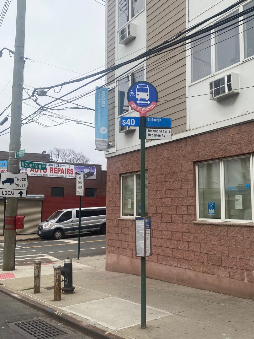
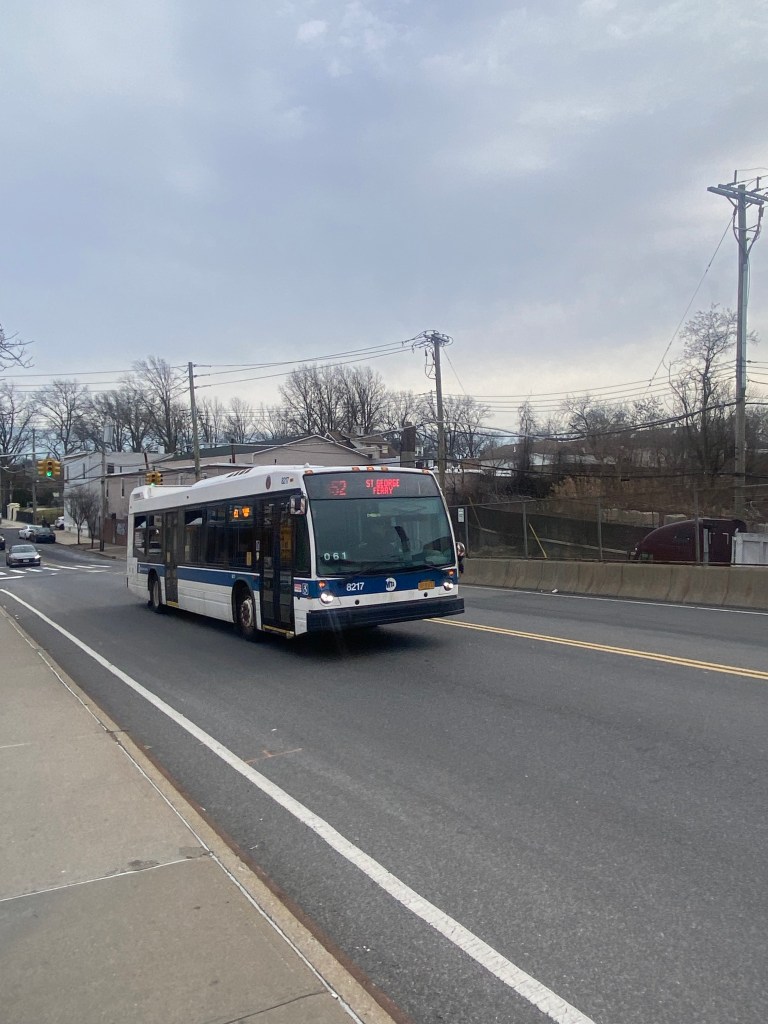
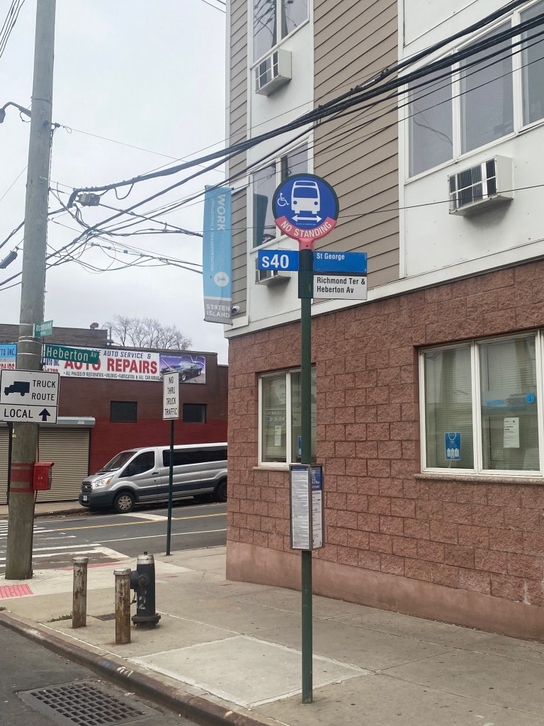
S52 bus toward St George Ferry Terminal on Tompkins Avenue in the Rosebank section of Staten Island.Bus stop for S40 toward St. George Ferry Terminal at Richmond Terrace/Heberton Ave.
Unfortunately, buses on Staten Island are known for unreliable service. While they tend to be significantly faster on the road than buses in other boroughs, they are still plagued with unexpected delays and infrequent service on some routes. For example, the S59, one of the few buses running between the North and South Shores of Staten Island, has headways of every 15-20 min all day including during rush hours. On top of this, these headways are assuming every bus that is scheduled actually runs. According to MTA statistics, service delivered on Staten Island local/limited and select buses has only averaged 87.7% each month over the past year compared to a 95.6% citywide average. Since July 2023, service delivery has been even more abysmal with monthly service delivered rates only ranging between 81.7-87.6% with the 81.7% being the number just last month.
Since buses on Staten Island are infrequent and often no-show when scheduled, less residents are likely to ride them. This can be detrimental for bus service as low ridership could be mistaken for low demand rather than choice of more reliable travel modes. If the MTA perceives lower demand on Staten Island routes, the borough could be targeted for even less frequent service when the MTA has budget issues or when the borough’s bus network is redesigned. This is similar to what happened with the initial Queens Bus Network Redesign Draft Plan in 2020 that called for low frequency service in communities similar to those on Staten Island. The plan got so much backlash that it was pulled and a new draft plan was prepared and published in March 2022 following pandemic-related delays. A proposed final plan was published in Dceember 2023.
The cycle of low ridership on unreliable bus service followed by service cuts is all too common in American cities, which is part of why about 76% of Americans drive alone to work. Many might make the case that Staten Island does not need more transit service because of its lower population density than the other boroughs. While many New Yorkers view Staten Island as a suburban enclave, the borough has a population of nearly 500,000 and a population density higher than both Houston and Los Angeles. Additionally, more frequent transit in areas with densities similar to and even less than Staten Island can work. In Toronto, a city with a population density about half of Staten Island’s, buses come every 5 minutes, 24 hours a day. As a result of this frequent service, many people including car owners ride them. So, having more frequent buses on Staten Island is largely a matter of funding, resources and political will.
Speaking of funding and resources, these things may make it difficult for the MTA to run more frequent service. The MTA recently received state funding back in 2023 to address its budget shortfalls that could have led to higher than expected fare increases and service cuts systemwide. Additionally as mentioned earlier, the MTA struggles to service the existing schedule as service delivery rates on Staten Island are the worst in the city. In 2022, the MTA attributed the lower rates to lower staffing levels and higher rates of driver absences. Back then, MTA spokesperson Sean Butler told the Staten Island Advance that the MTA was performing “‘aggressive efforts’” to hire new bus operators. This included initiatives such as larger bus training classes and creating step by step guides to help interested applicants. Now in 2024, the MTA is still hiring bus operators and you can find more information on becoming a bus operator here:https://new.mta.info/careers/bus-operator.
As for increasing service beyond existing schedules, there have not been substantial efforts to do this yet on Staten Island. The last documented time bus frequencies were increased on Staten Island was in response to a surge in employment at an Amazon Facility in Bloomfield. There is a bill in the State Legislature known as the MTA Freeze Fares, Fund Frequency and Free Bus Act that would increase bus headways to every 6 minutes on the 100 busiest routes in the system for 17 hours a day. Despite lower ridership on Staten Island than in other boroughs, busy routes such as the S79-SBS on Hylan Blvd, along with the S46/96 and S40/90 on the busier North Shore may qualify. Ultimately, it will require substantial funding and political committment to increase bus service.
Outside of frequencies, another area Staten Island buses particularly struggle in is additional bus stop time. Additional bus stop time refers to the additional amount of time buses wait at each stop prior to departing than scheduled. On Staten Island, the average additional bus stop time each month over the past year was 2 minutes, 50 seconds which is higher than the 1 minute, 56 second citywide average. There are several reasons this can be the case. One is a higher rate of MetroCard and exact change use to board the bus, as these payment methods take longer than the OMNY contactless system. According to data from the Urban Institute in 2013, 7.2% of Staten Islanders are unbanked including 15.1-20% on the North Shore where bus ridership is likely highest. As OMNY almost always requires the use of a bank card, many Staten Island riders must use the other fare systems. In addition, most Staten Island buses make stops in either the St. George Bus Terminal, Eltingville Transit Center or both. This may increase bus dwell times as buses have the unique tasks of picking up/dropping off large quantities of riders at one stop. In addition, most bus routes on Staten Island have at least one stop near a large high school, which could mean high rates of passengers getting on and off near schools.
To address these issues , the MTA can increase the availability of the OMNY Card and improve bus boarding conditions near busy stops. The OMNY Card allows riders to preload a card with cash similar to how they would a MetroCard. Currently, the OMNY Card is only available at nine retailers on Staten Island. Of these nine, three of them are located within blocks of each other in the Great Kills neighborhood and two are in and around the Staten Island Mall. None of them are on the North Shore which has the highest rate of both unbanked residents and residents without a car on Staten Island. In addition to limited availability, purchasing a card requires a $5 fee at time of purchase, making it a less competitive compared to the $1 fee for a new MetroCard and no additional charges for the use of exact change.
Once more bus riders use OMNY, MTA officials may want to consider all-door boarding on buses which should help reduce dwell times at busy stops. When asked about the idea by advocates, MTA Chairman Janno Lieber said that more bus riders must use OMNY before all-door boarding is considered. This is because fewer than 20% of riders citywide utilize the contactless payment method as of March 2023. When more bus riders use OMNY, transit officials will likely have to consider how fare evasion may be affected as this has been their chief concern for implementing all-door boarding in the past. One can argue that fare evasion will decrease as rider who would otherwise pay currently board on back doors without paying due to lines to pay at the front door. On the flipside, fare evasion may increase due to riders being allowed to board without making contact with the bus operators. The MTA’s decision on whether to allow all-door boarding with more OMNY use will likely be based on their risk-benefit analysis of what would lead to more fare evasion. Regardless, more OMNY use will reduce additional bus stop time due to it being a faster fare process.
While Staten Island may not be as congested as the rest of the city, its bus network still has its fair share of flaws. It is clear that addressing these flaws will lead to a better transportation network that is more suitable for the urban travel needs of Staten Island. Hopefully, the MTA can develop solutions to improve Staten Island bus service to enhance the mobility of all Staten Islanders.
Metropolitan Transportation Authority. “Queens Bus Network Redesign Proposed Final Plan.” MTA, 12 December 2023, https://new.mta.info/document/129216. Accessed 28 February 2024.
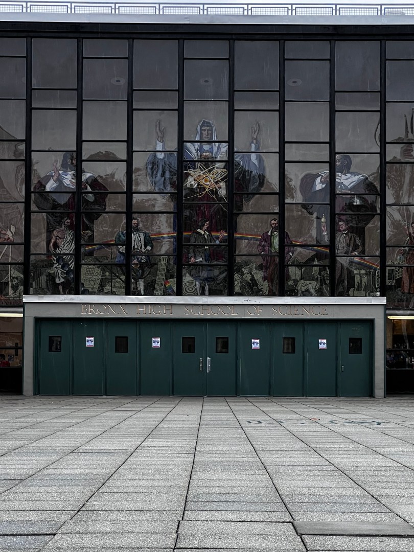
Bronx Science and the High School for American Studies(HSAS) are two of the most prestigious high schools in New York City, with a total of about 3,500 students. Both are located just blocks away from each other in the Bedford Park section of the Northwest Bronx. As a result of both schools’ prestige, thousands of students prepare vigorously for the SHSAT each year for a coveted spot at one of the two schools. The acceptance rates for Bronx Science and HSAS are a minuscule 3 and 0.4% respectively, lower than Ivy League Colleges such as Yale and Harvard.
Public transportation is the backbone of New York City. Due to the city’s congestion and limited parking space, many take public transportation to avoid the hassles associated with driving. Given the city’s high cost of living, many find driving to be prohibitively expensive and hence also decide to opt for transit. As a result of these factors and others, 46% of New Yorkers do not own a car and hence rely on public transit to get wherever they need to go. This tally does not include suburbanites who take mass transit in New York City in lieu of driving for the same reasons as residents.
In New York City, much of the population relies on mass transit run by the MTA(Metropolitan Transportation Authority)to get around. According to data from the NYC Department of City Planning, only 46% of city households own a car. Even vehicle owners often use mass transit to get to Manhattan due to traffic congestion and high parking costs. Additionally, hundreds of thousands of riders from outside of the city ride the Metro-North and LIRR commuter rails to get around the suburbs as well as into the city daily. Given how many people it moves, the MTA also plays a major part in New York’s economy. An NYU study from October 2020 found that a 40% reduction in bus/subway service and a 50% reduction in commuter rail service would cost riders more than $1.7 billion in lost time each year. This is only reflective of the impact of transit service reduction and does not reflect the impact of if mass transit were to not exist at all.
Tremont Avenue in The Bronx is one of the busiest east-west streets in the borough. In addition, it is one of The Bronx’s longest streets at about 7 miles between the Throggs Neck and Morris Heights neighborhoods. The street crosses the entire borough and connects to several other major corridors such as White Plains Rd, Third Ave, and University Ave. Tremont Ave also runs parallel, to the Cross Bronx Expwy, which provides drivers an alternative to one of the most congested highways in the Northeast. In addition, Tremont Avenue provides access to several major destinations such as the River Park Towers and Crotona Park. Every subway route in The Bronx has a stop on or within a 3 minute walk of Tremont Ave. Additionally, Tremont Ave is served by the Metro-North’s Harlem and New Haven Lines at the Tremont Station. As for buses, Tremont Ave is served by the Bx40, Bx42 and Bx36 routes, that provide connections to various communities across the Bronx with the Bx36 going to Washington Heights, Manhattan.
As you can imagine, Tremont Avenue is known for its congestion that leads to slow travel speeds especially for bus riders. Tremont Avenue is especially known for slow bus speeds between University Avenue and Boston Rd. During rush hours, buses average speeds of less than 5 to 8 mph in most sections in both directions. As 29,000 ride the bus through here daily and 72% of nearby residents do not own a car according to the NYCDOT, bus service here is critical to people getting around. Unfortunately, Tremont Avenue’s high volume also in part contributes to safety risks. Between 2016-2020, 1,100 were injured in crashes on Tremont with 215 of them being pedestrians. The intersections of Tremont Ave and the Grand Concourse, Anthony Ave and Boston Rd are considered Vision Zero Priority Intersections respectively.
Due to the slow bus speeds and safety conditions, the New York City Department of Transportation(NYCDOT), is developing a plan to improve Tremont Ave between Boston Rd and University Ave for all road users. The agency has already taken several steps in order to so. In 2016, the agency added a combination of traditional and shared bike lanes, curb extensions and better lane markings for the purpose of improving safety for cyclists between Boston Rd and Tremont’s western terminus at Sedgwick Ave. As for bus speeds, the MTA and NYCDOT proposed adding Select Bus Service to Tremont as part of the 2017 Bus Forward Plan. This would have included the addition of off-board fare collection and likely bus lanes. There has been no discussion of SBS implementation during the recent Bronx Bus Network Redesign or the NYCDOT’s current project.
As for what the NYCDOT’s current plans are, it seems like anything is on the table. In their recent presentation to Bronx Community Advisory Board 1, they showed their transit toolkit which included everything from curbside bus lanes to transit-exclusive busways. In addition, they demonstrated bus boarding islands and pedestrian islands that could help shorten crossing distances for pedestrians and have them wait for the bus in safer places. They also presented ways to make the bus stop more comfortable for riders, through means like benches and leaning bars.
Given how slow buses on Tremont, it would not be surprising to see the NYCDOT propose almost any of the street additions they presented to the Community Advisory Board. The most significant change, a busway, is already in place on the nearby 181st St in Washington Heights. The nearby Fordham Rd in The Bronx , was also slated to get a busway, but it was nixed due to opposition from local businesses and the lack of alternatives for drivers could have resulted in gridlock conditions of nearby side streets. As busways have usually only been on the absolute slowest corridors, a busway on Tremont Ave does seem to be unlikely. While Tremont’s speeds are as slow as some busway corridors have been in some spots, it is just not as consistently slow as corridors like 181st St have been. Busways are likely saved for the slowest corridors due to opposition they have received in nearly each instance from drivers and businesses due to the inability to drive and park on the corridor. As cars often double park to access the various retail stores on Tremont, a busway will likely not sit well with many road users.
Several cars double parked on a Sunday Afternoon at E Tremont Av/Mapes AvMultiple cars parked in bike lane on E Tremont Av/Crotona Av
While a busway may not work, the NYCDOT will almost certainly propose some sort of bus lane for the corridor. A center running bus lane is likely unfeasible as the corridor is not as wide as those such as E 161st St where center running lanes have been implemented. However, an offset or curbside bus lane definitely has a significant chance of being proposed. A curbside lane is exactly what it sounds like while an offset lane, is the use of the rightmost travel lane as a bus lane. Both may generate opposition from drivers due to either the loss of road space or parking space depending on which setup the NYCDOT wants to go with. Regardless, the NYCDOT will likely go with the curbside lane due to the street having only one travel, parking and in some parts a bike lane in each direction. In a presentation to Manhattan Community Board 3 regarding another bus improvement project, the agency said that curbside bus lanes were reserved for narrower corridors while offset bus lanes are set for corridors with more space. Therefore, this is likely the NYCDOT’s best chance at striking a balance between the needs of motorists and bus riders.
Tremont Avenue at Prospect Ave with one travel lane and one bike lane in each direction.
Outside of bus lanes, the NYCDOT is considering adding Transit Signal Priority(TSP) to Tremont so that buses either have extended or early green lights so that buses could proceed faster through intersections. This could definitely be helpful as TSP on five busy routes citywide sped up buses by an average of 18% according to NYCDOT data. Additionally, the NYCDOT and the MTA have already worked to install ABLE cameras on the Bx36 route that runs along the corridor due to enforce the bus lanes and busways respectively on University Ave in The Bronx and 181st St in Manhattan. Even without Tremont Ave bus lanes, the cameras already help improve reliability on Tremont Ave by but it already helps improve overall reliability on Tremont Ave by preventing the bus from being late to Tremont Ave riders due to congestion in other areas.
In regards to bus stops, any of the items in the NYCDOT’s toolkit are likely feasible at most stops along the corridor. In some cases, benches and leaning bars may be subject to spatial constraints, but they nonetheless could become a common sight. The most significant obstacle to getting bus stop upgrades will almost certainly be the city’s budget cuts, initiated by Mayor Eric Adams due to the migrant crisis among other issues. The cuts have even gotten to the point where the New York City Department of Parks and Recreation is maintaining less trash bins and cutting back substantially on park cleaning and maintenance. Given the NYCDOT’s commitment to street improvement projects across the city despite the cuts, small bus stop upgrades will likely not be the agency’s priority.
In addition, most of the NYCDOT’s pedestrian toolkit should be able to come in handy. While bus boarding islands may be difficult due to spatial constraints, smaller pedestrian islands could help to reduce crossing distances and improve safety. Data from the Federal Highway Administration shows that these islands can help to reduce pedestrian crashes by 32%, indicating their effectiveness. The NYCDOT is also considering left and right turn bays at select intersections for drivers to make their turns. Left turns are notoriously dangerous as they involve drivers turning at a higher radius and speed coupled with crossing oncoming traffic. A 2016 study from the NYCDOT shows that left turn bays reduced pedestrian and cyclist injuries by 15%, meaning these bays could help to save lives on the road.
All in all, the NYCDOT’s decision on what to implement on Tremont Ave will likely depend on the needs of the community as well as the risks and benefits of each decision. As the corridor varies in population and commerical density, the NYCDOT broke it into five sections to determine which solutions fit best in each area. This may mean bus lanes or certain types of bus lanes in some spots or not others. This could also determine which pedestrian safety additions are pertinent to which intersections. Since most major decisions will include maintaining space for motorists or adding space for buses and pedestrians, any choices will likely not make everyone happy. The fact that people frequently access Tremont Ave by all modes will make these decisions even more difficult. As the NYCDOT is looking to make large scale improvements, hopefully they come to a solution that benefits all road users for years to come.
New York City Department of transportation. “DOT Press Releases – DOT Releases Status Report on “Transit Signal Priority” Technology Used To Speed MTA Buses.” NYC.gov, 24 July 2017, https://www.nyc.gov/html/dot/html/pr2017/pr17-055.shtml. Accessed 30 December 2023.
Queens is New York City’s largest borough by land area and second in population, far surpassing that of Manhattan, The Bronx and Staten Island. Given its size and proximity to both Long Island and Manhattan, neighborhoods in Queens can range from suburban-like in Little Neck to Manhattan-like in Long Island City. Therefore, getting around Queens by public transit can mean traveling by various modes. In some parts of Central and Western Queens, the subway can easily be used in order to get from point A-point B east to west, while other trips require slower bus rides. In Eastern Queens, residents almost always have to rely on buses to get anywhere including to the subway. Many residents who can afford it can take the faster LIRR, however this may be prohibitively expensive for some even with the CityTicket. While buses in Eastern Queens do tend to be faster than other places, the length riders have to travel from here to subway stations still contributes to neighborhoods here having some of the longest commutes in the city.
The State of Connecticut is a small state with a very diverse set of landscapes. Much of the state composes of small, but densely populated urban areas such as Hartford, New Haven, Bridgeport and Stamford. The state also has a plethora of smaller suburban cities and towns along with some rural areas. Many parts of the state are within commuting distance of New York City and 43,000 people commute from Connecticut into the city daily according to NYC Department of City Planning numbers. While the reverse commuting numbers are lower, 9,000 people also commute from NYC to Connecticut on a daily basis.
*Though some corridors that lack regularly scheduled frequent and reliable bus service are discussed, there may be some that I might have missed. If you think I missed a particularly slow and infrequent bus route, let me know in the comments!
New York City is undoubtedly the most transit dependent city in the United States, as only 46% of residents own a car according to data from the NYC Department of City Planning. New Yorkers opt to ride public transit for various reasons, from the parking and traffic challenges of driving to the sheer cost of more reliable modes. Unfortunately, most New Yorkers know that mass transit is not the same for everyone, as two million New Yorkers live in so called “transit deserts” with little to no access to subway service. These New Yorkers often face long bus rides to get to subway service and have commutes that are substantially longer than those who live in more subway-rich neighborhoods.
The One Metro New York(OMNY) system is slowly but surely becoming the dominant way New Yorkers pay to ride buses and subways throughout the city. With the rollout of OMNY beginning on select bus routes and at certain subway stations in 2019, riders have been able to tap their smart device or card on an OMNY reader to board the bus or subway, rather than use a prepaid MetroCard. The goal for the MTA has been to develop a contactless fare option that is more flexible and convenient for its riders. In addition to the added convenience for riders, OMNY has provided the MTA with the ability to implement fare policies they were not previously able to such as fare capping. With fare capping, riders who spend $34 or take 12 rides in a single week can ride free for the remainder of that week. Before fare capping, the same riders either had to pay for an Unlimited or Pay-Per-Ride MetroCard which often would have left them in situations where they paid for rides they did not take or wound up paying more for their rides because they did not purchase the Unlimited MetroCard. The MTA had planned to retire the MetroCard in favor of OMNY by the end of this year, however that has been delayed to 2024 due to software issues.