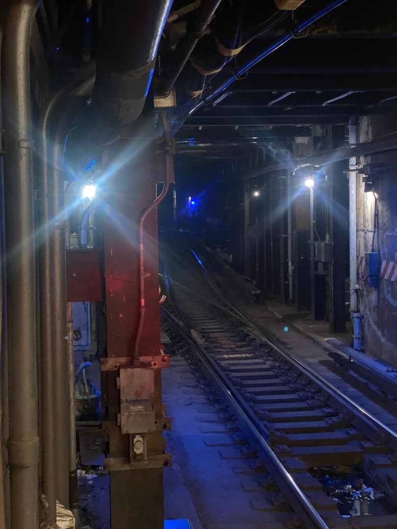
The Concourse Line(B,D) is a vital subway line running along the Grand Concourse in The Bronx. The line links many of the borough’s most densely populated communities together, such as Fordham, Mt. Eden, and parts of the South Bronx. Major Bronx destinations along the line include Montefiore Medical Center, Fordham University and Yankee Stadium. In addition, it connects these neighborhoods to Manhattan and Brooklyn along with other lines in the NYC Subway system. According to data from the NYC Department of City Planning, only 25-36% of households in the community districts along the line have access to a vehicle. Hence, the subway line is one of the primary means of travel for many residents. Based on data from the MTA, the Concourse line had over 137,000 daily riders in 2022.
The New Haven Line(NHL) of the MTA’s Metro-North Railroad(MNR) is one of the busiest commuter rail lines in the New York area. The NHL is the line that connects Connecticut and parts of Westchester County near the Long Island Sound to New York City. In addition to getting to NYC, many use the line to travel to other growing cities such as New Rochelle, Stamford, and Bridgeport. The line has three branches in addition its main branch that run to Waterbury, New Canaan and Danbury, making the line essential for commuter travel across the state of Connecticut. The operating costs for the main NHL are split between the Connecticut Department of Transportation(CTDOT) and the MTA by a 65%/35% split, respectively. The CTDOT fully bears the cost of operating the line’s branches. In 2023, the NHL was the MTA’s busiest Metro-North Line, with 26.1 million trips despite many people still working from home.
With this high ridership in mind, the MTA and the Connecticut Department of Transportation(CTDOT) worked together to make major service improvements to improve commutes for riders. The most significant of which was the addition of super express trains from New Haven to Grand Central Terminal. These trains run three times during the AM and PM peak periods in the peak direction and only make stops at New Haven, Bridgeport, Stamford and Grand Central. This turned a trip that would almost always take over two hours to one that could be completed in just an hour and 39 minutes when people need to get into Manhattan the most. In comparison, a transit trip from many parts of NYC to Grand Central could take a similar amount of time.
New Haven Line train parked at Grand Central Terminal.
In addition to express trains, the Metro-North added seven more trains a day to the Waterbury Branch, a 47% service increase as a result of infrastructure improvements made to the branch. These new trains have led to service beginning earlier in the morning and there being more trains available during the off-peak hours. This flexibility makes it easier for those with nontraditional work schedules and other obligations in New York City to get there using mass transit. Infrastructure improvements that allowed for the service increase included new signals and tracks, replaced railroad ties and repaired grade crossings.
With both projects being almost two years old, riders definitely seem to be benefiting from the added rail services. A ridership overview given by the MTA during their most MNR/LIRR joint committee meeting partly attributes increased Metro-North ridership to both the new Super Express Trains and Waterbury Branch trains running on the NHL. It is clear that when riders have service options that fit their needs, they utilize them and reap the benefits of faster, easier, and cheaper commutes. This is especially true for Manhattan-bound commuters, given the challenges and costs of driving into the Central Business District. According to a report from the NYC Department of City Planning in 2011, 35% of those who drove into Manhattan did so because of transit schedules, and another 13% did so due to transit stops. These were both among the leading reasons for driving into Manhattan amongst suburban drivers. Hence, the recent Metro-North improvements can go a long way toward continuing to increase transit ridership and reducing congestion in Manhattan as well as major roads such as the Connecticut Turnpike(I-95). Since congestion pricing is on the way, the new services will likely also help CT residents save money on congestion pricing tolls.
Despite these additions being a game-changer for riders, there are numerous signs that even more substantial service upgrades are coming. Both Super Express service and increased Waterbury Branch service were included in some of Governor Ned Lamont’s state budgets and are a part of Lamont’s TIME FOR CT rail initiatives. TIME FOR CT is Governor Lamont’s plan to save CT riders 25 minutes by 2035 through a massive $10-12 billion investment throughout Connecticut’s rail infrastructure.
The plan is split into three major components: service, infrastructure, and “a rail fleet for everyone”. Service essentially includes projects like the Super Express service and the increased Waterbury branch service that provide more travel options to commuters. Infrastructure improvements enhance the systems necessary for quality train service to operate, including tracks, signals, and bridges. Projects under this category include several bridge replacements on the NHL along with the addition of a fourth track near the Milford station. Connecticut’s goal is to allow for train speeds of 90-110 mph while sparking employment and economic growth throughout the state. While 90-110 mph is not the speed of high-speed rail seen across the world, it is still substantially better than the line’s current top speed of 80 mph. Hence, riders will be able to travel much further faster, allowing them to get to more places and access more opportunities. Lastly, “a rail fleet for everyone” will allow for better trains that fully serve the needs of those riding them. This will include ensuring that all trains are fully accessible to riders along with adding dual-mode locomotives to run on NHL branches that would allow for more one-seat rides between branch lines and NYC.
The Time for CT plan has the potential to dramatically change rail travel in the state of Connecticut. As the most recent service changes have already had a major impact on riders, there is no telling how much better the system will become once all projects in the plan are completed. In addition to travel improvements, Connecticut is likely to see transformative economic benefits, too. According to the American Public Transportation Association, every $1 invested in public transportation results in $5 in economic value. Additionally, every $1 billion in transit investment creates about 50,000 jobs. The economic impact could be recognized through various means, such as increased sales for small businesses, new corporations moving into the state, and new transit-oriented developments. Transit-oriented developments are mixed-use developments that include commercial and residential spaces within walking distance of a transit station. Some transit-oriented developments include Darien Commons near the Noroton Heights NHL station and Avalon Harrison, located near the Harrison NHL station, three stops from the CT state line.
Connecticut has and is continuing to show how commuter rail investment can lead to great things on so many levels. It will be interesting to see the full effects of the Time for CT plan, given how it is such a large-scale, comprehensive investment into the New Haven Line. Given the early successes of the plan, optimism is brewing for a new era for commuter rail and enhanced economic activity in the state of Connecticut.
Fazzalaro, James J. “SUMMARY OF MAJOR PROVISIONS OF CONNECTICUT/METRO NORTH RAIL CAR PURCHASE AGREEMENT.” ct.gov, 17 November 2006, https://www.cga.ct.gov/2006/rpt/2006-R-0678.htm. Accessed 8 May 2024.
To most, Southeastern Queens comprises of Queens south of the Grand Central Pkwy and east of the Van Wyck Expwy(I-678). While it is less densely populated than most of Western Queens, people in many parts of the area still rely on walking and transit to get around. In the two Community Board Districts that cover the bulk of the area, 15 and 33% of residents, respectively, do not own cars. Additionally, there are many youth in these communities who also rely on walking and transit, as you have to be 18 to drive independently in most cases in New York City.
Southeastern Queens is known for some verdant streets and offering a nice urban/suburban blend for its residents. However, the area sorely lacks open space. According to a map from the NYC Parks Department, there are significant portions of Queens CB Districts 12 and 13 that are not within walking distance of a park. In addition, both districts are among the ten districts in New York City in which 0% of residents live within walking distance of a pedestrian plaza. For reference, New York City has 59 community districts. Due to how far residents are from parks, getting to open spaces often requires either a long walk, drive or transit ride for most residents. This makes spaces far less accessible for residents here than residents from other communities, especially for transit commuters. As Southeastern Queens has no subway service in most areas, it is extremely difficult for most without a car to get to open spaces as they have to rely on buses.
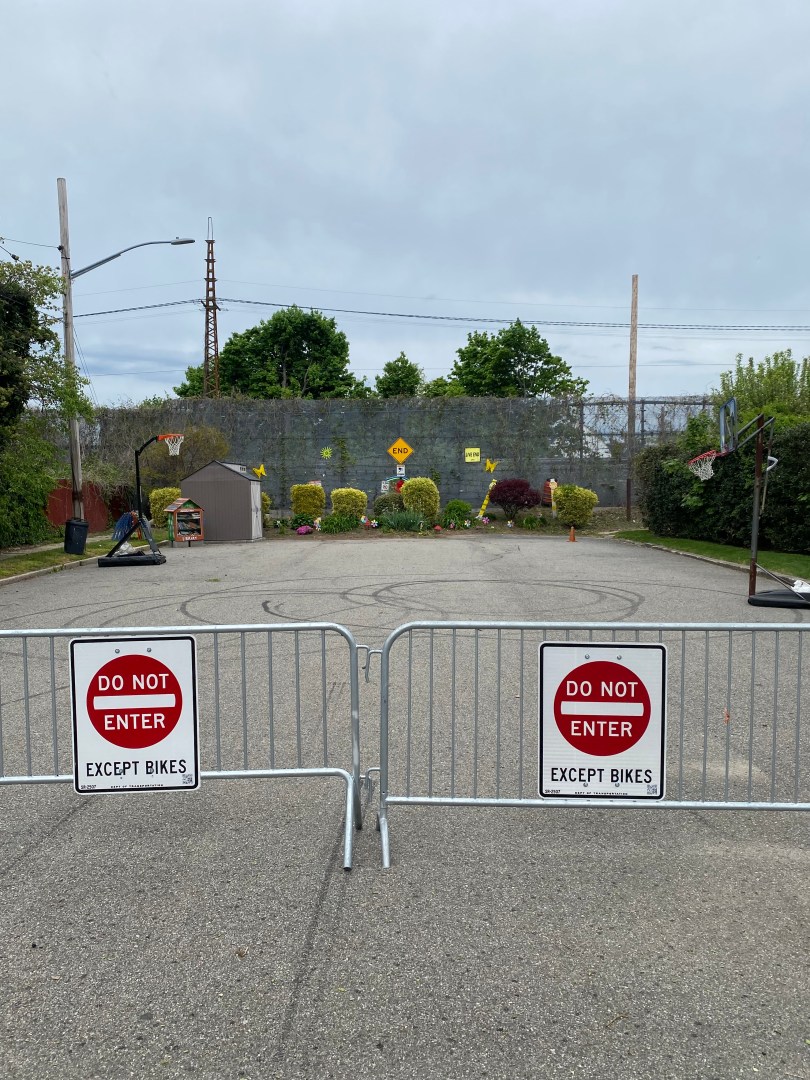
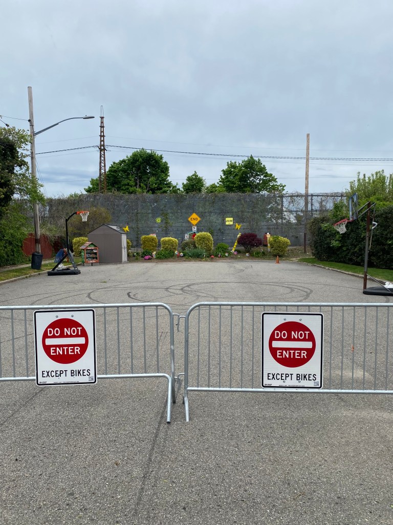
Thankfully for community members, the New York City Department of Transportation(NYCDOT) is planning Southeastern Queens’ first-ever pedestrian plaza. The new plaza will be located on 180th St at the intersection of 180th St and Murdock Avenue in the St. Albans neighborhood. The plaza will be in a dead-end block that serves almost no use to motorists and is the perfect size to serve as a space for community members. According to a presentation from the NYCDOT, the purpose of the plaza is to create more communal open space and increase pedestrian safety at the intersection of Murdock Avenue and 180th St. The plaza proposal also includes a curb extension across the street from the plaza as well as painted crosswalks. While the area is already an open street, the plaza will offer significant enhancements.
Open Street where public plaza will be built at Murdock Ave/180th St.
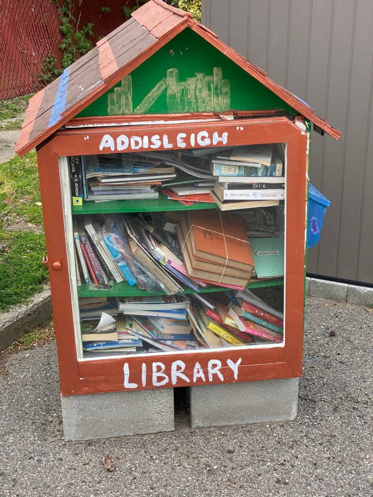
The plaza itself will be 3,750 feet long and protected by granite blocks and delineators. It will also include permanent street furniture such as seats, tables, and planters. In addition, the NYCDOT plans to add asphalt art to the plaza to make it a warm and inviting space for community members to spend their time. The NYCDOT and Addisleigh Park Civic Association will release a Request for Proposals(RFP) for artists who will complete the asphalt art at some point this spring. An RFP is a document that details a project and solicits contractors to bid for the ability to complete the project. The Addisleigh Park Civic Association will also likely be responsible for maintaining the plaza as a partner of the NYCDOT. Most open streets and public plazas have partners that are responsible for their maintenance and upkeep.
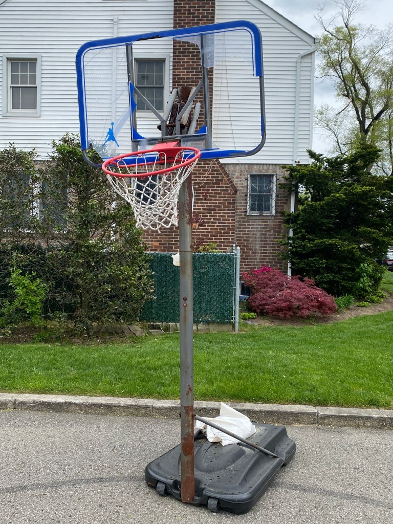
The new plaza will not be the first time the space will be used for the community. Since Spring 2022, the space has been one of NYC’s “Open Streets” managed by the Addisleigh Park Civic Association. Currently, it is fully closed to vehicular traffic seven days a week from 9 AM-10 PM and serves as a space for community members. There is even a small makeshift bookcase that served as a mini-library. However, the open street status means that permanent street furniture could not be present and the activities possible were limited due to the street still being designed for cars. With a plaza, community members can use the space for any car-free purpose so long as it can be accommodated within the space’s boundaries. On my visit to the plaza on Saturday, May 4th, 2024, I noticed chairs being hung to what appeared to be a string along with two dysfunctional basketball hoops. One of the hoops was completely bent, and the other had no backboard, making both unfit for game use. The street became a plaza will address this issue by allowing permanent seating along with higher quality recreational fixtures to be added without the concern of where to place them when an open street is closed, or there is inclement weather. Hence, the plaza will make a huge difference in how the street area will be utilized.
Basketball hoop at Murdock Ave Open Street with no backboard.Basketball hoop with broken backboard and bent rim at Murdock Ave Open Street.Chairs attached to string at Murdock Ave Open Street.Mini-Library at Murdock Ave Open Street.
The Murdock Ave location was chosen for plaza construction by the NYCDOT due to its significant success as an open street. As part of the Open Streets program, the NYCDOT pays attention to successful locations and considers changes to tangibly enhance the open street for users. Since the programs inception in 2020, not too many open streets have received enhancements based on the NYCDOT’s criteria. The ones that have implement or proposed enhancements are been predominantly concentrated in more densely populated communities such as West 22nd St in Chelsea, W 103rd St on the Upper West Side and 34th Avenue in Jackson Heights. Avenue B on the Lower East Side and 4th Street in Park Slope have also been evaluated for improvements. The implementation of this plaza is truly an outlier and effectively be a pilot for how the city creates open space in less densely populated communities with more car ownership.
The project to build the plaza will be completed by the fall with street markings and delineators coming by the summer. The street art and furniture will be installed by late summer or the fall at the absolute latest. Given the streets’ current use by the community, the new plaza will make the space even better for relaxing, having fun and making memories for residents. Additionally, the plaza can be a model for how more cities can utilize more of their streets in more neighborhoods for non-travel uses through willpower and innovation.
Trolleys were once a widespread and reliable means of getting around New York City and many other cities in the United States. Trolley lines were once just as widespread as today’s bus routes across cities. Since most Americans in cities took mass transit to work, trolleys had plenty of riders and the companies that operated them often made large profits. Unfortunately for the companies, the rise of the automobile led to cars often blocking trolley tracks and creating congestion which caused delays. According to the Daily News, trolleys were also considered old-fashioned by many due to the noises they made, such as “screeching wheels and clanging bells,” along with their wheels losing traction on icy inclines during the winter. This led to many NYC companies converting their trolley services into bus services and most bus routes run by the MTA today are the semblance of a former trolley line.
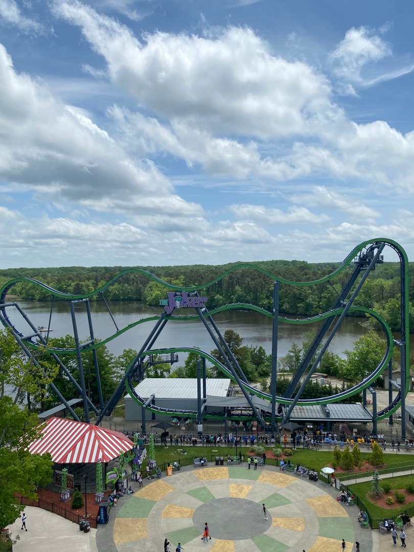
Six Flags Great Adventure is by far one of the most popular amusement parks in the Northeast. Located about 70 miles from NYC, the park is known for its jaw-dropping roller coasters and fantasy-themed rides. In 2021 according to AECOM, Six Flags Great Adventure attracted more than 2.9 million visitors, making it a premier family recreation destination. As COVID-19 concerns have eased since then, the number of visitors in 2022 and 2023 was likely higher.
The Nostrand Avenue Line is a busy subway line in Brooklyn. The line runs from Franklin Ave-Medgar Avenue College and Flatbush Av-Brooklyn College and is served by the 2 and 5 lines. The Nostrand Avenue Line connects several densely populated neighborhoods in Central Brooklyn, such as Midwood, Flatbush, and Prospect Lefferts Gardens. Additionally, the line provides connections to both local and express service on the Eastern Pkwy Line(2,3,4,5), which provides access to even more destinations across Brooklyn and Manhattan. Overall, the line served over 35,000 riders per day in 2022 according to MTA statistics.
Express buses are critical transportation assets for residents of the outer boroughs. In areas far from Manhattan, subway service, or both, express buses are often the only direct mass transit link between many communities and Manhattan. As congestion pricing nears, many may turn to express buses to avoid the even higher costs associated with driving in Manhattan. In February 2020, about 42,000 riders took express buses daily, according to the Gothamist.
*Rail service in Rockland/Orange County is run by NJ Transit through a contract with the MTA Metro-North Railroad. Hence, the rail stations in both counties are Metro-North stations despite being served by NJ Transit.
Rockland and Orange Counties are two densely populated suburban counties on the west side of the Hudson River in New York State. Together, the two counties have a population of about 1.7 million residents. As these counties are all suburbs of NYC, many residents commute into the city for work. According to a report from the NYC Department of City Planning, 17% of Rockland County residents and 11% of Orange County residents commute into NYC. The salaries these workers earn in NYC are critical for the economies of their home counties. The same report states that more than a quarter of all wages in Rockland County come from jobs worked in NYC. In Orange County, the percent of wages earned in NYC is 17%.
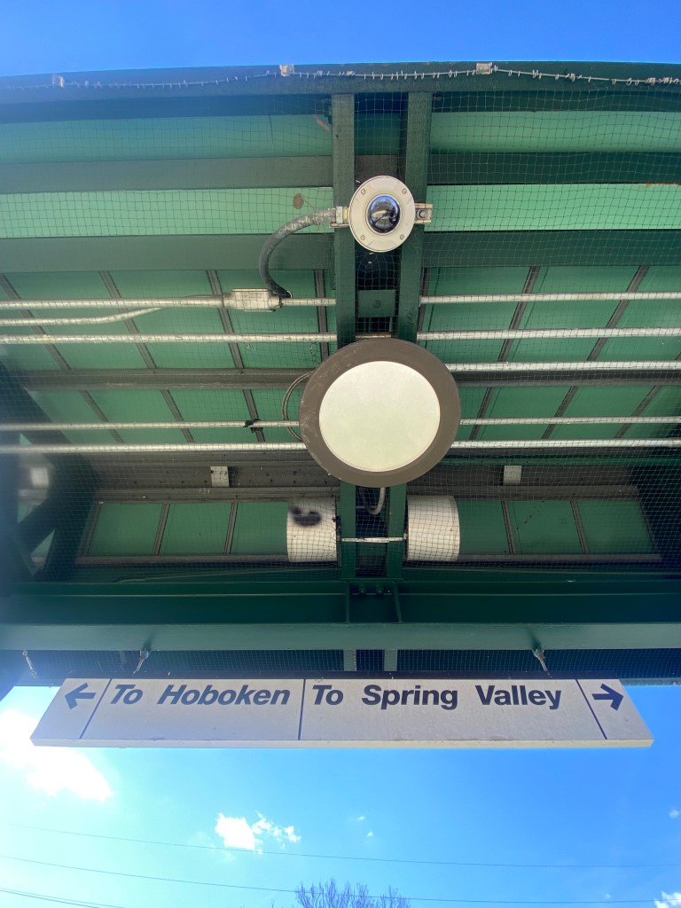
Unfortunately for these residents, transit options into the city are relatively scarce compared to the rest of the region. Rockland and Orange Counties have no direct commuter rail links to Manhattan. As a result, these rail commuters are forced to transfer to other trains at either Hoboken or Secaucus Junction. Given how infrequent trains are, this leads to commute times being substantially longer for residents of these counties than other NY suburbs. Additionally, commutes to Manhattan are especially tedious given the number of transfers required between commuter rail, subway, bus, and/or taxi modes to get to many destinations.
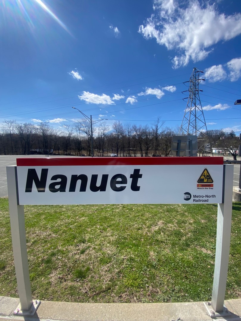
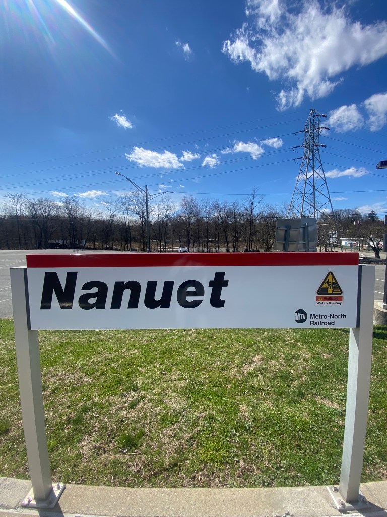
Signage at Nanuet Metro-North station indicating destinations of trains.Station sign at Nanuet Metro North Station.
The only form of direct transit between Rockland and Orange Counties and Manhattan are private coach buses primarily run by CoachUSA. CoachUSA buses are often infrequent and, in many cases, only provide peak-directional trips during rush hours. Hence, CoachUSA is not an option for many who have non-conventional or varying work schedules. In addition, these buses make many stops sometimes even in multiple counties. Whether or not a bus is private or public, these buses are often slowed down by heavy congestion on the George Washington Bridge, Lincoln Tunnel, or Holland Tunnel. Many bus commuters whose buses use the GW Bridge often face long subway rides to get into Midtown or Lower Manhattan.
Due to the lack of convenient travel options, many residents opt to drive into Manhattan. In fact, Rockland and Orange County are home to the only areas of the NY region where more residents who commute into NYC do so by car than any other mode. This leads to tedious trips for many drivers to congestion especially at crossings into New York and on major highways such as the Garden State Pkwy.
This is a large part of why Rockland County has sued the MTA over its proposed congestion pricing plan. Some Orange County legislators have joined Sullivan County lawmakers in another suit. Congestion pricing is a plan to charge drivers who drive below 60th Street in Manhattan a $15 toll. The purpose is to raise money for mass transit improvements and reduce congestion in the busiest parts of Manhattan. In addition to lacking transit options, Rockland County argues that congestion pricing violates the Equal Protection Clause of both the NYS and U.S Constitutions by discriminating against drivers from outside of the CBD by having them by a toll as opposed to those driving within the CBD who would not pay. This is despite both groups contributing equally to congestion according to a Rockland County press release.
There are many arguments that could be made over the validity of the claims made in the lawsuits. However, it is clear that residents of Rockland and Orange Counties do not have the same mass transit options for getting into Manhattan as other residents of similar communities. Additionally, the mass transit that congestion pricing would fun is primarily subway and buses, are located out of the way for many of these residents, given how they do not have a rail link to Manhattan. Nevertheless, these residents would still be expected to pay for these improvements as they will only receive a $5 discount on the toll provided they use the Lincoln or Holland Tunnel. They would still wind up paying about $25 per round trip entering Manhattan.
While the dissent from Rockland County is understandable, congestion pricing is expected to do a lot to improve travel in New York City. Besides needed transit investments, congestion pricing is expected to dramatically reduce traffic which should lead to faster travel times and less carbon emissions in the Manhattan CBD.
So, how could the MTA and/or other agencies improve Rockland/Orange County-Manhattan transit to make travel easier and make the impact of congestion pricing more equitable? There are multiple potential solutions but actually implementing one may be harder than you think.
The first and most ideal solution is for direct rail links between Rockland/Orange Counties and Manhattan. Several Rockland County politicians have made this proposal, such as State Sen. Elijah Reichlin-Mendick and House Rep. Pat Ryan This would most likely be via extensions to both the Port Jervis and Pascack Valley Lines into Manhattan. However, these lines currently terminate at Hoboken due to there simply being no way for these trains to access NJ Transit’s tracks leading to Penn Station from their routes to Rockland and Orange Counties. The solution to this issue would be a rail loop that would make this connection near Secaucus Junction, where riders currently transfer to get on other trains to Penn Station. This loop has already been proposed as part of the massive Gateway Project. The Gateway Project is a plan to repair the existing tunnels between NYC and NJ that are in decrepit shape and increase rail capacity between the two states. In addition to the loop, the project would include new tracks between Newark and NYC, a new tunnel underneath the Hudson River and an expansion of Penn Station. Unfortunately, due to a myriad of delays, cost overruns, and the engineering challenges associated with such a project, the new tunnel and rehabilitation of the current one is not expected to be completed until at least 2038. A Penn Station expansion will also take years to finish. While smaller Gateway projects will likely be completed before then, the Bergen Loop will likely not be one of them as there needs to be more tunnel space between NY and NJ and platform space for more trains at Penn Station for a direct rail link to occur. Hence, this will be a major improvement likely at least 15 years down the line.
If a direct rail connection will take so long, how about short term improvements? Another option could be to enhance existing bus services. This could include simply offering more routes, from more places at more times. Due to lower population densities in parts of Rockland and Orange Counties, it may be hard to justify more buses making stops throughout suburban neighborhoods. Hence, bus companies might want to utilize existing park and rides which are located throughout these counties. Companies can also consider constructing new ones or sharing ones owned by the New York State Department of Transportation for its HudsonLink bus system. HudsonLink connects various parts of Rockland County with Westchester County on the east side of the Hudson River.
In addition to improving bus service to Manhattan, counties can take more actions to increase connections to these buses. As these buses often serve park and rides, drivers must often drive to the bus. This can lead to increased congestion on local roads along with additional travel costs for drivers in the form of gas and parking fees. Hence, Transit Orange and Transport of Rockland can consider increasing bus frequency along lines that also serve these park and rides. As many buses run at headways of every 30 min and even less frequently, these are often not viable options for those needing to connect to longer-distance buses to get to Manhattan.
Also, the counties can consider operating microtransit in areas with lower population density but close proximity to a Park & Ride. Microtransit works similarly to rideshare only with fixed stops and a fare the same as a typical public bus ride. Essentially, one makes a reservation and is placed on a small bus with other people going in the same direction. Many parts of America with similar population densities, such as Dallas/Fort Worth, Valdosta, Georgia, and parts of Washoe County, Nevada. In Washoe County, which includes Reno, transit ridership nearly tripled with the introduction of microtransit. Washoe County’s microtransit is successful in a county with similar car ownership rates than the Northwestern Suburbs and no CBD everyone is trying to get to. Hence, microtransit likely has even greater potential in the Northwestern Suburbs.
‘ Regardless of the quality of transportation, it will need to be affordable and competitive with the costs of driving. Right now, the cost of driving into Manhattan is competitive with mass transit, even with congestion pricing tolls taken into account. For instance, most bus trips from Rockland and Orange Counties cost between $20-30 round trip. Additionally, a study from the NYC Department of City Planning shows that 44% of car commuters in Manhattan had parking subsidized by their employer. Hence, there are likely many Rockland/Orange County residents for whom driving will continue to be less expensive than public transportation.
In addition, many residents simply cannot afford the higher costs of mass transit. According to U.S. Census data, 14.4% of residents in both Rockland and Orange Counties respectively live below the federal poverty line. Since the cost of living is higher in these countries than in most of the countries, the number of residents who struggle to make ends meet is likely higher.
Thus, county governments and the MTA can take numerous steps to help reduce the cost of transit for residents. One is the implementation of a fair fares program similar to the one that exists for subways and buses for NYC residents. This would provide residents below the poverty threshold for their municipality with half fares on commuter rails, local buses, private buses, and NYC Transit. For private buses, the customer would pay the company half of the fare, and their county’s government would cover the rest. This type of program could help these residents tremendously to afford mass transit and provide more people with better access to opportunities in Manhattan. Additionally, with one company running most of the private bus service, it would be much easier for Rockland and Orange counties to facilitate such a program.
Another idea could be for counties to subsidize the companies outright to reduce fares for all. Governments subsidize private companies all the time in order to lead to increased job creation and tax revenue in their respective municipalities, counties and states. A larger example is Michigan’s $1.7 billion deal with the Ford Motor Company to help with the construction of its electric vehicle battery power plant. Closer to home, Nassau County has a nearly $1.3 billion contract with the company Transdev to operate its NICE bus system. County and state governments could financially incentivize private bus companies in multiple ways. One would be to private tax incentives for them to lower fares the other would be to pay the companies directly for whatever revenue they would lose. The governments would have to work out a deal that works best for them, its residents, and companies trying to profit. However, if it can be done, it can make a major difference for commuters.
Rockland and Orange Counties have the least options for getting into Manhattan than almost anywhere in the New York Metropolitan area. It would take significant investments to improve and/or expand public transportation to make it the most convenient and affordable way for residents to get to Manhattan. With congestion pricing on the horizon, improved public transit can help residents feel less of a burden from congestion tolls. Hopefully, investments of some kind can be made so that Rockland and Orange Counties can continue to thrive as commuter suburbs to New York City.
Works Cited
CBS New York. “NYC congestion pricing plan passes final vote, will bring $15 tolls for some drivers.” YouTube, 27 March 2024, https://www.youtube.com/watch?v=tRl7Cxwv_xc. Accessed 1 April 2024.
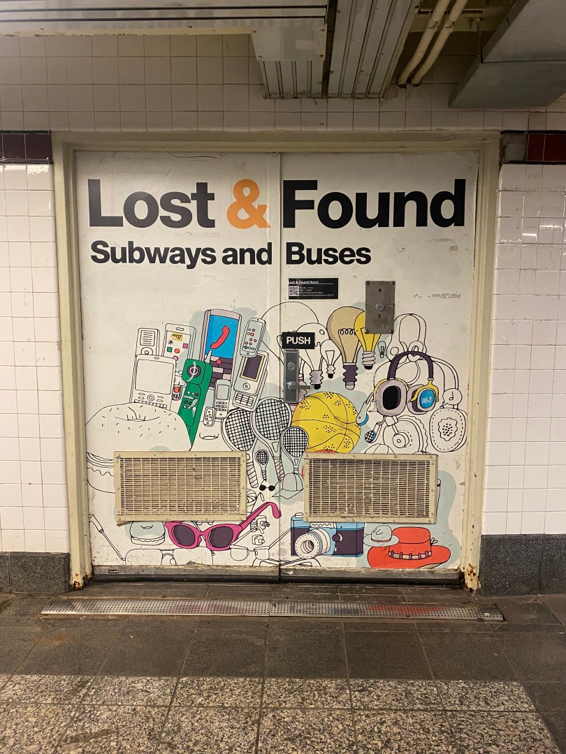
The New York City Transit system is by far the largest transit system in the United States and one of the largest systems in the world. Overall, the MTA’s 331 bus routes and 22 subway routes serve millions of passengers daily. This system allows New Yorkers to get to many destinations seamlessly without the use of a car.
The buses and subways are crucial to mobility in New York City, serving millions of passengers daily. Given the size of the system, people generally keep their personal belongings safe, fearing they will not be able to retrieve an item if it is lost. When most people do lose something, they almost always think there is zero chance of getting it back.
This is absolutely not the case, as the MTA actually has a robust lost-and-found system that not many people know about. In this tutorial, I’ll show you how to retrieve items lost on mass transit and where to go to get your stuff back!