This Manhattan Bus Depot Could Be A Model For Sustainable Bus Depots Citywide

By Joseph Morales

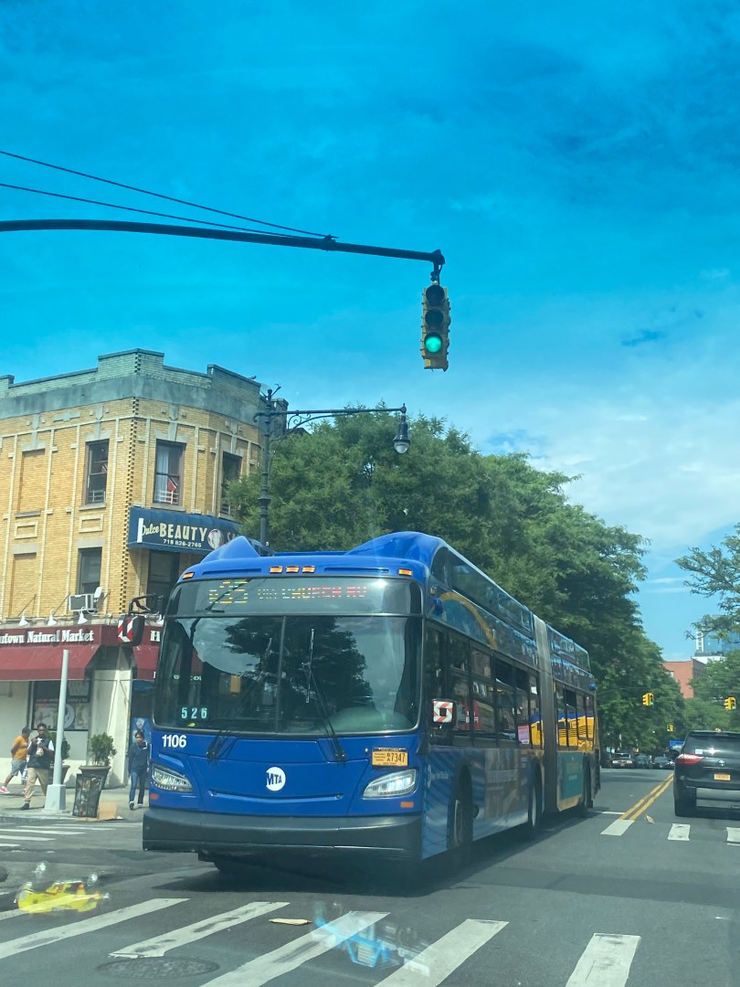
. New York City is by far one of the most transit-dependent cities in the United States, with millions of people using mass transit to get around the five boroughs on a daily basis. While the city is world-famous for its subway system, its bus system is also a crucial part of the city’s transportation network, with 5,780 vehicles serving 327 total routes across the city as of 2021. 

                   As you might predict, having this many vehicles in one of the densest cities in America means that finding the proper space to park and maintain these buses can be a challenge. This is where the MTA’s 29 bus depots come into play, where buses, in addition to being parked and maintained, are painted, cleaned, and have their respective fare revenues collected. Unlike subway trains, cleaners do not enter buses upon a bus’s arrival at the last stop. Hence, the cleaning buses undergo at their depots is essential to keeping them as sanitary and pleasant as possible for riders. In addition, the MTA has two central maintenance facilities, the Zerega Avenue Maintenance and Training Facility in The Bronx and the Grand Avenue Central Maintenance Facility in Brooklyn.

Read More »

After Years of Service Cuts, Nassau County Bus Riders Are Receiving Major Service Upgrades This Fall

By Joseph Morales

Nassau County is one of two counties in the Long Island region of New York. Most of the county, with the exception of Long Beach, is located within one of three towns, Hempstead, North Hempstead, and Oyster Bay, which consist of many villages, such as Valley Stream, Mineola, and Massapequa. While the county is mainly suburban, many pockets of higher residential and employment densities are seen in the heart of villages, such as in the Mineola/Garden City/Westbury area along with Downtown Hempstead, as well as along certain transportation corridors such as Sunrise Hwy/Babylon LIRR Branch.

Read More »

Service on CT Metro-North Branch Has Finally Resumed After Being Closed All Summer

By Joseph Morales

The New Canaan Line is a branch of the Metro-North’s New Haven Line(NHL) that runs from Stamford to New Haven, CT. The line connects areas north of the Stamford station with the rest of the NHL, which offers riders ample connections to other areas of Connecticut along with Westchester County, NY, and New York City. Additionally, the branch’s terminus at the Stamford station provides riders with access to Downtown Stamford, which is one of Southern Connecticut’s most prominent economic and cultural hubs. The Stamford station is also home to Amtrak trains, with the Stamford Transportation Center being just a block away, providing riders with access to trains that traverse the northeast along with bus routes that traverse Fairfield County, respectively.

Read More »

When Will The Court Square Station Become Fully Accessible?

By Joseph Morales

The Court Square subway station complex in Long Island City, Queens, is one of the busiest station complexes in the NYC Subway system located outside of Manhattan. With its location in one of Queens’ most densely populated neighborhoods and just minutes from Manhattan, many people from across New York City and the region travel to Court Square for work, school, recreation, and many other purposes. The activity density in Long Island City is so great that many even consider it one of New York City’s satellite downtowns, along with Downtown Brooklyn. In addition to being a popular neighborhood now, Long Island City is also considered to be one of Queens’ fastest-growing neighborhoods, with the number of residential developments surging and office jobs in the area increasing at about double the citywide average in the last ten years despite the disruption caused by the pandemic. Hence, even more commuters will likely use the Court Square complex in the future. In addition, its connectivity to five subway lines makes it a popular transfer hub with connections to many other densely populated sections of Queens, Manhattan, and Brooklyn. 

Read More »

The MTA Is Proposing Major Changes to Church Ave Bus Service As Part of the Brooklyn Bus Network Redesign. What are the Pros and Cons?

By Joseph Morales

Church Ave is a major residential and commercial corridor that runs about 4 miles east-west through Central Brooklyn between the Kensington and Brownsville neighborhoods. In addition to traversing several busy neighborhoods, the corridor traverses several busy streets and roadways such as Ocean Pkwy/Prospect Expwy, Flatbush Ave, Nostrand/Bedford Ave, and Utica Ave, providing connections for motorists to travel to numerous destinations throughout Brooklyn. In addition, the street is home to several key destinations such as Prospect Park, SUNY Downstate Medical Center, and the Erasmus Hall High School Campus, which currently has about 1,994 students according to data on campus schools from MySchools NYC though the building once served over 7,000 students as a larger high school.

Read More »

New Elevators Make Two Partially Accessible Subway Stations Fully Accessible

By Joseph Morales

The NYC Subway is the lifeblood of New York City, getting millions of New Yorkers to their destinations across the city on a daily basis. According to MTA statistics, 5.5 million people rode the subway from one of the city’s 472 subway stations in 2019. Even after the COVID-19 pandemic led many to work from home and many office workers still work hybrid schedules, ridership numbers are still consistently in the millions, and the highest recorded ridership on a given day since the start of the pandemic is a record of 4.09 million set on May 17th, 2023. While many American cities have some sort of rail-based transit system, New York’s is especially critical to its residents, as only 46% of NYC households own cars compared to 91.7% of households in the U.S. according to NYC Department of City Planning/Forbes data, respectively. Hence, being able to utilize the subway system allows New Yorkers to travel distances across the city by rail, which would not be as easily traversable by transit in other parts of the country with bus and rail systems that are more limited in scope and coverage. 

Read More »

Pedestrian and Cycling Safety Improvements Are Coming To Major Staten Island Mixed-Use Corridor Near FDR Beach

By Joseph Morales

Lincoln Avenue is a busy mixed-use street that runs between the Midland Beach and Grant City neighborhoods on the South Shore of Staten Island. The eastern portion of the corridor between Franklin Delano Roosevelt(FDR) Boardwalk and Beach/Father Cappodano Blvd and Hylan Blvd is marked predominantly by dense clusters of single-family homes. This area is also home to an elementary school, P.S 038 George Cromwell with a middle school IS.002 George L Egbert being just one block away. Altogether, over 1,300 students attend school on or in the immediate vicinity of Lincoln Ave based on data from MySchools. Lincoln Ave is also one block away from Miller Field, which boasts the largest concentration of athletic fields in Staten Island.

Read More »

The MTA Is Working To Add Elevators To South Bronx Subway Station By The End of The Year

By Joseph Morales

The E 149th St station on the Pelham Line(6 train) is located between the Mott Haven and Hunts Point neighborhoods in the South Bronx. The station is located in a primarily residential community with many small businesses along the surrounding streets. The station is also just a short walk from the verdant St. Mary’s Park, which is used by Bronxites from throughout the borough.

Read More »

New Technology Makes Is Set To Make Transit More Accessible At Busy Manhattan Subway Stations and A Busy Bus Route

By Joseph Morales

65/66th Street is one of the most vital corridors that runs along the Upper East/West Sides of Manhattan. The corridor is home to several major regional destinations, such as Rockefeller University, Memorial Sloan Kettering Cancer Center, the Central Park Zoo, Lincoln Center, and so much more. Additionally, the corridor is home to the 1 train on the West Side(Broadway/7th Avenue Line) and the 6 train on the East Side(Lexington Avenue Line), meaning while the corridor is well connected to the rest of the city by subway, many transit riders might utilize the M66 crosstown bus in order to access trains traveling to different parts of Manhattan and The Bronx that the other line is disconnected from. Transit is extremely imperative to people getting around along 66th Street and the surrounding communities as not only do most people traveling to Manhattan use mass transit, but only 30% of UES and 27% of UWS households own cars, according to data from the New York City Department of City Planning(NYCDCP). Thus, transit is critical to the movement of both residents and visitors in the 66th St area daily.

Read More »

New Signal System Is Coming To Another Busy NYC Subway Line To Dramatically Reduce Delays And Speed Up Service

By Joseph Morales

The Culver Line is a busy subway line that runs between Downtown Brooklyn and Coney Island. The F Train runs on the entirety of the line, and the G train runs on much of the northern section of the line, providing Culver Line riders with strong connections to various sections of Brooklyn, Manhattan, and Queens, as well as a plethora of other subway and bus lines that traverse the city. In addition, the line connects many of Brooklyn’s most historic, densely populated, and most highly visited neighborhoods together, such as Park Slope, Williamsburg, Bedford-Stuyvesant, Downtown Brooklyn, Flatbush, and Coney Island. Additionally, many households along the line lack access to a car, with car ownership rates in the communities surrounding the line being between 33 and 51 percent, according to data from the NYC Department of City Planning. Thus, the line is essential to many area residents being able to get around on a regular basis reliably.

Read More »