
By Joseph Morales
Westchester County is one of the most populated counties in New York’s suburbs. The county is home to almost 1 million residents and features a range of communities. This includes charming villages like Tuckahoe and Ardsley and more bustling urban centers like Yonkers and Mount Vernon. The county also features a plethora of major shopping and recreation hubs. These include New Roc City, Ridge Hill and Downtown White Plains.
With Westchester County’s population and destinations of regional significance, access to non-vehicular travel modes is critical to the mobility of many. This is largely because Westchester is much less car dependent than many suburban areas in the United States. According to county data from 2021, 15% of residents do not have access to a vehicle. The numbers are higher in multiple cities such as Yonkers(24%) and Mount Vernon(33%). These numbers also do not include the thousands of car-free NYC residents that reverse commute daily via the Metro-North Railroad and Bee-Line Buses. Even car owners often use mass transit to get to jobs in NYC or walk and cycle in their towns for shorter trips.
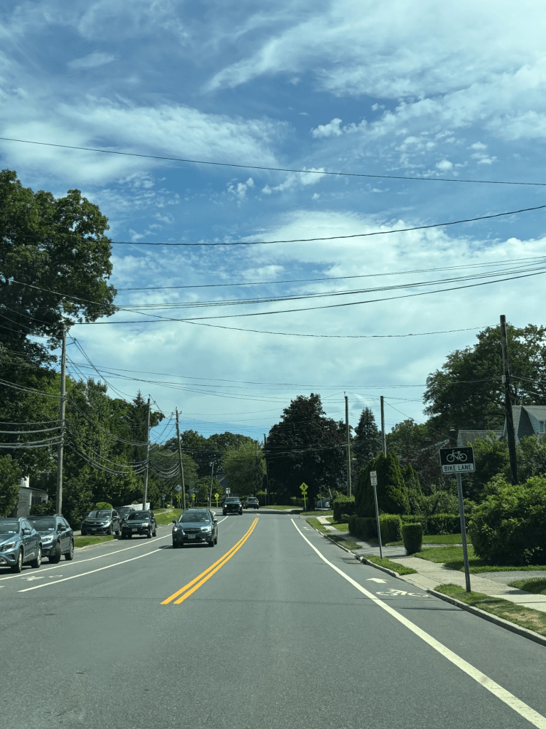
Despite Westchester’s diverse mobility needs coupled with cities that feel a lot like the neighboring Bronx, the county sorely lacks quality infrastructure for non-vehicular modes. For starters, Westchester has just one bus lane and very few bike lanes on its streets. The lack of bike lanes makes it difficult for residents to take advantage of the County’s sprawling trail system as safe connections to destinations are limited. In addition, a dearth of bus lanes is not helping public bus service to meet the reliability needs of riders. According to a study by the Tri-State Transportation Campaign and Make The Road NY, about 70% of riders attributed bus lateness to traffic. Many areas of Westchester also lack basic pedestrian infrastructure. The same study found that only 32.9% of respondents had a sidewalk where they boarded a Bee-Line bus. Such a lack of sidewalks makes it harder not just to use mass transit, but also to walk for many short trips in towns and neighborhoods. Other issues that adversely affect pedestrian safety include things like speeding vehicles and complex intersections.
In June, the Westchester County Department of Planning started the Complete Street Municipal Assistance Program in order to help municipalities address non-vehicular transportation issues. The agency announced that there is $15 million available in the county’s capital budget to assist municipalities with Complete Streets Projects. These are projects that enhance alternative travel modes and/or make streets safer for pedestrians and cyclists. The streets can include a plethora of infrastructure components which include but are not limited to bus lanes, bike lanes, sidewalks and pedestrian crossings. Other less sizable but still significant safety improvements such as curb extensions and lane modifications are also eligible for funding. Municipalities can have up to 50% of a project’s total cost covered by the county.
There is no question that the new funding is a pivotal step towards making Westchester County streets safer and easier to use for non-motorists. Since funding recipients will not be decided until early 2026, we do not know exactly what projects will receive funds and where they are located. It is important to note that the program only applies to municipal roads and many streets in Westchester County are county roads or state roads. Non-municipal streets include several major arteries such as Mamaroneck Ave, Central Park Ave and Boston Post Rd. However, there are still many streets that are managed by municipalities that will apply to have such a large portion of an impactful street project covered. Also, the county’s desire to pay for improvements on these streets demonstrates a commitment to Complete Streets that will likely be reflected on County roads as well.
Despite the lack of knowledge on what projects will be funded, there are some hints as to what projects municipalities may consider given the county’s general infrastructure needs.
It is likely that at least some municipalities will apply for funds to improve streets as part of Transit-Oriented Development(TOD) plans near Metro-North stations. Multiple municipalities such as Scarsdale and White Plains have or have had transit-oriented development plans that include street improvements of some kind. Successful TODs in places like Chappaqua, Tuckahoe and Rye are all lauded for being walkable in their own right. One of the core elements of successful transit-oriented development is that people need to be able to safely and comfortably walk from transit stops to community destinations. They also need to be able to traverse areas within the community(Ex: Office to Fast Food Establishment) to avoid the additional car trips transit-oriented development is supposed to reduce. In addition to walkability, many TODs also aim to improve cycling access in order to facilitate safe last-mile connections and reduce congestion near train stations. This can in turn lead to less pollution and noise near higher densities of businesses and residences. With how important multimodal improvements can be to quality TOD, it would not be surprising for municipalities to use additional funds to make their visions for their downtowns come to fruition.
Outside of TOD, municipalities are likely to try to use county funds to make a series of improvements on a particular street to better conditions for all road users. This fits right into the definition of “complete streets” as the street would truly be able to serve the needs of different road users equitably. A conceptual example of the concept can be found on Farragut Av in the Village of Hastings-On Hudson. Here, the village added bike lanes along with new crosswalks to facilitate safer street crossings. The bike lanes also resulted in the street becoming narrower, which is generally associated with lower vehicle speeds and less traffic incidents. Having a new lane also made it easier to access key destinations by bike. These include Hastings High School and the Old Croton Aqueduct Trail.

In New Rochelle, the city has already chosen to apply for funding to deliver a similar level of improvements to Quaker Ridge Rd in the northern section of the city. This street connects North Ave with NY-125(Weaver St) along with multiple schools, golf courses and the popular Ward Acres Park. Currently, the street’s wide setup and narrow sidewalks make it so that cars drive fast and almost everyone has to drive to their destinations. Improvements that could change these conditions include a narrowed roadway with some space being occupied by bike lanes along with widened and extended sidewalks. A center turning lane could help to make turns safer by organizing traffic at intersections. The sidewalks will provide adequate space for pedestrians and people waiting for the Bee-Line 45Q bus. This particular combination of additions is known as a road diet and was already considered as part of a study in 2019. It is likely that New Rochelle’s new proposal will be similar.
Outside of full complete street treatments, municipalities may still apply for funds to make some single element and/or smaller scale additions that still make a big difference for road users.
One major street component that municipalities are likely to jockey for funding for is sidewalks. From Yonkers to Somers, many areas of the county lack sidewalks outside of urban and downtown cores. This is often one of the most significant barriers people face to walking and using mass transit in Westchester. For instance, residents off Ardsley Rd in Greenburgh live just a stones throw from multiple bus routes, a gym, supermarket, and slew of retail on Central Park Ave. However, people cannot walk there simply because there are no sidewalks alongside the busy road. Adding sidewalks here could turn a plethora of car trips into short walks down the street. Data from the Federal Highway Administration(FHWA) says that roadways with sidewalks can see a 65-89% reduction in crashes. These numbers demonstrate that sidewalks are a key element for any municipality hoping to make their streets pedestrian friendly.


Another group of street elements that municipalities will likely consider for projects big and small are traffic calming items. These include elements intended to slow driver speeds and/or increase pedestrian space such as speed humps and curb extensions. They can also include lane modifications with things such as left turn bays in order to organize and calm traffic. Items like those are almost never seen as fancy but they certainly play a key role in saving lives on roads. A report worked on by faculty from one of Germany’s most prestigious universities, Humboldt University of Berlin, found that speed humps led to an expected 50% decrease in pedestrian-involved collisions. As for curb extensions, a study done by the Institute of Transportation Engineers and the FHWA showed that curb extensions contribute to an expected 37% decrease in collisions. Both data points show that traffic calming items can go a long way towards keeping pedestrians safe and even saving lives.
Outside of safety related elements, the cities may also try to get funding for bus lanes in order to speed up buses. Many might not think much of the need for bus lanes in Westchester as congestion on local streets is not nearly to the same magnitude as it is in the neighboring Bronx. However, as stated earlier, 70% of riders in a TSTC survey connected bus delays to traffic. That high number can be very well due to the places where more people ride the bus. Specifically, a map published by the county shows that transit ridership is substantially higher in and around the downtowns of larger cities where congestion is also the highest. This is a large part of why bus speeds are an important issue to Westchester’s bus system. On top of that, these areas are transit hubs where many routes begin and terminate. With a high rate of riders coupled with delays here cascading across entire routes, bus delays in busier areas affect most Bee-Line bus riders regardless of where they are going.
The nature of the Bee-Line’s speed issues creates a strong sense for where bus lanes may be a good fit on Westchester County streets. Bus lanes would likely be most effective on the busier streets in Downtowns or on busy streets that lead up to them. Examples of major arteries in or near downtowns where bus lanes could be useful include Nepperhan Ave in Yonkers, NY-119 in Greenburgh and Mamaroneck Ave between White Plains and Mamaroneck. On Central Park Av in Yonkers, bus lanes already exist and help to move people faster on two of Westchester’s most important routes, the 20 and 21. Though there is no data on Central Ave specifically, data from similar corridors in Chicago’s suburbs showed that bus lanes contributed to ridership increases from 6.6-15.6% on certain lines. Hence, it is likely that more bus lanes in Westchester County can achieve similar success.
Westchester’s Complete Streets program stands to be huge for the mobility of people throughout the county. The program stands out as a significant investment that could make multimodal travel safer and more reliable throughout the county. While we do not know what projects will be funded yet, it is almost certain that people will soon be able to walk, cycle and maybe even have faster bus rides in places they could have never imagined before. Hopefully, the changes will lead to a culture of designing more people-friendly streets throughout Westchester County for years to come.
Works Cited
Bachman, Shelby, et al. “The effectiveness of installing a speed hump in reducing motor vehicle accidents involving pedestrians under the age of 21.” Journal of Transport & Health, vol. 8, 2018, pp. 30-34. ScienceDirect, https://www.sciencedirect.com/science/article/abs/pii/S2214140516303760. Accessed 3 July 2025.
City of New Rochelle, et al. “City of New Rochelle Quaker Ridge Road Improvements Project Public Information Meeting.” CivicPlus, 27 February 2019, https://ny-newrochelle2.civicplus.com/DocumentCenter/View/10733/2019-02-27-PowerPoint-Presentation_Public-Information-Meeting. Accessed 3 July 2025.
“City Overview.” City of Mount Vernon, New York, https://cmvny.com/210/City-Overview. Accessed 3 July 2025.
“County and State Roads and Parks.” Westchester County Department of Planning, https://planning.westchestergov.com/images/stories/MapPDFS/countystaterdsparks.pdf. Accessed 3 July 2025.
“Governing The States and Localities.” Vanderbilt University, 2016, https://cdn-dev.vanderbilt.edu/t2-my-dev/wp-content/uploads/sites/1478/2019/10/Vehicle-Ownership-in-U.S-2016.pdf. Accessed 3 July 2025.
“Households Without Vehicles.” Westchester Index, 2023, https://www.westchesterindex.org/community/households-without-vehicles. Accessed 4 July 2025.
New York City Department of City Planning. “The Ins and Outs of NYC Commuting – Regional Planning.” NYC.gov, September 2019, https://www.nyc.gov/assets/planning/download/pdf/planning-level/housing-economy/nyc-ins-and-out-of-commuting.pdf. Accessed 3 July 2025.
Official Westchester Gov Videos. “County Executive Ken Jenkins Announces $15M in Funding for Complete Streets Program.” YouTube, 5 June 2025, https://www.youtube.com/watch?v=1qqP0AWislE. Accessed 3 July 2025.
“Pace Achieves Double-Digit Ridership Growth as Service Enhancements Drive Success.” Pace Bus, 19 February 2025, https://www.pacebus.com/news/double-digit-ridership-growth. Accessed 3 July 2025.
Tri-State Transportation Campaign, and Make The Road New York. “The Buzz on The Bee-Line 2.0.” TSTC, 8 July 2024, https://tstc.org/wp-content/uploads/2024/07/2024-07-08_Buzz-on-the-Bee-Line-2.0.pdf. Accessed 3 July 2025.
United States Census Bureau. “Westchester County, New York.” U.S. Census Bureau QuickFacts: Westchester County, New York, 1 July 2024, https://www.census.gov/quickfacts/fact/table/westchestercountynewyork/PST045224. Accessed 3 July 2025.
Village of Scarsdale. “Welcome to the Village of Scarsdale Strategic Mobility + Placemaking Plan.” Scarsdale Mobility, 2022, https://www.scarsdalemobility.com/. Accessed 3 July 2025.
“Walkways.” Federal Highway Administration, https://highways.dot.gov/safety/proven-safety-countermeasures/walkways. Accessed 3 July 2025.
Wang, Helu. “Study examines ‘transit oriented developments’ in Lower Hudson Valley communities.” lohud, 26 April 2024, https://www.lohud.com/story/news/local/new-york/2024/04/24/lower-hudson-valley-ny-transit-oriented-developments-white-plains-mall-galleria/73428069007/. Accessed 3 July 2025.
“Westchester County Complete Streets Municipal Assistance Program Information.” Westchester County Department of Planning, 3 June 2025, https://planning.westchestergov.com/images/stories/pdfs/csmapd.pdf. Accessed 3 July 2025.
“Westchester County Mobility and Transit Plan.” YouTube, 13 October 2021, https://www.youtube.com/watch?v=koZjq7AJoRA. Accessed 3 July 2025.
WSP-Parsons Brinckerhoff. “White Plains Transit District Strategic Plan-Multimodal Transportation Center Redevelopment Project.” City of White Plains, December 2016, https://www.cityofwhiteplains.com/DocumentCenter/View/2296/White-Plains-Transit-District-Strategic-Plan. Accessed 3 July 2025.
