
By Joseph Morales
New York City’s Open Streets program has helped New Yorkers to rethink what streets can be used for besides travel. Since 2020, many New Yorkers have rode their bicycle, ate al fresco at a restaurant, or engaged in another recreational activity on an open street. Others have used them to simply hang out or enjoy having more space than the city’s bustling sidewalks can typically offer. Besides being a fun place to be, open streets have made walking and cycling significantly safer in these areas than it was before the open streets program.
Open Streets have been particularly popular in Western Queens. West of 100th St there are 10 open streets which is more than many areas of the city with a similar size and population density. This is also almost the same number of open streets as there are in The Bronx where there are 12 open streets.
The high prevalence and success of open streets here has likely been for several reasons. According to NYC Department of City Planning data, only 40-50% of households in most Western Queens community districts have cars. These numbers are likely even less in the transit-rich locations most open streets are located in through the area. This means that a smaller share of residents benefit from a full use road for cars than in other communities. In addition, Western Queens has the least park space per capita based on info from the New York City Independent Budget Office. This makes open streets a critical source of car-free space for some of the city’s most densely populated residential neighborhoods.
As open streets have thrived in Western Queens, the city has developed initiatives to enhance these spaces and cement a sense of permanence for them. This has included adding a protected bike boulevard to the 39th Ave Open Street and planning a new public plaza on 46th Ave in LIC. The 34th Ave Open Street in Jackson Heights was such a hit that the NYCDOT is now planning a long-term “transformation” of the 1.3 mile street. What the plan will ultimately become still remains to be seen.
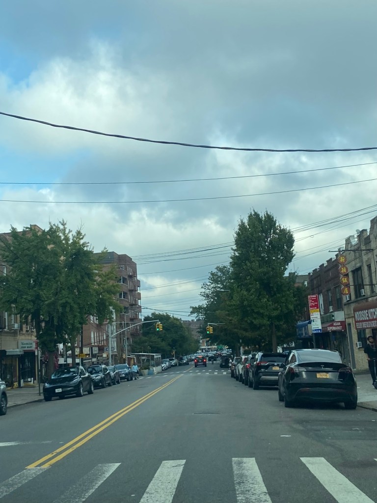
Now, the NYCDOT is planning yet another open streets enhancement in Western Queens. The agency plans to improve safety, amenities and the public realm on the Woodside Ave Open Street.
Part of the plan includes extending the open street one block to Broadway. This will give people more free rein on the open street and provide a car-free connection to the neighborhood’s main commercial and transit corridor. The new visibility of the open street to Broadway pedestrians could make them more inclined to visit which could benefit Woodside Av small businesses. The NYCDOT will also expand pedestrian space and narrow the roadway through massive painted spaces. This can reduce crossing distances and provide pedestrians with car-free spaces to walk or hang out even when the open street is not in effect. Public seating and outdoor dining space is expected to be added too. For motorists, parking will be preserved near residential buildings between 79th St and Broadway. These initiatives are expected to be in effect by this fall.

In addition to pedestrian centric improvements, the NYCDOT also wants to improve Woodside Ave for cyclists. To improve the area bike network, the plan is to add a eastbound bike lane on Woodside Ave from 69th to 79th Sts and add a loop to connect it to shared lanes on 41st Ave. The agency is also exploring adding a bike lane to 73rd St.

Major open street enhancements on Woodside Ave have been a long time coming for community members. According to NYCDOT data, 33 pedestrians were injured on the corridor between 2019 and 2023. In addition, the community district Woodside Ave is in has one of the highest cyclist injury rates in the city and has among the lowest bike lane coverage. This is despite 57% of people biking in the area based on an NYCDOT study. The study also showed that 66% of respondents wanted to see improved walking and cycling conditions.
All of the improvements the NYCDOT is planning will address these issues. While the pedestrian space tactic being used does not have a name, other projects that increase space such as pedestrian islands and sidewalks are associated with substantial safety benefits. In addition, the standard bike lanes being added on streets with lane configurations like Woodside Ave can lower incident numbers by 30%. With the nearest non-playground park being a mile away, the open street is critical to providing much needed open space.
The project will not end once the planned enhancements are made. Throughout 2025, the NYCDOT will evaluate the success of the additions to the street. They will likely consider things like pedestrian injury statistics and the usage of open space to determine whether or not the enhancements met the project’s goals. Then, the agency will work with the community to develop a capital design that could make good features permanent and add things people feel are missing.
Open Street enhancements on Woodside Ave are set to make a major difference for community members. The project will make it much more desirable to walk, bike or just hang out on this vibrant street. Adding a capital design to the street will allow the street to be more people-centric and allow people to truly relish it as a permanent open space. Hopefully, the project can achieve its goals to improve safety and provide Elmhurst with the high quality public space that community members deserve.
Works Cited
“Bicycle Lanes | FHWA.” Federal Highway Administration, https://highways.dot.gov/safety/proven-safety-countermeasures/bicycle-lanes. Accessed 16 August 2024.
Do, Vivian, et al. “New York City’s Open Streets Program During COVID Has Unintended Consequences on Noise Complaints.” Columbia University Mailman School of Public Health, 28 February 2023, https://www.publichealth.columbia.edu/news/new-york-citys-open-streets-program-during-covid-has-unintended-consequences-noise-complaints. Accessed 16 August 2024.
Federal Highway Administration-Office of Safety, and Tamara Redmon. “FHWA Safety Program.” FHWA Highway Safety Programs, https://safety.fhwa.dot.gov/ped_bike/tools_solve/walkways_brochure/walkways_brochure.pdf. Accessed 16 August 2024.
Huber, Daniel, and Admin. “Which Neighborhoods Have More Nearby Park Space Per Capita? | New York City by the Numbers.” Independent Budget Office, 15 July 2020, https://ibo.nyc.ny.us/cgi-park2/2020/07/which-neighborhoods-have-more-nearby-park-space-per-capita/. Accessed 16 August 2024.
New York City Department Of City Planning. “Car Ownership in NYC.” Tableau, 24 November 2022, https://public.tableau.com/app/profile/dcptransportation/viz/ACSProfiles/Dashboard1. Accessed 16 August 2024.
New York City Department of Transportation. “46th Ave Plaza Proposal.” NYC.gov, October 2021, https://www.nyc.gov/html/dot/downloads/pdf/46th-ave-plaza-cb2-oct2021.pdf. Accessed 16 August 2024.
New York City Department of Transportation. “NYC DOT – Current Projects.” NYC.gov, June 2024, https://www.nyc.gov/html/dot/html/about/current-projects.shtml# Accessed 16 August 2024.
New York City Department of Transportation. “NYC DOT – Open Streets.” NYC.gov, https://www.nyc.gov/html/dot/html/pedestrians/openstreets.shtml. Accessed 16 August 2024.
New York City Department of Transportation. “39th Ave Bike Blvd.” NYC.gov, 1 June 2021, https://www.nyc.gov/html/dot/downloads/pdf/39th-ave-bike-blvd-cb2-jun2021.pdf. Accessed 16 August 2024.
New York City Department of Transportation. “Woodside Ave. Open Street / Little Thailand Way 76th St. to Broadway.” NYC.gov, 25 July 2024, https://www.nyc.gov/html/dot/downloads/pdf/woodsive-ave-open-street-jul2024.pdf. Accessed 16 August 2024.
