
By Joseph Morales
Staten Island is the most car-centric and least densely populated borough in New York City. Despite this fact, the borough would be America’s 39th most populous city if it were its own municipality, ranking higher than cities like Miami, Cleveland, and Minneapolis. In addition, 17% of Staten Island households do not have access to a car, which is still significantly higher than the U.S rate of 8.3%. Nowhere is Staten Island’s urban feel more apparent than on the Island’s North Shore, with a car-free household rate of 29% and a population density similar to neighborhoods in Brooklyn and Queens. Mass transit options here include a robust bus network with local buses that could get you just about anywhere on the Island. There are also various express bus routes that connect almost every neighborhood to Manhattan. In addition to buses, some parts of the North Shore also have a train line known as the Staten Island Railway(SIR), that connects the south and west parts of the Island to St. George on the Island’s North and East Shore. Though not considered part of the subway system, the SIR runs with subway trains on a subway-like line with lower headways than NYC subway routes.
Despite there being higher transit ridership on the North Shore, it is true that many if not most transit trips from throughout Staten Island end in Manhattan. In most cases, riders either take the express bus straight to Manhattan or take a local bus and/or SIR train to the Staten Island Ferry. So many railway passengers go to the ferry that fares are only collected at the two stops closest to the ferry terminal on the SIR. The fare policy is set up this way because the MTA deemed it non-cost-effective to add turnstiles to other SIR stations due to the line’s ridership numbers. The bus system
Soon, however, this ridership trend is likely to change a bit. While many riders will still go to the ferry, new developments on the North Shore will lead to more transit ridership within Staten Island as people will be traveling to new places for a variety of purposes. The North Shore Action Plan is a plan to bring more housing, retail, and recreation spaces to the North and East Shores of Staten Island. The goal of the plan is to turn the North Shore into “a vibrant, mixed-use waterfront community,” revitalize the areas surrounding the area’s 2-mile waterfront on the NY Harbor, and bring significant economic growth to North Shore neighborhoods. Despite three rezonings and major commitments from both the city and private investors, Mayor Eric Adams and City Councilwoman Kamillah Hanks(District 49), both want to see more done in North Shore communities. When the plan was released last September, Mayor Adams called it a “once-in-a-generation investment” and Councilwoman Hanks called the plan “a roadmap to build a vibrant waterfront for Staten Islanders to enjoy.”
Not only is the development taking place along the waterfront, but most of it is taking place directly adjacent to the Staten Island Railway. Most of the developments are occurring in the immediate vicinity of the St. George, Tompkinsville and Stapleton SIR stations. While the plan has not been touted as transit-oriented development, its core principles of creating walkable, mixed-use developments adjacent to mass transit makes the plan an example of quality TOD. Transit-Oriented Development is a development around mass transit where people can access commercial space, residences and more all within walking distance. Though not explicitly stated in North Shore Action Plan announcements, projects to build housing in certain areas reflect Mayor Adams’ goal in the City Of Yes Housing Plan to build more affordable housing near subway/commuter rail stations in all five boroughs. Most of the projects are also in close proximity to several if not most Staten Island bus routes.
Public transportation will undoubtedly make a major impact on the success of the North Shore Action Plan. As much of the housing will be affordable housing serving low-income residents, quality public transit will be key to ensuring residents can get around without relying on more expensive modes. Additionally, these developments will be among the most dense Staten Island has ever seen and be located in what are already the borough’s most densely populated neighborhoods. Hence, mass transit will certainly play a role in reducing congestion and parking concerns near new housing and commercial spaces.
There are a whopping 13 new construction projects in the North Shore Action Plan and all except for one is located within a 5 minute walk of either the St. George, Tompkinsville or Stapleton SIR stations. The sole project that is further is still just a 15 minute walk away from the Tompkinsville Station. This will make for large-scale development which will significantly enhance the life of Staten Islanders and bolster the local economy.
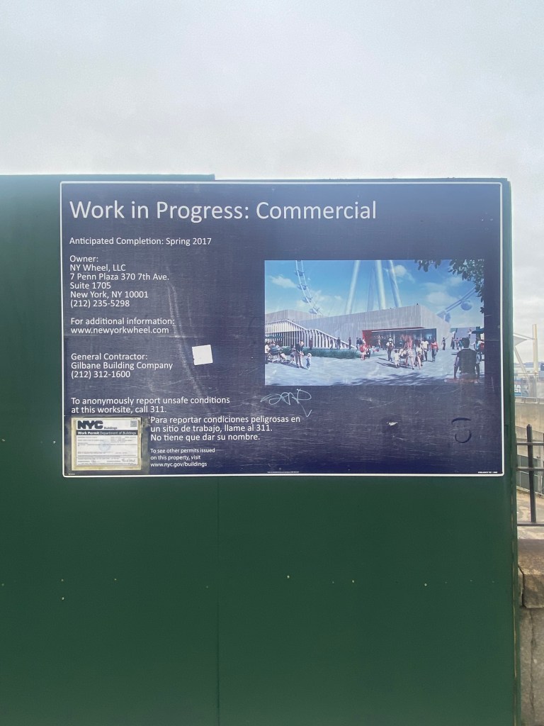
The two main projects in St. George include restoring access to the St. George Esplanade and developing the previously abandoned Bank Street Site. The Bank Street Site was supposed to be the site of a massive Ferris Wheel known as the NY Wheel that was meant to bing a new major tourist attraction to Staten Island. Unfortunately, a myriad of financing issues with developers led to the project getting canceled despite an 820-car parking garage being completed along with a large portion of a 70,000-square-foot terminal building. The St. George Esplanade was a three-acre green space that closed in 2017 to accommodate construction on the Bank Street Site and has not reopened since.
The New York Economic Development Corporation wants to revitalize both properties by constructing a new esplanade and seeking a developer to turn the terminal building into an entertainment center along with providing new open space adjacent to the waterfront. The entertainment center would be required to offer “year-round programming and events”. With the venue’s size, it is possible that it will be rented by an entity that plans to host large-scale events that can draw people from across the region and beyond. As for the esplanade, it will be connected to an existing esplanade via pedestrian and bike paths. The NYCEDC is working with elected officials to secure a $20 million public investment in the new esplanade.


These developments are just what St. George needs to be one of New York State’s vibrant downtown areas with a diverse range of recreation and entertainment options. When both projects are completed, St. George will be home to an outlet mall, a minor league baseball stadium, the iconic St. George Theatre and so much more in addition to the new developments. In addition, St. George may likely have less congestion than many similar downtowns across the United States. This is in large part because almost every Staten Island bus route terminates in St. George along with the SIR, enabling easy transit access from almost every corner of the borough. This is before considering the fact that St. George is the SI terminal for the iconic Staten Island Ferry. With all those local and regional transit options, St. George is the perfect place to have regional attractions, as it is easy for many New Yorkers from near and far to get there without a car. Also, these attractions could draw the attention of many who ride the Staten Island Ferry for fun to get off at St. George and explore the community. This can allow the community to take full advantage of its proximity to one of New York’s most popular transit modes.
One stop down on the SIR, developments are also booming in the Tompkinsville neighborhood. Like St. George, the community will have several employment hubs and destinations that attract visitors from throughout the region. Considering Tompkinsville’s proximity to St. George, mass transit will be even more important to ensuring the North Shore does not become too congested given this cluster of development. It also helps that some of the buses that run in Tompkinsville can take advantage of bus lanes on Victory Blvd, helping them get in and out of the neighborhood faster.
One of the major developments here is Lighthouse Point, in which the first phase alone will include 115 apartments, the College of Staten Island Tech Incubator, and a location of The Learning Experience, an early childhood education center. In addition, the NYCEDC is attempting to redevelop the vacant 19,000 sq ft Building 10, which was originally part of the former U.S. Lighthouse Service General Depot. The agency plans to release a Request For Proposals(RFP) for a bidder to take on the project by the end of this year.
Another significant project is a new esplanade that will be constructed as the neighborhood’s only waterfront access currently is a partially collapsed promenade at Bay St Landing. A new pier is also planned, with a total of two acres of public waterfront space set for construction between the pier and esplanade. The esplanade will also include bike and pedestrian access to Miller’s Launch, making it easier for the company’s 135 employees to walk, bike, or take transit to work. Additionally, the NYC Parks Department is constructing the brand-new 45,000 sq ft, $92 million Mary Cali Dalton Recreation Center that NYC Parks Commissioner Sue Donoghue said will be “a gem of the park system.” This recreation center will be located at 1 Hannah St, just steps away from the Lyons Pool and the Tompkinsville SIR station. As this will be the only recreation center in the area, the SIR and local buses will help to ensure parking is not nightmarish when the rec center is open. While many who may live along the SIR own cars, it is quite possible many on the line will be intrigued to take the train to get to the center, given the convenience.
In addition to Tompkinsville and St. George, some new development is also coming near the Stapleton SIR station. Here, most of the development is in the form of new affordable housing. This is mainly comprised of a 360-affordable housing project known as Stapleton Beacon, along with another 330 mixed-income homes/retail space as part of the final phase of Staten Island Urby. There is enough active population growth and new housing coming to the neighborhood that the New York City School Construction Authority(SCA) plans to construct a new 600-seat public school in the community after construction on Stapleton Beacon starts. The ongoing population increase is in part due to the presence of mass transit, according to the North Shore Action Plan. Given how many Staten Islanders live a long walk or bus ride away from the ferry, the location next to the SIR near St. George is likely compelling to many commuters. Also, Stapleton’s connection to six MTA bus routes gives residents access to many parts of Staten Island as well.
With so many new developments, Staten Island’s North Shore is the latest part of the city to receive a major boom around mass transit. Given the North Shore’s vibrancy and regional connectivity, there is no telling what the future of North Shore may look like. Through the North Shore Action Plan, Staten Island will have a core business district that can be an example of quality and affordable waterfront and transit-oriented development for cities across the United States.
Works Cited
“City and Town Population Totals: 2020-2023.” U.S. Census Bureau, 16 April 2024, https://www.census.gov/data/tables/time-series/demo/popest/2020s-total-cities-and-towns.html. Accessed 19 May 2024.
“List of United States cities by population.” Wikipedia, 2024, https://en.wikipedia.org/wiki/List_of_United_States_cities_by_population. Accessed 19 May 2024.
Metropolitan Transportation Authority. “REPORT OF THE BLUE-RIBBON PANEL on MTA Fare and Toll Evasion.” MTA, May 2023, https://new.mta.info/document/111531. Accessed 19 May 2024.
New York City Department of City Planning. “City of Yes for Housing Opportunity.” ArcGIS StoryMaps, 21 September 2023, https://storymaps.arcgis.com/stories/f266a53c9cda42d5b7f63b57dc08f849. Accessed 19 May 2024.
New York City Department of City Planning-Transportation. “Car Ownership in NYC.” Tableau, 24 November 2022, https://public.tableau.com/app/profile/dcptransportation/viz/ACSProfiles/Dashboard1. Accessed 19 May 2024.
New York City Economic Development Corporation, and Councilmember Kamillah Hanks(49th District). “Staten Island North Shore Action Plan: Building a Vibrant, Mixed-Use Waterfront Community.” NYCEDC, Summer 2023, https://edc.nyc/sites/default/files/2023-09/NYCEDC-Staten-Island-North-Shore-Action-Plan.pdf. Accessed 19 May 2024.
New York City Office of the Mayor. “Mayor Adams.” NYC.gov, 14 September 2023, https://www.nyc.gov/office-of-the-mayor/news/662-23/mayor-adams-nycedc-councilmember-hanks-double-down-support-staten-island-s-north-shore. Accessed 19 May 2024.
New York City Office of the Mayor. “Mayor Adams Break Ground on $92 Million Mary Cali Dalton Recreation Center on Staten Island.” NYC.gov, 23 February 2024, https://www.nyc.gov/office-of-the-mayor/news/138-24/mayor-adams-ddc-nyc-parks-break-ground-92-million-mary-cali-dalton-recreation-center-on#/0. Accessed 19 May 2024.
Porpora, Tracey. “Exclusive: Any hope of a smaller NY Wheel is now dead; NYC terminates lease.” SILive.com, 3 February 2023, https://www.silive.com/news/2023/02/exclusive-any-hope-of-a-smaller-ny-wheel-is-now-dead-nyc-terminates-lease.html. Accessed 19 May 2024.
