
By Joseph Morales
*Though some corridors that lack regularly scheduled frequent and reliable bus service are discussed, there may be some that I might have missed. If you think I missed a particularly slow and infrequent bus route, let me know in the comments!
New York City is undoubtedly the most transit dependent city in the United States, as only 46% of residents own a car according to data from the NYC Department of City Planning. New Yorkers opt to ride public transit for various reasons, from the parking and traffic challenges of driving to the sheer cost of more reliable modes. Unfortunately, most New Yorkers know that mass transit is not the same for everyone, as two million New Yorkers live in so called “transit deserts” with little to no access to subway service. These New Yorkers often face long bus rides to get to subway service and have commutes that are substantially longer than those who live in more subway-rich neighborhoods.
While this type of transit desert is very familiar to New Yorkers, particularly in the outerboroughs, what if it was the other way around? What if subway access to other boroughs was plentiful, but access to a bus for a simple crosstown trip was not? Even though this is not nearly the case for most, it is for those who live around or travel on these three major corridors in the city. Even when there is subway service, a lack of frequent crosstown bus service makes it harder for those on one part of the corridor to connect to other subway routes if the one they are nearest to does not take them to where they need to go. In addition, this can inhibit the elderly and others who cannot walk long distances from being able to take essential trips in their community, such as to a supermarket, community center or other places. While having to pony up money for a taxi or rideshare is inconvenient for anyone; the extra cost is especially burdensome for those who live in low-income communities are are already struggling to cope with the MTA’s bus and subway fare increase to $2.90.
These corridors in which lack frequent crosstown bus service the most in NYC are the 49th-50th and 106th St Corridors in Manhattan, along with the 138th/135th St corridor between Mott Haven in The Bronx and Harlem. In these areas, there is access to multiple subway stations making it easy to travel north-south or even to another borough. However, traveling east-west is a major challenge with buses in addition to being slow like many crosstown routes across the city, are also very infrequent, making them almost completely unreliable.
The 49th-50th St corridor is the most extreme example of this disparity, as 12 different subway routes stop at six different subway stations within immediate walking distance of the corridor. However, the M50 bus which is supposed to connect both the corridor and these subway routes together only runs every 15-20 minutes during weekdays and every 30 minutes on weekends. On top of this, MTA performance statistics show the route has had average speeds below 5.9 mph each month since September 2021 with even more horrendous lows during the busy holiday season, making this corridor one of the hardest to get across in the entire city. Given the already high congestion of Midtown Manhattan, the narrowness of 49th and 50th St certainly does not help the cause for buses. In addition, the lack of service inhibits people from travelling between the numerous key destinations along the corridor such as Rockefeller Center, Broadway Theatres, the United Nations, major hotels and more. There are also a substantial amount of residents along the corridor who must contend with the limited crosstown travel options. The other two closest crosstown buses, the M42 and M57, are both between 7-8 blocks away from 49th/50th and have speed statistics very similar to the M50.

(Could have been technical breakdown with stop machine.)

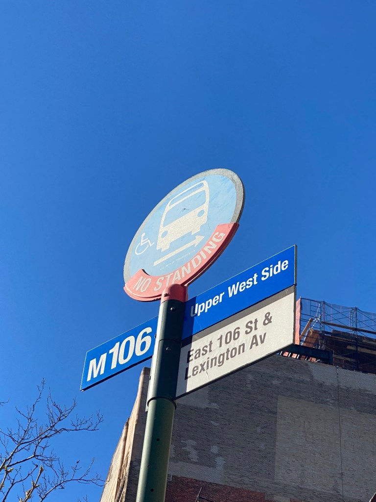
As for 106th St, the M106 bus has headways(time between each bus) very similar to that of the M50. This route, unlike most Manhattan crosstown routes, runs from East 106th St in East Harlem, down 5th Avenue to the 97th St Traverse/W 96th St, rather than sticking primarily to 106th St . This is likely because of the limited commercial density in the 100s on the West Side, which would mean less trips being made there from the also heavily residential East 106th St area. However, for those trying to crosstown in this area, it is a challenge for almost the same reasons as the M50. The M106 does run faster thanks to time spent on the largely residential 106th St and its speed statistics reflect that. The route has a speed range of between 6.1-7.0 mph on average each month since September 2021, which is a bit better than the M50. However, it does spend a good amount of time in slow traffic on 5th Ave and 96th St, which causes its speed statistics to even out where it does right around the Manhattan average.
The lack of crosstown bus access particularly causes challenges for the elderly, who must walk long distances to get to several destinations. While the 106th St area is within walking distances to two stations for the 6 train on Lexington Ave, a resident on E 106th can be as much as a 15 min walk from a subway station. As the lack of crosstown service inhibits many people from both East Harlem and the UWS from making trips to the other neighborhood, it especially hinders the 31.5% of East Harlem residents and 10.4% of UWS residents who live in poverty and cannot afford other modes according to 2021 data from the NYU Furman Center. Given that a large number of residents around East 106th St live in NYCHA developments, the amount of low-income New Yorkers whom the M106 is their main crosstown travel option is likely higher. The closest, more frequent crosstown routes are the M116 and M96, which are both 10 blocks away from the M106.
The last major corridor with such infrequent and unreliable bus service in the 138th/135th St corridor between Mott Haven in The Bronx and Harlem. While the frequency of the Bx33 bus that serves the corridor is just as minimal as it is for the other two corridors, bus speeds are higher than for the other two, with the range being between 6.6-7.2 mph since September 2021. Unlike the other two corridors that have segments in predominantly commercial and residential areas, the Bx33 route has more mixed-use density along it throughout both The Bronx and Manhattan, albeit with more mixed-use properties being on the Bronx side. Mixed-use refers to neighborhoods and properties with a combination of residential, commercial and other uses of space within. While the 6 train does make a few stops across 138th St, it does not travel onto 135th St in Manhattan or connect to Manhattan’s West Side in any way. On top of that, none of the stations are accessible to those with mobility disabilities. The M125 also serves part of 138th St, however, it crosses a much more congested 125th St in Manhattan, providing riders connecting to subway lines with a slower trip.
People travelling to other subway routes besides the 6 tends to be one of the top uses for the Bx33, as according to a report from the MTA in 2019, 50.2% of Bx33 riders were transferring from the bus to the subway, one of the highest marks among all Bronx bus routes. People who find it difficult to ride the subway may also find use for the Bx33, as NYU Furman Center data shows that 15.9% of Mott Haven and 11.8% of Central Harlem residents are disabled. One Bx33 rider who was in a wheelchair named who I spoke with in January 2022, said this about Bx33 service, “Terrible man, the 33 dosen’t run regular at all, and you can’t depend on it, and that’s why I go down here and take the 21, I’d rather take the 33 but I always wind up taking the 21, because the 33 don’t run regularly”. Another rider, Mildred Rodriguez, who was riding the Bx33 from the Bronx with the intent of transferring to the subway in Manhattan to go to Washington Heights said, “Like now, I’ve been waiting, I’m freezing. Sometimes the bus doesn’t come and I have to wait half an hour here, or 45 minutes especially on the weekend. Like on the weekdays, it comes a little bit. Weekends forget it, it’s horrible.”
The MTA did evaluate the route as part of the Bronx Bus Network Redesign and likely chose not to increase frequencies as the route had some of the lowest ridership numbers in The Bronx at the time of the redesign. However, these ridership numbers could have very well been due to the route’s low frequency as riders likely consider alternatives to get to their destinations. As the South Bronx continues to be one of the fastest growing communities in the city, there may be an even greater need for more frequent service in the near future. It may be especially necessary given the fact that pollution caused by automobiles has played a role in the neighborhood having some of the highest asthma rates in the city. Hence, the MTA may want to find ways to keep as many cars off the road in this area as possible.
So, if a lack of frequent and reliable crosstown bus service is an issue, how can the MTA go about addressing it? Despite the three corridors being different in so many ways, the main thing they all have in common, is that they lack the number of mixed-use properties other corridors around them have with the exception of part of East 138th St in Mott Haven. Given the fact that providing public transit is very expensive and rarely turns a profit, the MTA looks at ridership numbers directly in order to allocate service on both subways and buses. As primarily residential and commercial land uses often have more rigid travel patterns, it is dense, mixed use communities where transit is able to thrive. This is because there is a variety of people travelling in the community for a wide array of purposes at various times of the day. This is what the corridors with the most infrequent transit service in the city lack in comparison with the corridors around them.
However, just because the corridors do not have as many mixed-use properties as the ones around them, does not necessarily mean that more frequent or even faster transit cannot be justified. In the mid-1980s, the New York City Department of Transportation(NYCDOT) had a bus and taxi way on 49th/50th Sts that worked almost exactly like the current busways in NYC with the exception being that this one also permitted taxis. Despite the inclusion of taxis, there were major time savings on 49th St as bus riders and taxis during the midday saved a whopping 11.4 minutes, followed by savings of 2.5-5.2 minutes all other times of day. However, the savings were much more miniscule for riders on 50th St where buses and taxis and average of 0.4 minutes going across. While these results left a lot of uncertainty as to the bus/taxi easy effectiveness nor did it discuss the impact of frequency on ridership, it does provide insight into how crosstown bus service here can be improved for riders. Given the fact that service was much faster on 49th St, it is highly likely that an M50 with such dramatically improved speeds would have had more ridership and thus, more frequent service from the MTA.
Even if a busway cannot work everywhere, it is interesting to consider if more frequent service would attract more riders. As this transportation issue is not as widespread in NYC as other issues, it is interesting to think about how the MTA would go about addressing it. Hopefully, the MTA can determine solutions that make it easier to get across the city regardless of where someone is starting their trip.
*If there are other areas where it is difficult to get across town in NYC that I missed for the reasons discussed, let me know in the comments!
Works Cited
New York City Department of City Planning. “Car Ownership in NYC.” Tableau, 24 November 2022, https://public.tableau.com/app/profile/dcptransportation/viz/ACSProfiles/Dashboard1. Accessed 17 November 2023.
“EXPLAINING NYC’S TRANSIT DESERTS — Dollaride.” Dollaride, 18 July 2022, https://www.dollaride.com/blog/2022/7/18/deep-dive-into-nycs-transit-desert-problem. Accessed 17 November 2023.
Metropolitan Transportation Authority. “M50 Local Crosstown Service.” MTA, 1 September 2019, https://new.mta.info/document/7616. Accessed 17 November 2023.
Metropolitan Transportation Authority. “MTA Metrics.” MTA, September 2023, https://metrics.mta.info/?bus/speeds. Accessed 17 November 2023.
Metropolitan Transportation Authority. “M106 Local Crosstown Service.” MTA, 19 January 2020, https://new.mta.info/document/7691. Accessed 17 November 2023.
“East Harlem Neighborhood Profile – NYU Furman Center.” NYU Furman Center, 2022, https://furmancenter.org/neighborhoods/view/east-harlem. Accessed 17 November 2023.
“Mott Haven/Melrose Neighborhood Profile – NYU Furman Center.” NYU Furman Center, 2022, https://furmancenter.org/neighborhoods/view/east-harlem. Accessed 17 November 2023.
Metropolitan Transportation Authority. “MTA Bx33 Bus Timetable.” MTA, 26 June 2022, https://new.mta.info/document/88901. Accessed 17 November 2023.
Metropolitan Transportation Authority. “Existing Conditions Report-Bronx Bus Network Redesign.” MTA, February 2019, https://new.mta.info/sites/default/files/2019-03/77_19_BBNRExisting_Working%20File_Final_Low%20Rez.pdf. Accessed 17 November 2023.
“Asthma.” Columbia University Mailman School of Public Health, 2023, https://www.publichealth.columbia.edu/research/centers/columbia-center-childrens-environmental-health/our-research/health-effects/asthma. Accessed 17 November 2023.
Jovanis, Paul P., et al. “Effect of 49th-50th Street Bus and Taxiway on Traffic Congestion in Manhattan.” Transportation Research Board, https://onlinepubs.trb.org/Onlinepubs/trr/1990/1256/1256-004.pdf. Accessed 17 November 2023.
