By Joseph Morales
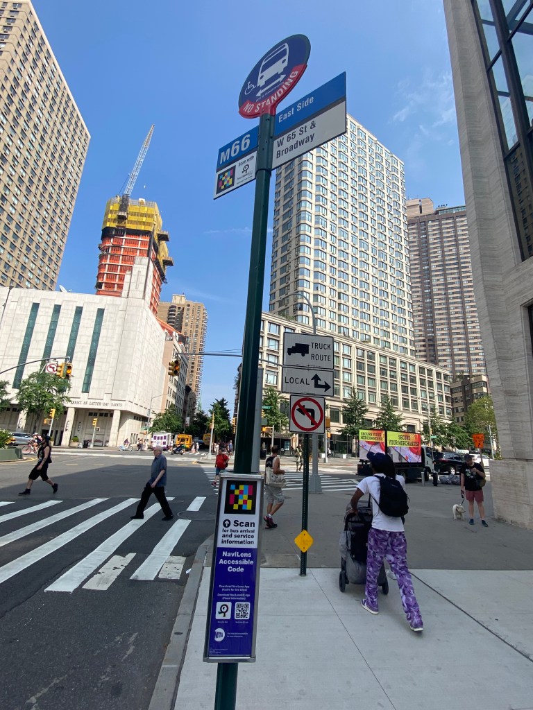
65/66th Street is one of the most vital corridors that runs along the Upper East/West Sides of Manhattan. The corridor is home to several major regional destinations, such as Rockefeller University, Memorial Sloan Kettering Cancer Center, the Central Park Zoo, Lincoln Center, and so much more. Additionally, the corridor is home to the 1 train on the West Side(Broadway/7th Avenue Line) and the 6 train on the East Side(Lexington Avenue Line), meaning while the corridor is well connected to the rest of the city by subway, many transit riders might utilize the M66 crosstown bus in order to access trains traveling to different parts of Manhattan and The Bronx that the other line is disconnected from. Transit is extremely imperative to people getting around along 66th Street and the surrounding communities as not only do most people traveling to Manhattan use mass transit, but only 30% of UES and 27% of UWS households own cars, according to data from the New York City Department of City Planning(NYCDCP). Thus, transit is critical to the movement of both residents and visitors in the 66th St area daily.
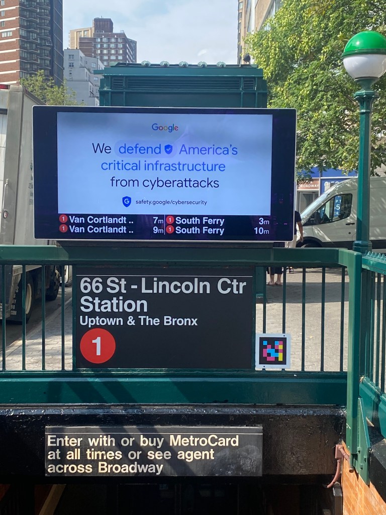
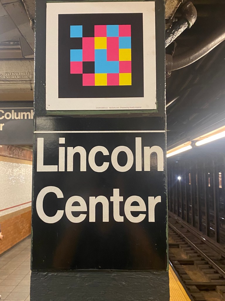
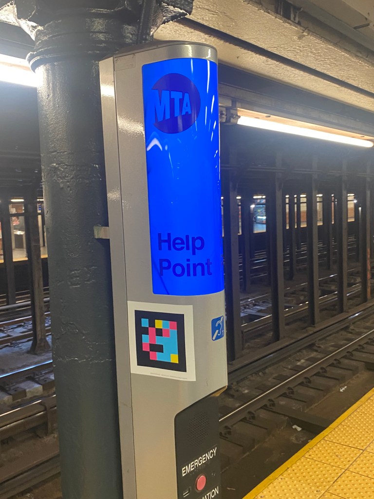
As the MTA continues its efforts to make transit more accessible for all, they are partnering with the developer of the NaviLens app to bring NaviLens codes to both the 66th St-Lincoln Center(1) subway station as well as all 24 bus stops along the M66 bus route in order to help the blind and visually impaired navigate the transit system in the community. The project is occurring in large part due to funding secured by District 47(West Side) State Senator Brad Hoylman-Sigal, which will also help to enable codes to be placed throughout in the subway system in District 47 at other 1 train stations as well as at 59th St-Columbus Circle(A,B,C,D,1), 14th St(A,C,E) and 8 Av(L). This will build on the pilot program already in progress in which codes are already present at stops along the M23-SBS route, which operates east-west along 23rd Street.
At bus stops, NaviLens codes are placed on both the stop name section as well as the schedule box. As for subway stations, codes are placed in numerous spots at the station’s entrance so that riders who are low vision or blind can scan the codes and receive auditory instructions to enter the station. All codes are colorful and can be picked up by the app up to 40 feet away(12x further than QR and barcodes) and at an angle of up to 160 degrees, making it easier for individuals to detect station entrances and bus stops as GPS technologies often do not guide the visually impaired to the precise location of a destination, known commonly as “the last few-yards problem.” In addition, the codes are placed throughout the subway station so that people can detect certain key locations and amenities, such as the turnstiles, the platform, and help points. For both bus stops and subway stations, codes can be used to tell individuals the amount of time until the next bus/train arrives. In addition to the NaviLens app itself, the codes can also be used for the NaviLens GO app, which helps sighted users to determine bus stop/subway station information and bus/train arrival times from up close rather than by reading signage. The MTA also added maps of the 1 line to both the Uptown and Downtown mezzanines that included Braille so that those who are blind or low-vision can navigate not just the station but the subway system as a whole. The app can be utilized on public transit systems in both Barcelona and Murcia in Spain as well as in schools.
While the MTA recently implemented NaviLens technology on the M23-SBS last year, this expansion of NaviLens to the 66th St-Lincoln Center(1) station is the first expansion of NaviLens in the subway system since the app’s success at the much larger Jay St -Metrotech(A,C,F,R) station in Downtown Brooklyn. This is also the largest expansion of the program which the MTA has undertaken so far, with codes expected to be deployed throughout the 1 line, as mentioned earlier throughout this summer as well as the fall.
Outside of NaviLens, the company MagnusMode is working to include examples of stations and subway experiences on Manhattan’s West Side in its app MagnusCards. The app helps those with cognitive disabilities as well as others to ride the subway through short guides on topics such as how to ride safely, how to pay the fare, and more. Through the app’s character Mangus, the app, according to the MTA, “combines the specialized instruction of a behavior therapist with real-world images.” These stories are essentially similar to what many in special education consider “social stories” that help those with cognitive disabilities navigate many aspects of everyday life, such as going shopping, having a conversation, or settling a conflict. In addition to helping those with cognitive disabilities, the app may be able to particularly help those with autism and other learning disabilities as the app is titled on the Apple App Store as “MagnusCards-Autism App” and is categorized as an “Autism Independence Guide”. Users may also benefit particularly from subway stations on Manhattan’s West Side being used as examples as these are some of the busiest, most stimulating and arguably the most difficult to navigate stations in the entire system. Hence, this can help those with autism and other disabilities to ease anxiety in places where it may be the hardest to do so. As of now, the MTA nor MagnusMode has announced which stations on the West Side will be used as examples or if they will be the same as the ones receiving NaviLens codes in the coming months. The app already includes support on how to utilize the NYC Subway, NJ Transit Bus/Train as well as transit services in London and Toronto along with other areas throughout North America.
As the MTA is deploying numerous innovative methods to make transit more accessible on the M66 bus and at the 66th St-Lincoln Center station, it is worth wondering if this project will be a model as to how both the MTA and other transit agencies can make their systems more accessible and comfortable for riders with a variety of disabilities.
Works Cited
New York City Department of City Planning-Transportation. “Car Ownership in NYC.” Tableau, 24 November 2022, https://public.tableau.com/app/profile/dcptransportation/viz/ACSProfiles/Dashboard1. Accessed 23 July 2023.
Metropolitan Transportation Authority. “Expanding Innovative Accessibility Solutions.” MTA, 18 July 2023, https://new.mta.info/accessibility/expanding-innovative-solutions. Accessed 23 July 2023.
Metropolitan Transportation Authority. “Check out NaviLens at M23-SBS bus stops!” MTA, 27 April 2022, https://new.mta.info/article/help-us-test-navilens-app. Accessed 23 July 2023.
NaviLens. Empowering The Visually Impaired, https://www.navilens.com/en/#where-section. Accessed 23 July 2023.
Metropolitan Transportation Authority. “Subway and bus ridership for 2021 – New York City Transit.” MTA, 2022, https://new.mta.info/agency/new-york-city-transit/subway-bus-ridership-2021. Accessed 24 July 2023.
