
By Joseph Morales
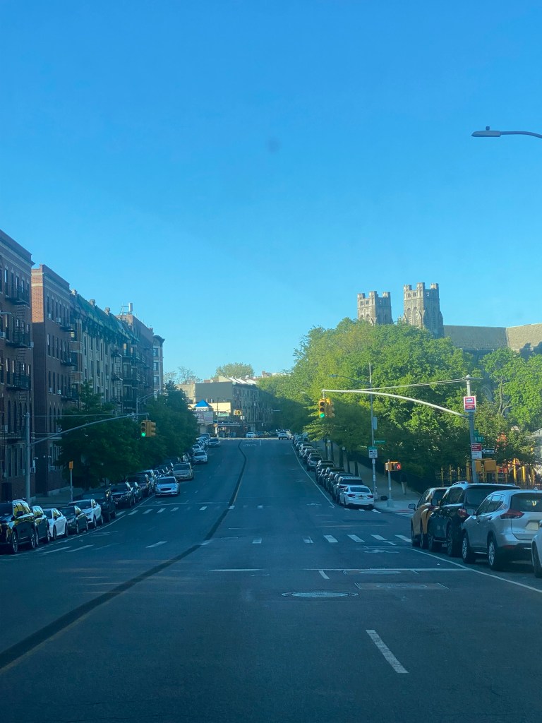
University Ave is one of the busiest north-south streets in the West Bronx. Though the corridor is mainly residential, it connects several east-west arteries, such as Fordham and Kingsbridge Roads and Burnside and Tremont Avenues. The street is also home to Bronx Community College. The bus routes that run along the corridor, the Bx3 and the Bx36, cross the Washington Bridge into Manhattan and serve University Ave, providing riders with many transfer options for traveling throughout the Bronx and Manhattan via other bus and subway lines. Thus, it is no surprise that in the existing conditions report for The Bronx Bus Network Redesign, the travel pattern Burnside to Washington Heights had the 6th most trips between two TAZs (Transit Analysis Zones), and the travel pattern Morris Heights to Washington Heights ranked 20th. Both of those trip patterns are served by the Bx3 and Bx36 buses.
While critical in all parts of New York City, bus service is especially important in the communities served by the Bx3 and Bx36. This is because the rate of households with a car is only as high as 54% in a given community district served by one of the buses and is as low as 25% in Bronx Community District 5, in which parts of the district are located directly off the corridor. Also, according to the NYU Furman Center, the poverty rates in community districts along the corridor(Bronx CD 5 & 7) are 31.4 and 22.5%, respectively. The median income is also $33,650 in CD 5 and $43,440 in CD 7. These numbers may make it more likely that people using University Ave ride bicycles or use mass transit to get around.
Unfortunately, buses along the corridor had always been known to be slow and unreliable. According to an NYCDOT presentation, bus speeds ranged between 5.4-7.1 mph in the southbound peak direction in the AM peak(7 AM-10 AM) and between 4.2-5.8 mph in the northbound peak direction in the PM peak(3 PM-7 PM)
This is why the NYCDOT has decided to install bus lanes along the corridor between Kingsbridge Rd and the Washington Bridge for the purpose of speeding up buses. They are only leaving out part of University Ave on the northbound side at the intersection of University Av/W Tremont Av in front of the Morris Heights Educational Complex(not to be confused with the Morris High School Campus) due to there already being minimal road space due to protected bike lanes and a massive curb extension that includes a Bx3/Bx36 stop.
The NYCDOT has already installed the bus lanes between Tremont Ave and the Washington Bridge as part of phase 1, as discussed in an article published last August: https://transit-central.com/2022/08/01/university-ave-in-the-bronx-is-receiving-major-upgrades-to-bus-and-bicycle-travel/ While the project was initially planned to be split into three phases, it was consolidated into two phases with one being south of Tremont Ave and the other being north of Tremont Ave.
Now, the bus lanes as part of the project’s second phase between Tremont Ave and Kingsbridge Rd are about to be constructed, according to an NYCDOT tweet published on May 1st. This is a critical segment as bus speeds here, like the rest of the corridor, ranged between 5.4-5.8 mph in the peak. As the Bx3 operates along the entirety of the corridor, delays in one area can delay riders across the entire route regardless of where they are going. Hence, this likely explains why bus speeds on the Bx3, which operates along the entirety of the corridor, have stood flat around the seven mph range between March 2022 and March 2023, according to the latest MTA performance metrics. Other important metrics, such as Customer Journey Time Performance and Wait Assessment, also stood flat.


The bus lanes are not the only things being completed in phase 2. The NYCDOT also plans to add a two-way protected bike lane to the corridor between W Tremont Ave and W 181st St. This is an extremely important addition to this portion of the corridor as in this area alone, 24 pedestrians, 12 cyclists, and 161 motor vehicles occupants were injured in accidents with one pedestrian being killed. Even though cyclists do not make up the bulk of the injuries, the bike lanes can benefit the safety of all road users. Researchers from the University of Colorado, Denver, and the University of New Mexico found that in cities with protected bike lanes, deadly crash rates for all road users decreased by 44% compared to the average city. The study analyzed 13 years of crash data from 12 major U.S. cities, such as San Francisco, Chicago, Houston, and Dallas. This is likely because less road space and more cyclists can lead to less speeding and dangerous maneuvers from motorists.
Bike sharrows or shared bike/vehicle lanes are present throughout the corridor; however, they are not clearly marked and are nowhere near as effective at reducing injuries as protected bike lanes. An NYCDOT study of over 100 bike lanes citywide found that protected bike lanes reduced the risk of injury by 34%, whereas sharrows only reduced injuries by 18%, indicating that protected bike lanes are substantially more effective.
. As stated earlier, given the fact that this is a critical portion of the corridor, it is crucial that it is connected to the protected bike lanes that already run between the Washington Bridge and Tremont Av to ensure cyclists have safe connections to major east-west travel arteries including bike lanes on W Tremont Ave that stretch for a significant portion of the Tremont Ave corridor across The Bronx. The protected bike lanes will also connect to the future Fordham Area Bicycle Network, including bike lanes running throughout nearby neighborhoods.
From W 181st St to Kingsbridge Rd, the plan is to remove the existing shared lanes and divert the bike path to the adjacent Aqueduct Walk, a car-free greenway more suitable for cyclists. This will ensure that the entire corridor is linked through cycling infrastructure so that the project can offer cycling connections to as many areas of The Bronx and beyond as possible.
With the NYCDOT working to improve two popular modes of travel in The Bronx, through this single project, they can improve the corridor using a holistic approach that truly benefits all road users. It will be interesting to see if more multimodal transportation improvement projects like this happen throughout the city.
Works Cited
Metropolitan Transportation Authority. “Bronx Bus Network Redesign.” MTA, February 2019, https://new.mta.info/sites/default/files/2019-03/77_19_BBNRExisting_Working%20File_Final_Low%20Rez.pdf. Accessed 11 May 2023.
New York City Department of City Planning-Transportation. “Car Ownership in NYC.” Tableau, 23 February 2022, https://public.tableau.com/app/profile/dcptransportation/viz/ACSProfiles/Dashboard1. Accessed 11 May 2023.
“Fordham/University Heights Neighborhood Profile – NYU Furman Center.” NYU Furman Center, 2019, https://furmancenter.org/neighborhoods/view/fordham-university-heights. Accessed 11 May 2023.
“Kingsbridge Heights/Bedford Neighborhood Profile – NYU Furman Center.” NYU Furman Center, 2019, https://furmancenter.org/neighborhoods/view/kingsbridge-heights-bedford. Accessed 11 May 2023.
Metropolitan Transportation Authority. “MTA Metrics.” mta.info, 2023, https://metrics.mta.info/. Accessed 11 May 2023.
New York City Department of Transportation. “University Ave Bus and School Safety Improvements.” NYC.gov, 12 October 2021, https://www.nyc.gov/html/dot/downloads/pdf/university-ave-north-cb5-oct2021.pdf. Accessed 13 May 2023.
Bliss, Laura. “Why Some Cities Are So Much Safer for Bike Riders.” Bloomberg.com, 3 June 2019, https://www.bloomberg.com/news/articles/2019-06-03/why-some-cities-are-so-much-safer-for-bike-riders. Accessed 13 May 2023.
New York City Department of Transportation. “Safe Streets For Cycling.” NYC.gov, October 2021, https://www.nyc.gov/html/dot/downloads/pdf/safe-streets-for-cycling.pdf. Accessed 13 May 2023.
