
By Joseph Morales
East Gun Hill Rd in The Bronx is one of the busiest streets in the northern section of the borough. The bustling roadway is home to many businesses. It connects several other major Bronx streets such as Eastchester Rd, Bronxwood Ave, and Webster Ave. Motorists can also connect to the Bronx River Pkwy, Hutchinson River Pkwy, and Interstate 95(New England Thruway). Multiple schools, such as JHS 144 Michaelangelo and the Evander Childs High School Campus, are along the corridor. The Montefiore Moses Hospital Campus and North Central Hospital are also near E Gun Hill Rd.
Given the corridor’s many vital destinations and the number of bus and subway transfers available, it is no surprise that the main buses along Gun Hill Rd(the Bx28 and Bx38) serve 40,000 passengers daily, according to an NYCDOT(New York City Department of Transportation) presentation. These buses also serve the Co-Op City area, which includes schools, residences, and the Bay Plaza Shopping Center. These buses are the primary connection between Co-Op City and the Gun Hill Rd corridor. The buses also connect Co-Op City residents to multiple subway lines, as no subway service is located within Co-Op City.
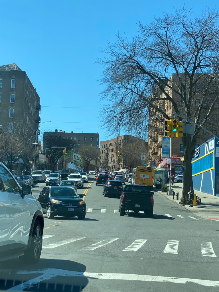
Unfortunately, these buses are considered slow and unreliable, with speeds of less than five mph westbound during the AM hours and eastbound during the PM hours, according to NYCDOT statistics. The same statistics show that trips during peak-period generally take 15-17 minutes longer than evening and overnight trips. As a result, only 65% of Bx28/38 trips are completed within 5 min of the scheduled time, causing inconvenience for many riders. These numbers are primarily driven by vehicular congestion and double parking outside the many businesses that line the corridor.
In addition, and likely in large part due to the high traffic volumes on Gun Hill Rd, Gun Hill Rd ranks within the top 10% of most dangerous streets for pedestrians in The Bronx. According to DOT statistics, the corridor saw 64 severe injuries and two fatalities between 2015-19, and on average, nearly five people a week are injured in crashes occurring along Gun Hill Rd. The corridor is designated as a Vision Zero Priority Corridor.
Thus, the NYCDOT will take multiple steps to address the issues and improve Gun Hill Rd for all road users. To enhance bus speeds on the busiest portion of the corridor between Bainbridge Ave and Webster Ave, the NYCDOT will implement a westbound center-running bus lane with two bus boarding islands and an offset bus lane in the eastbound direction. The center-running bus lane would undoubtedly have the most significant impact on any potential bus service improvements. It would be the third center-running bus lane in the Bronx, one of only a handful in New York City. The offset bus lane would be one lane away from the curb so motorists could still park and engage in any curbside activities that they can currently under the status quo.
Courtesy: Google Maps
The center-running bus lane, however, would be the first in New York City to be located along such a steep slope. It may be intriguing to many to see how it works. It will hopefully work better than the curbside bus lanes on a similarly hilly portion of the nearby Fordham Rd, on which buses have a speed between 4-6 mph or even slower in certain circumstances, according to an NYCDOT presentation. While Fordham Rd is a more congested street than Gun Hill Rd, its topography combined with busy intersections, without a doubt, plays a role in speeds being as low as they are. The NYCDOT likely wants to avoid that situation here.

Courtesy: Google Maps
The NYCDOT will also construct offset bus lanes in both directions between White Plains Rd and Bartow Ave, along with pedestrian safety improvements at over 20 locations in the area. These improvements will consist of painted curb extensions and a couple of pedestrian islands to give pedestrians more space when crossing the street and make them more visible to oncoming motorists. Left turn bays will be added to the intersection of E Gun Hill Rd/Eastchester Rd to simplify left turns. In addition, left turns will be prohibited from Adee Ave onto E Gun Hill Rd, likely due to the length of the turn and the street geometry, as shown in the photo below.


These improvements should significantly improve pedestrian safety along Gun Hill Rd. According to The New York City Pedestrian Safety Study and Action Plan published in 2020, left-turning crashes that resulted in a pedestrian being killed or seriously injured(KSI) were triple the KSI for right-turning crashes. In addition, curb extensions and pedestrian islands should increase street space at bustling intersections, making it easier for pedestrians and motorists to see each other and shortening crossing distances.
Changes between these two sections on E Gun Hill Rd between Webster Av and White Plains Rd would primarily occur in late 2023/2024, while some changes may take place now this spring to complement the work being done along the rest of the corridor. This portion is being completed later, possibly because this section is adjacent to the entrance/exit to the Bronx River Pkwy, a driver of congestion unique to this particular area.

As for changes to curbside regulations, 14 parking spaces between Boston Rd and Eastchester Rd will be repurposed for added pedestrian space and space for pickups/dropoffs outside of the Gun Hill Rd(5) station(Dyre Avenue Line). However, seven spaces will be added next to former bus stops and adjacent to pedestrian space. Thirty-one spaces adjacent to businesses will become metered to ensure parking availability to businesses, make more parking available, and reduce the prevalence of double parking, which slows down buses and vehicular traffic.
Between Eastchester Rd and Gunther Ave, eight parking spaces will be repurposed to make room for a new left turn bay onto Eastchester Rd, and 15 new parking spaces will be added in former bus stops next to added pedestrian space.
This project will become one of several bus/pedestrian safety improvement bundles the NYCDOT has worked on across the five boroughs. The NYCDOT said in a presentation to Bronx Community Board 11 that initially, an increase in congestion is likely due to drivers adjusting to the new street configuration. They also stated that this would change as more drivers take alternate routes, travel at less busy times, or use other forms such as buses. The options are plentiful for anyone attempting to find an alternative to Gun Hill Rd, such as the Moshulu Pkwy, Allerton Ave, Arnow Ave, and more. With as many options as there are, substantially more congestion on side streets should not become an issue. The NYCDOT will also extend green light time on Gun Hill Rd to keep all vehicles moving faster, and pedestrians would only lose about 20 seconds to cross Gun Hill Rd.
This project likely faces a significant road to completion. Gun Hill Road runs through four community board districts, and the two bus routes both enter at least one additional district. While no community board has veto power over the project, since that the boards are very influential in how these types of projects play out, there will likely be a lot of conflicting input on many aspects of the project. On top of that, each district has varied population density, bus ridership, and private vehicle use rates. Therefore, some will likely be against the loss of vehicular space and in contrast, others will strongly advocate for the added bus and pedestrian space. The possible impacts of these disputes should be mitigated because less parking is proposed to be removed for this project than for other bus/pedestrian safety projects. However, many will likely claim that the loss of vehicular space will lead to increased congestion.
While there will be an adjustment period, hopefully, this project will lead to a better Gun Hill Rd for all road users.
Works Cited
New York City Department of Transportation. “Gun Hill Rd Bus & Pedestrian Improvements – C B 11 – March 13, 2023.” nyc.gov, 13 March 2023, https://www.nyc.gov/html/dot/downloads/pdf/gun-hill-rd-cb11-mar2023.pdf. Accessed 26 March 2023.
New York City Department of Transportation. “The New York City Pedestrian Safety Study & Action Plan.” nyc.gov, August 2010, https://www.nyc.gov/html/dot/downloads/pdf/nyc_ped_safety_study_action_plan.pdf. Accessed 2 April 2023.
“Fordham Road – Inwood Bus Priority – Community Advisory Board Meeting #3.” nyc.gov, March 2022, https://www.nyc.gov/html/dot/downloads/pdf/fordham-rd-inwood-cab-mar2022.pdf. Accessed 26 March 2023.
