
By Joseph Morales
The Bronx is a very busy borough and thus many of its residents rely on its bus system to get around, especially in areas that lack subway access. More Bronxites in low-income communities throughout the borough tend to rely on buses more often than those in other areas as residents there are less likely to own vehicles and more likely to live in the most dense areas of the borough. As shown in the graphs below, this is a mostly hard and fast rule with the exception of the northwestern corner of the Bronx in the Kingsbridge/Riverdale areas. Thus, the Bronx Bus Network is truly an engine of opportunity and equity in the borough.

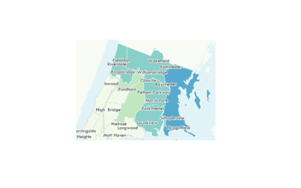
Map of the population density of low-income families in the Bronx provided by the MTA in their Existing Conditions Report for the Bronx Bus Network Redesign.
Link: https://edc.nyc/article/new-yorkers-and-their-cars#:~:text=According%20to%20recent%20census%20estimates,own%20three%20or%20more!
Link: https://new.mta.info/sites/default/files/2019-03/77_19_BBNRExisting_Working%20File_Final_Low%20Rez.pdf
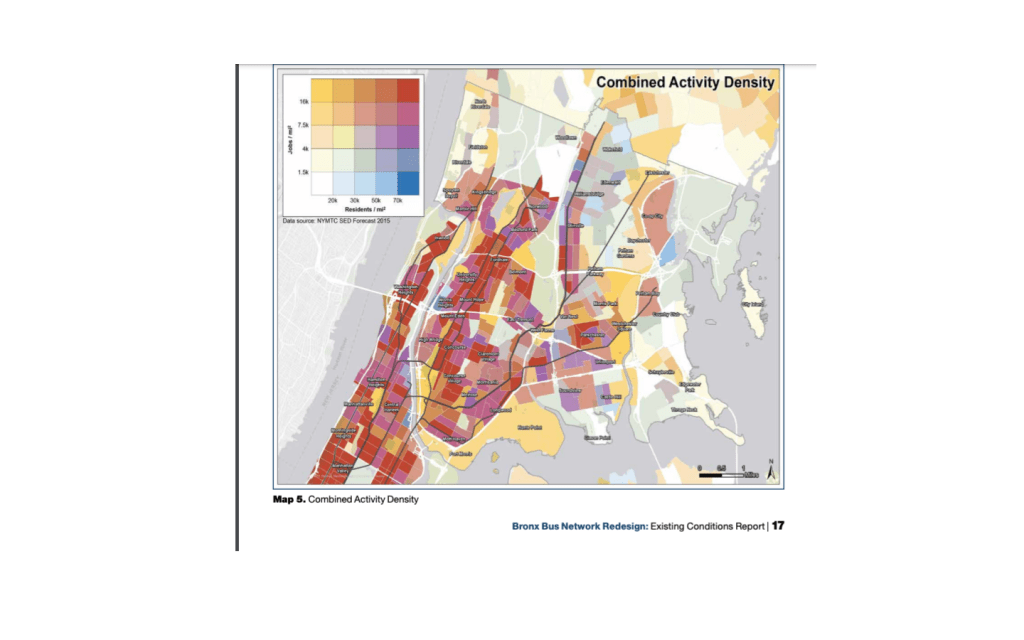
Given these statistics, it is also no surprise that the vast majority of the Bronx’s bus lanes also run through low-income communities in the southern and western portions of the borough as shown in the graph below. The use of bus lanes, where applicable is critical to the speed and reliability of the bus routes that use them to traverse across the borough. They are particularly critical on corridors such as Fordham Road, which serves 85,000 riders daily on multiple different bus routes. Given the fact there are multiple bus routes on Fordham Rd that travel throughout The Bronx, delays here could effect riders throughout the borough regardless of if they ride the bus on Fordham Rd or not.
So, the MTA has decided to install or has installed ABLE(Automated Bus Lane Enforcement) cameras on buses on the Bx12, Bx41 and Bx19 bus routes in order to keep vehicles out of bus lanes. These routes rank among the busiest in the borough and the Bx12 ranked second in the city for ridership in 2021 only behind the M15 which operates along First and Second Avenues in Manhattan. While bus lanes generally help to improve bus speeds, many bus lanes across the city including those used by the Bx12, Bx41 and Bx19 routes have been blocked constantly by standing or parked vehicles, leading to bus delays. The cameras are mounted on buses and can take a picture of the license plate number of a vehicle blocking a bus lane in order to issue a fine.
Due to the program beginning for the Bx12 and Bx41 buses in late November, the cameras should be able to issue fines for motorists at some point this month, due to the 60-day grace period required by NYS law. Cameras on the Bx19 will be installed soon according to an MTA press release.

Bus lanes for the Bx41 on Webster Av/E Tremont Av

E Fordham Rd/Washington Ave near Fordham Plaza(Bus lane is the rightmost lane on the street)

Bus lanes on E 149th St/Grand Concourse
During this period, the cameras are required to issue warnings rather than fines to ensure that drivers are aware of the program. This should be a viable mechanism to increasing bus speeds as the installation of ABLE on the M14-SBS in Manhattan resulted in a 24% increase in bus speeds and a 14% increase in weekday ridership according to an article from Businesswire on the topic. While the addition of ABLE cameras on bus routes is not considered a street safety improvement tactic, the article also stated that there was a 40% decrease in crashes along the route following the addition of ABLE cameras. In addition, the article stated that 80% of drivers who were found to have been violated a parking violation in a bus lane did not go on to commit another violation, indicating that ABLE cameras are a good means of enforcing bus lane regulations.
The MTA determine these routes to add ABLE cameras to based on the number of miles of bus lanes covered, the ability to address some of the newer bus lanes in the city, input form the MTA and NYCDOT on areas known to have problems and a balanced distribution between boroughs. It also helps that the MTA picked two routes in The Bronx that run on corridors in which other high ridership routes such as the Bx1/2, Bx9 and Bx22 operate so riders on multiple routes riding across the borough can benefit from the speed upgrades that ABLE cameras provide, even if the cameras are not mounted on their buses. The Bee-Line 60/61/62 buses on Fordham Rd are particularly long as those routes go as far as White Plains and Port Chester, NY and travel more than 20 miles between the Fordham Rd. corridor and their end destinations. Though Webster Ave, only carries the Bx41, it is a high ridership route that is the only north-south transit service for a very busy Webster Ave corridor.
The MTA is also planning on installing ABLE cameras on 4 other routes which are the Q43, B62, B25 and B42. These four routes all have significant ridership and operate through busy areas of Queens and Brooklyn. Bus riders hope that these along with other bus priority measures can continue to improve bus service in The Bronx and throughout New York City.
Works Cited
“MTA Activates First Bus Lane Enforcement Cameras in the Bronx.” MTA, 21 November 2022, https://new.mta.info/press-release/mta-activates-first-bus-lane-enforcement-cameras-bronx. Accessed 30 December 2022.
New York City Department of Transportation. “Fordham Road – Inwood Bus Priority – Community Advisory Board Meeting #3.” NYC.gov, 15 March 2022, https://www1.nyc.gov/html/dot/downloads/pdf/fordham-rd-inwood-cab-mar2022.pdf. Accessed 30 December 2022.
“Hayden AI Completes First Phase of New York MTA Automated Bus Lane Enforcement System Expansion.” Business Wire, 28 December 2022, https://www.businesswire.com/news/home/20221228005307/en/Hayden-AI-Completes-First-Phase-of-New-York-MTA-Automated-Bus-Lane-Enforcement-System-Expansion. Accessed 30 December 2022.
“New York City Transit – Subway and bus ridership for 2021.” MTA, 2022, https://new.mta.info/agency/new-york-city-transit/subway-bus-ridership-2021. Accessed 30 December 2022.
New York City Department of Transportation, and MTA New York City Transit. “+selectbusservice Bx41 on Webster Avenue Progress Report.” NYC.gov, 25 August 2014, https://www.nyc.gov/html/brt/downloads/pdf/2014-08-25-brt-websteravenue-progressreport.pdf. Accessed 30 December 2022.
Blank, Liam. “NYC Metro Area Bus Lane Map.” Tri-State Transportation Campaign, 25 November 2022, https://tstc.org/nyc-metro-area-bus-lane-map/. Accessed 30 December 2022.
“Bronx Bus Network Redesign.” MTA, February 2019, https://new.mta.info/sites/default/files/2019-03/77_19_BBNRExisting_Working%20File_Final_Low%20Rez.pdf. Accessed 30 December 2022.
New York City Economic Development Corporation. New Yorkers and Their Cars | NYCEDC, 5 April 2018, https://edc.nyc/article/new-yorkers-and-their-cars. Accessed 30 December 2022.
