By Joseph Morales
The North Shore of Staten Island has the highest population density of anywhere on Staten Island, with its density being twice that of Staten Island and similar to population densities in certain parts of Brooklyn, Queens and The Bronx. In addition to its population, the North Shore boasts many key destinations for people in the borough such as St. George(which includes the Staten Island Ferry Terminal), Richmond University Medical Center, the Staten Island Zoo and two large high schools(Curtis and Port Richmond). According to data from the New York City Department of City Planning, 37% of North Shore residents travel by public transportation to work and 27% of North Shore residents do not have access to a car. While these numbers are lower than those in many neighborhoods citywide, they are still much higher than national statistics, indicating that public transportation plays a major role in how people get around on the North Shore of Staten Island. In 2019, according to data from the NYU Furman Center, the median income in Staten Island Community District 1 that consists of North Shore neighborhoods was $79,000 with a poverty rate of 13%, indicating that for many residents they may not be able to afford other modes of transportation.
Unfortunately for North Shore residents, primary corridors such as Castleton Ave and Richmond Terrace are often congested and lead to slow trips for bus riders and motorists. Bus riders often use these corridors to get across the North Shore, as well as to get to St.George, which in addition to being a major business center in the borough, hosts the St.George Ferry Terminal where riders can catch the Staten Island Ferry to Manhattan. These buses also provide transfers to many other North-South Staten Island bus routes as well as the S53 bus to Bay Ridge, Brooklyn and the S89 to Bayonne, NJ and the 8th St HBLR(Hudson-Bergen Light Rail) station. Motorists may be trying to travel to many areas across Staten Island in addition to attempting to reach major nearby roadways such as the Bayonne Bridge/Dr. M.L.K Expy, Staten Island Expy(I-278) and the West Shore Expressway.
Bus speeds on the S46/96 that runs primarily along Castleton Ave had an average speed of 10.6-10.9 each month between January-June 2022, which was below the borough average of 14.2-14.6 in the same timeframe. This is likely because Castleton Ave is a narrow and often congested street due to the high density of residences and businesses there. Several key destinations along the corridor include Richmond University Medical Center and the West New Brighton Houses. Stops on the route are also very frequent, with the bus stopping every 1-2 blocks at times. It is also important to note that any data on speeds likely has outliers as certain parts of the corridor are predominantly single family houses while others have substantially more commercial and residential density and thus have more congestion.
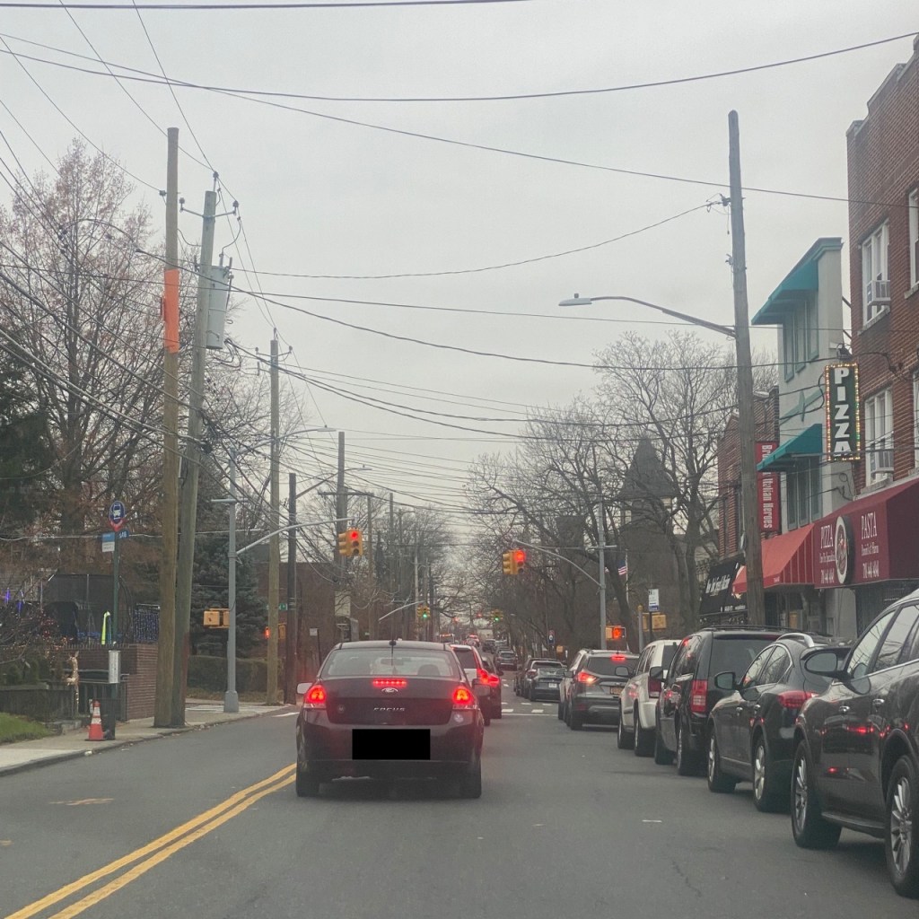
Castleton Ave/Oakland Ave near Richmond University Medical Center where the S46/S96 runs.
There are also numerous schools in the area, including I.S 61 William A Morris directly on Castleton Avenue and Port Richmond High School which is directly off the corridor which both have over 1,000 students. Schools tend to be major contributors to congestion during the school year, as many parents drive their children to school and the New York City Department of Education has about 1.1 million students and 135,000 full-time employees. This does not include private and parochial school staff and students as well as part-time NYCDOE employees or others that work inside of public schools such as NYPD School Safety Agents.
The S40/90 buses may endure similar issues operating along the Richmond Terrace corridor, close to where a potential BRT system could be constructed. Interestingly, speed on the S40/90 has fluctuated between 13-14 mph since 2011 while spiking to the 15.4-15.7 mph range between April and July 2022. The CJTP(Customer Journey Performance Time) was still around the Staten Island average of 65-75% for most of past 6 years excluding a few months between September 2020-May 2021 when bus reliability was stronger due to less congestion as small numbers of people began returning to work following the peak of the COVID-19 pandemic. CJTP evaluates what percentage of trips are completed within 5 minutes of schedule time. Even if buses here are at or above the Staten Island average, buses still make very frequent stops,. This slows the bus down should the bus have to make every stop. The S90 which makes limited stops, only runs weekdays from 5:40-8:15 AM eastbound and 3:30-11 PM westbound. Though these may seem like solid hours, travels at all other times traveling in either direction are still forced to ride the local bus.
Though there is less activity along this corridor overall, it is still within walking distance of almost all residences and businesses on Castleton Avenue in addition to providing closer connections to the Bayonne Bridge. Richmond Terrace is also home to cultural institutions Snug Harbor Cultural Center and Botanical Garden and the Staten Island Museum. Richmond Terrace is also the main street in the St. George neighborhood and is home to the St. George Ferry Terminal.
To address transportation issues on the North Shore, the MTA is evaluating the possibility of constructing a Bus Rapid Transit(BRT) system on the North Shore of Staten Island. Unlike Select Bus Service(SBS) found throughout Staten Island and New York City, this BRT system would run primarily along its own right of way using the abandoned North Shore rail line tracks. The other 2.2 miles of the system would take place in mixed traffic along both South Ave and Richmond Terrace with some type of bus-priority mechanism such as a bus lane in place. The main routes in such as system would be the S1 and the S2 which would run from St. George to West Shore Plaza and the Arlington neighborhood respectively. Other Staten Island bus routes, the S58, S57, S54 and S53 would also use the corridor for certain parts of the route via a Bard Avenue Ramp and would connect riders from across the BRT corridor to other parts of Staten Island as well as Brooklyn. The BRT would have 15 stations at key locations along the route. A map of the proposed system and bus routes can be found here on page 7:https://www.streetsblog.org/wp-content/uploads/2012/05/NSAA-Presentation.pdf

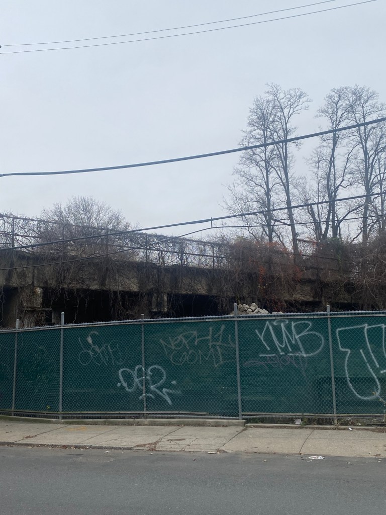
Abandoned North Shore Railway with overgrown trees as seen on Richmond Terrace/Heberton Ave near a potential Port Richmond BRT station
This project would undoubtedly be transformative and substantially cut travel times between West Shore Plaza and St. George by more than half from 50 minutes to 21 minutes according to the MTA and Systra Inc, North Shore Alternatives Analysis. It would also substantially cut travel times on the existing Staten Island bus routes that would use the corridor. It is possible that the area that has long been viewed as a transit desert along with the rest of Staten Island may become a transport hub. The BRT is expected to have 12,120 riders during the AM peak should the project be constructed. Given the fact that the North Shore has a substantial amount of congestion along with low and middle-income residents it is possible that ridership increases as taking the bus may become competitive to driving in terms of speed and convenience. If the BRT project is successful, it can become a model for cities nationwide and around the world on how to build effective Bus Rapid Transit systems to serve their needs.
The BRT may also spur development in the North Shore as there are a solid amount of vacant lots and abandoned storefronts on the North Shore particularly on Richmond Terrace, which is near some proposed BRT stations.
Vacant lot adjacent to potential BRT line and in walking distance of potential Port Richmond station.
Also to be constructed would be a park and ride at the Arlington station. Given a fact that many people in the Arlington neighborhood as well as the West Shore of Staten Island drive and may live far from the proposed Arlington BRT station, a large park and ride, may make it more convenient for them to take the bus. Thus, they may take the bus more often instead of drive for their entire trips, which would help to reduce emissions as well as congestion on the roads throughout Staten Island.
Other alternatives considered included a Light rail line along the between St. George and West Shore Plaza along with Transportation Systems Management(TSM). TSM would have included two new bus routes as well as the construction of a new transit center in Arlington. While commute times would have been reduced by 13 minutes, this idea was scrapped due to its minimal impact compared to the other alternatives. This was likely not the plan the MTA intended on taking from the beginning, however it was likely evaluated because federal law requires the evaluation of a low-cost alternative for any project. The light rail line was scrapped due to significantly higher costs and a roughly equivalent impact as far as reduced travel time to BRT. A BRT may have also been preferred as a BRT right of way can be used for other bus routes in addition to the main BRT routes allowing for riders to make more seamless connections to more places than with a single light rail line.
The S46/96 will be truncated at Elm Park/Morningstar and the S40/90 would be discontinued upon the opening of the BRT. However, the S48/98 would be extended to cover the gaps in service west of Arlington.
Like almost all other major transportation infrastructure projects like this, there may be some environmental and engineering challenges that complicate the project’s construction.
One of the biggest challenges may lead to a massive controversy as to whether or not the line should be built at all. As the North Shore Branch was abandoned in 1953, much of the line had become overgrown with trees and other plants and according to Curbed New York, building the BRT would result in thousands of these mature trees being chopped down. In the Snug Harbor area where the coastline has been significantly eroded , part of the MTA’s proposal would include shifting the BRT routes inland and completely demolishing a strip of parkland. In 2017, the Staten Island Economic Development Corporation(SIEDC) even held a competition in which multiple teams presented proposals for parks similar to the High Line in Manhattan which was also built on an abandoned railway. Since the proposed route would travel over several parts of the waterfront that have been completely eroded, the MTA has said that the construction of a causeway over the water may be necessary.
The MTA would also have to coordinate space with freight railroad operations near the Arlington Station in addition to other modes of transportation as well as parking near the proposed St. George Station. The MTA did address the freight issue in a presentation on the proposal in 2012(You can view the proposal here:https://www.streetsblog.org/wp-content/uploads/2012/05/NSAA-Presentation.pdf).
However, they did not have a concrete plan with how to deal with the issues near St. George.
The North Shore BRT project is currently in the Environmental Review process with the MTA’s goal being to publish an Environmental Impact Statement(EIS) on the project based on New York State’s Enviornmental Quality Review Act(SEQRA) in which there will be a robust public engagement program to allow for public feedback throughout the process. The purpose of a statement is to evaluate the impacts a project may have on the environment and determine how to avoid or mitigate those impacts. This process however, is currently on pause due to the pandemic and while it is moving forward internally within the MTA, it will be evaluated along with other projects for inclusion in the MTA’s 2025-29 Capital Plan.
Given Staten Island’s long history of being considered a transit desert ,this project would absolutely of historic nature for both the borough and the city as a whole as this would be the only true BRT corridor in New York City. Given the environmental concerns posed with the project, there may be some intense controversy regarding the project should the project advance further in the environmental review process. Time will only tell, what is in store for the future of the abandoned North Shore Railway. However, no matter what happens it is likely to have a broad and profound impact on the entire borough of Staten Island in many ways such as transportation access, economic development and the environment.
Works Cited
“Staten Island North Shore Bus Rapid Transit.” MTA, https://new.mta.info/system_modernization/northshorebrt. Accessed 28 December 2022.
Metropolitan Transportation Authority, and Systra USA. “North Shore Alternatives Analysis.” Streetsblog, May 2012, https://www.streetsblog.org/wp-content/uploads/2012/05/NSAA-Presentation.pdf. Accessed 28 December 2022.
Kensinger, Nathan. “Exploring Staten Island’s hidden North Shore Branch, eyed for a new bus line.” Curbed NY, 14 November 2019, https://ny.curbed.com/2019/11/14/20964723/staten-island-new-york-north-shore-branch-mta-photos. Accessed 28 December 2022.
MTA New York City Transit, et al. “Public Scoping Meeting Presentation.” MTA, 17 October 2019, https://new.mta.info/document/11176. Accessed 28 December 2022.
NYC MySchools. “I.S. 061 William A Morris (31R061).” NYC MySchools, 2022, https://www.myschools.nyc/en/schools/middle-school/31R061/. Accessed 28 December 2022.
NYC MySchools. “Port Richmond High School (31R445).” NYC MySchools, 2022, https://www.myschools.nyc/en/schools/high-school/31R445/. Accessed 29 December 2022.
Metropolitan Transportation Authority. “Bus Dashboard.” http://dashboard.mta.info/Bus. Accessed 28 December 2022.
“St. George/Stapleton Neighborhood Profile – NYU Furman Center.” NYU Furman Center, 2022, https://furmancenter.org/neighborhoods/view/st-george-stapleton. Accessed 29 December 2022.
New York City Department of City Planning-Transportation. “Car Ownership in NYC.” Tableau, 25 October 2021, https://public.tableau.com/app/profile/dcptransportation/viz/ACSProfiles/Dashboard1. Accessed 29 December 2022.
